1. An island needs a starting line
Andy arrived with a drawing of a pepper shaker.
“I thought you retired from the seasoning business,” Ana said.
“I did. This is my final shipment.”
After Death Valley’s salt-polygon puzzle, the four kids had a new question: how could an island grow out of the ocean?
Augie supplied the obvious equipment.
“Big shovel.”
“All the way to the bottom?” Allie asked.
“Very long handle.”
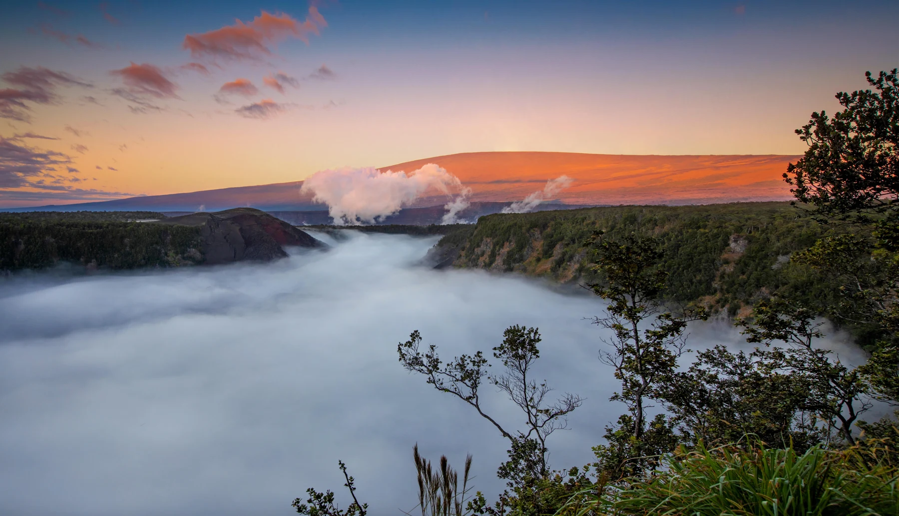
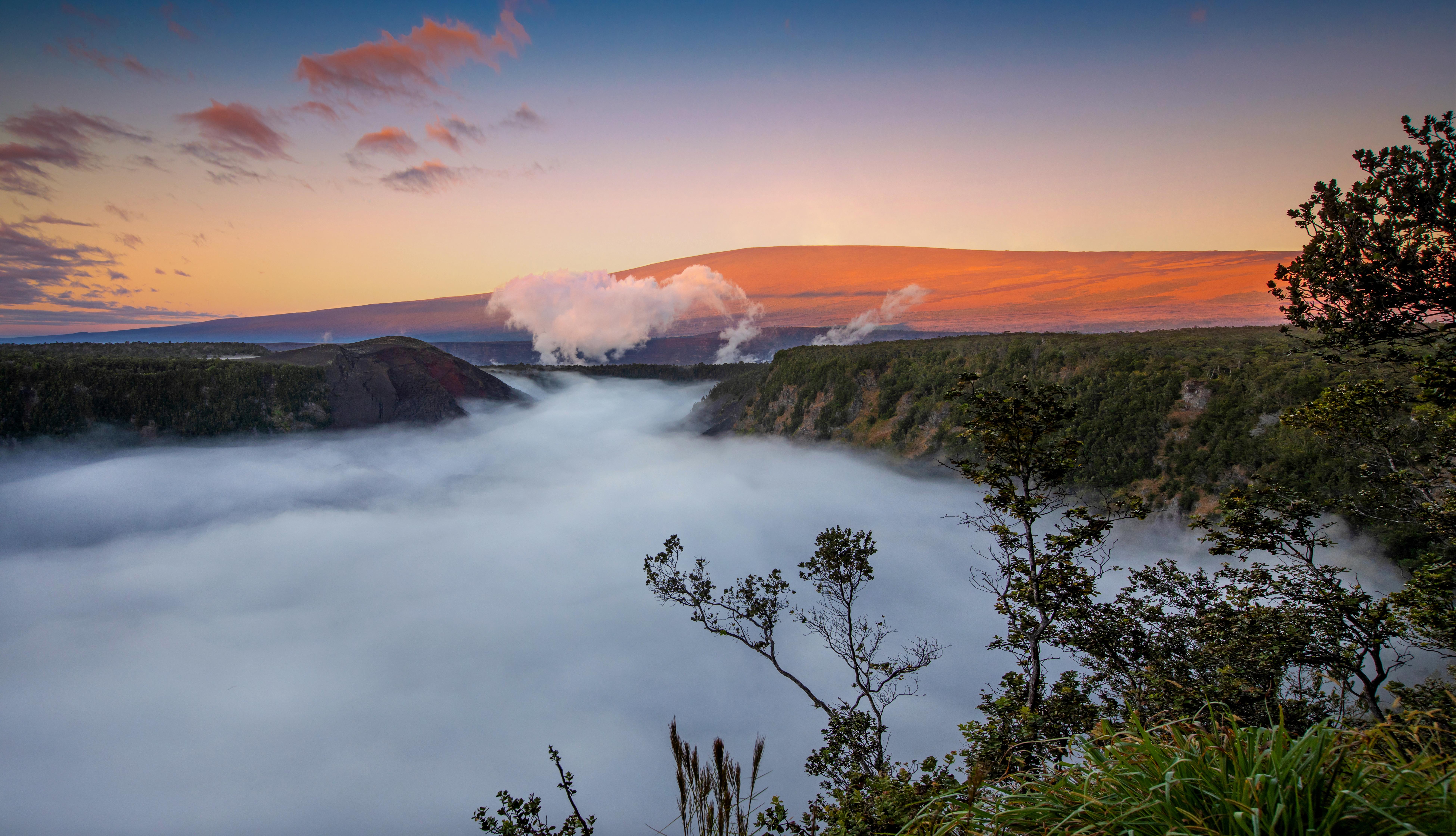
Their family had reached Hawaiʻi Volcanoes National Park on the island of Hawaiʻi. A photograph of Kīlauea Iki showed a wide crater, forested slopes, clouds, and a distant mountain. It did not look like the pointed mountain with a red fountain that Andy had drawn on every volcano page since preschool.
“My volcano needs a different hat,” he decided.
Mom and Dad had checked current park guidance and selected activities that suited the family and conditions. Their investigation would use official photographs, exhibits, and suitable viewpoints. Seeing molten lava was not a requirement for solving the case.
Allie wrote THE ISLAND-BUILDING RACE across a clean page.
“Who’s racing?” Ana asked.
“Processes that build land and processes that wear it down.”
Andy drew a lava flow wearing running shoes.
“Not an actual footrace,” Allie added quickly.
Augie crossed out the shoes.
“No feet.”
The park included parts of two volcanoes, Kīlauea and Mauna Loa. The whole island had a larger volcanic story, much of it hidden beneath the surrounding ocean.
Ana drew a small mountain above a blue line and a much larger shape below it.
“An island is not just the part we can see from a boat.”
Andy looked at Augie’s shovel.
“That handle is going to need an extension.”
2. The moving plate mystery
At an exhibit, the children found a map of the Hawaiian island chain.
“They look like stepping-stones,” Ana said.
“Stepping-stones for an extremely large person,” Andy replied.
The islands were part of a much longer trail of volcanic mountains, including many beneath the sea. Their arrangement held clues about a moving tectonic plate.
Allie placed a sheet of paper over a spot on the table. She slid the paper slowly while keeping her finger beneath one place.
“A simplified model,” she said. “The Pacific Plate moves generally northwest over a region of volcanic activity associated with a hotspot.”
“That finger is very warm,” Andy observed.
“Imaginarily warm.”
As the plate moved, volcanoes formed and developed over long periods. Older islands generally lay toward the northwest; the younger end of the main chain was toward Hawaiʻi in the southeast.
Ana drew a long arrow instead of a finish line.
“So the map records movement.”
“Not an island parade we could watch passing the window,” Allie said. “Geological motion takes time.”
Augie waved at the drawing anyway.
“Bye, island.”
The hotspot picture was a useful starting point, not a complete model of everything happening deep inside Earth. The kids would not try to explain a whole island chain with one dot and a finger.
Andy labeled his sketch: NOT TO SCALE. FINGER NOT INCLUDED IN REAL PLANET.
Their first discovery was bigger than their original question. To explain the island above the water, they needed to think about volcanoes, the ocean floor, Earth’s interior, and a plate on the move.
Ana turned the page.
“Good. We packed more paper.”
3. Rock with a change of address
“What exactly comes out of a volcano?” asked Augie.
“Molten rock,” Allie said. “Below the surface, we call it magma. Once it reaches the surface, we call it lava.”
Andy drew a suitcase.
“Same traveler. New address.”
“Useful way to remember the names,” Ana said.
Over repeated eruptions, lava could spread, cool, and become rock. Layers built up, helping create the enormous volcanic mountains that formed the island.
Unlike their imaginary shovel project, the building had begun underwater. An island emerged only when volcanic construction rose above the ocean surface.
Augie drew a mountain peeking over a blue line.
“Hello.”
Many Hawaiian lava flows were relatively fluid compared with the stickier lavas of some other volcanoes. Flows spreading outward helped build broad shield volcanoes.
“Shield?” Andy asked. “For a giant knight?”
“The name comes from the broad shape.”
Ana compared their drawing with Mount Rainier’s steeper outline from an earlier chapter. Different volcanic materials and histories helped produce different landscapes.
“And a shield volcano can still be dangerous,” Allie said. “Broad doesn’t mean gentle in every way.”
Mom reminded them that the safe way to learn depended on current conditions and park instructions. They would not approach a flow to test whether it was slow or step over a barrier for a better photograph.
Andy erased the tiny measuring tape beside his lava.
“Measurements by scientists. Questions by us.”
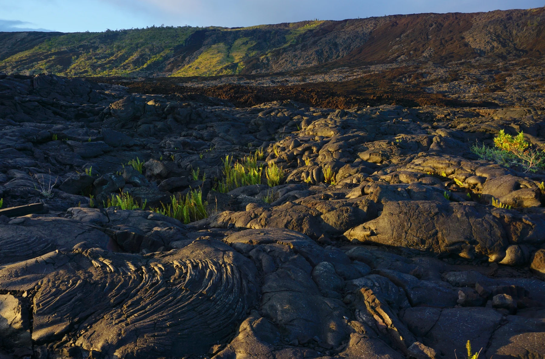
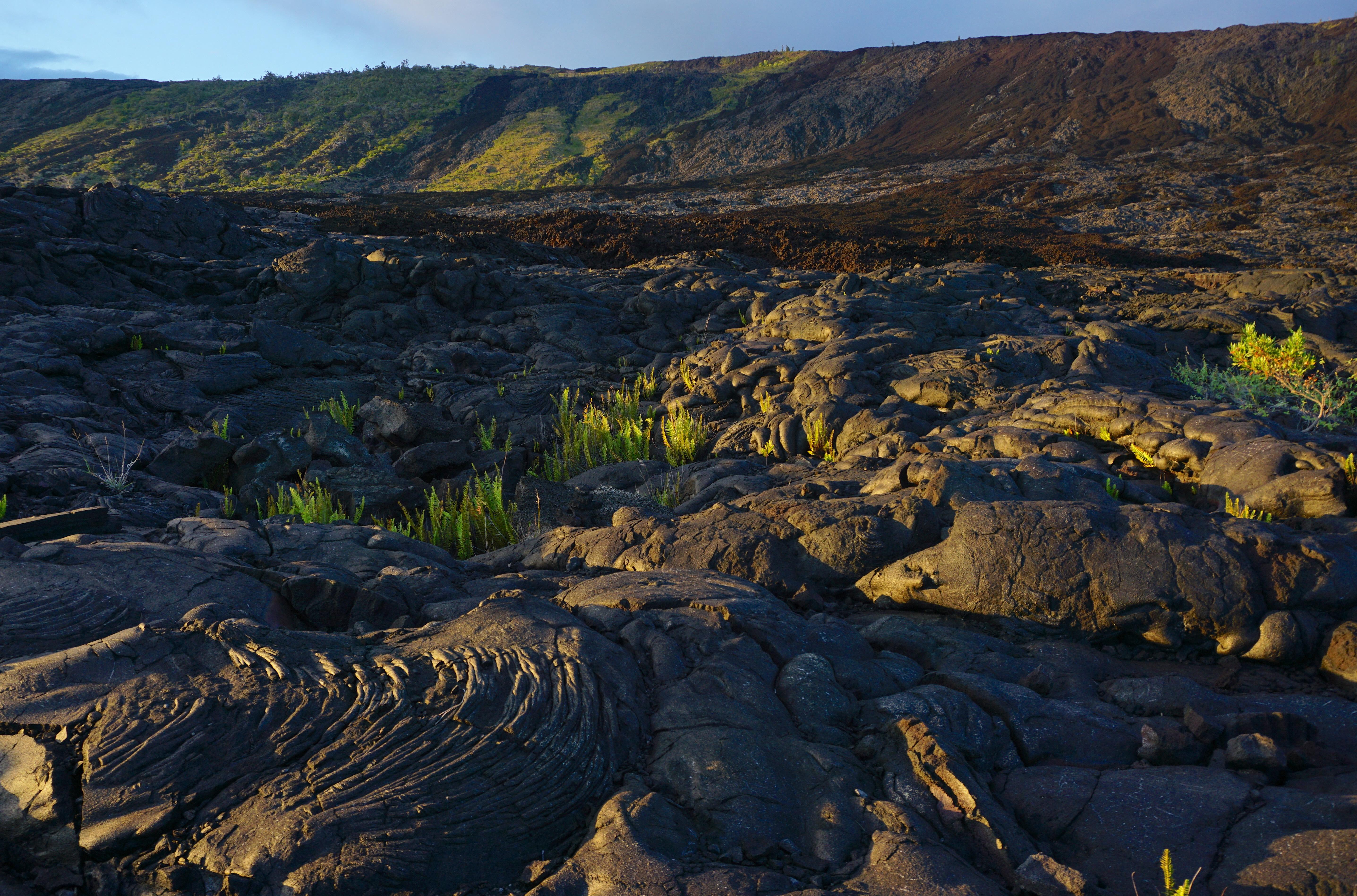
The children looked at a photograph of hardened flows near Hōlei Pali. Rock that now seemed still had once moved through the landscape.
Ana wrote: TODAY’S GROUND CAN BE A RECORD OF YESTERDAY’S FLOW.
Augie added a mailbox to the word LAVA.
“New address. Staying here.”
4. The rope that isn’t rope
A close-up picture showed dark rock folded into smooth-looking curves.
Andy leaned closer.
“Someone dropped a very large coil of rope.”
“Pāhoehoe,” Allie read. “A lava surface that can look ropy or relatively smooth.”
Another image showed rough, broken, jagged pieces.
“ʻAʻā.”
Augie pointed at the rough picture.
“That one forgot to comb its hair.”
The words came from Hawaiian and were also used in geology. They described different lava-flow textures. Conditions as lava moved and cooled affected the surface it left behind.
“Same island, different rock hairstyles,” Andy said.
“Texture is the clue,” Ana replied. “We shouldn’t decide a flow’s whole history from one little picture.”
A flow could change texture along its path. Its behavior depended on several things, including temperature, how easily it flowed, the slope, and the supply of lava. The children did not assign every smooth flow one speed and every rough flow another.
Allie drew two patches: loops on one side, angular marks on the other.
“The drawings help us compare. We can do the comparison without handling the rock.”
Augie drew a comb between them.
“Not needed.”
They also learned that black-looking ground did not tell them whether every spot was cool or stable. Color alone was not a safety test. Official access guidance mattered more than guesses.
Andy put his imaginary hair salon out of business.
“No customers with appointments longer than geological time.”
Ana laughed, then added a serious question to the bottom of the page.
“If lava makes its own surface, can it make a roof too?”
5. The river built its own tunnel
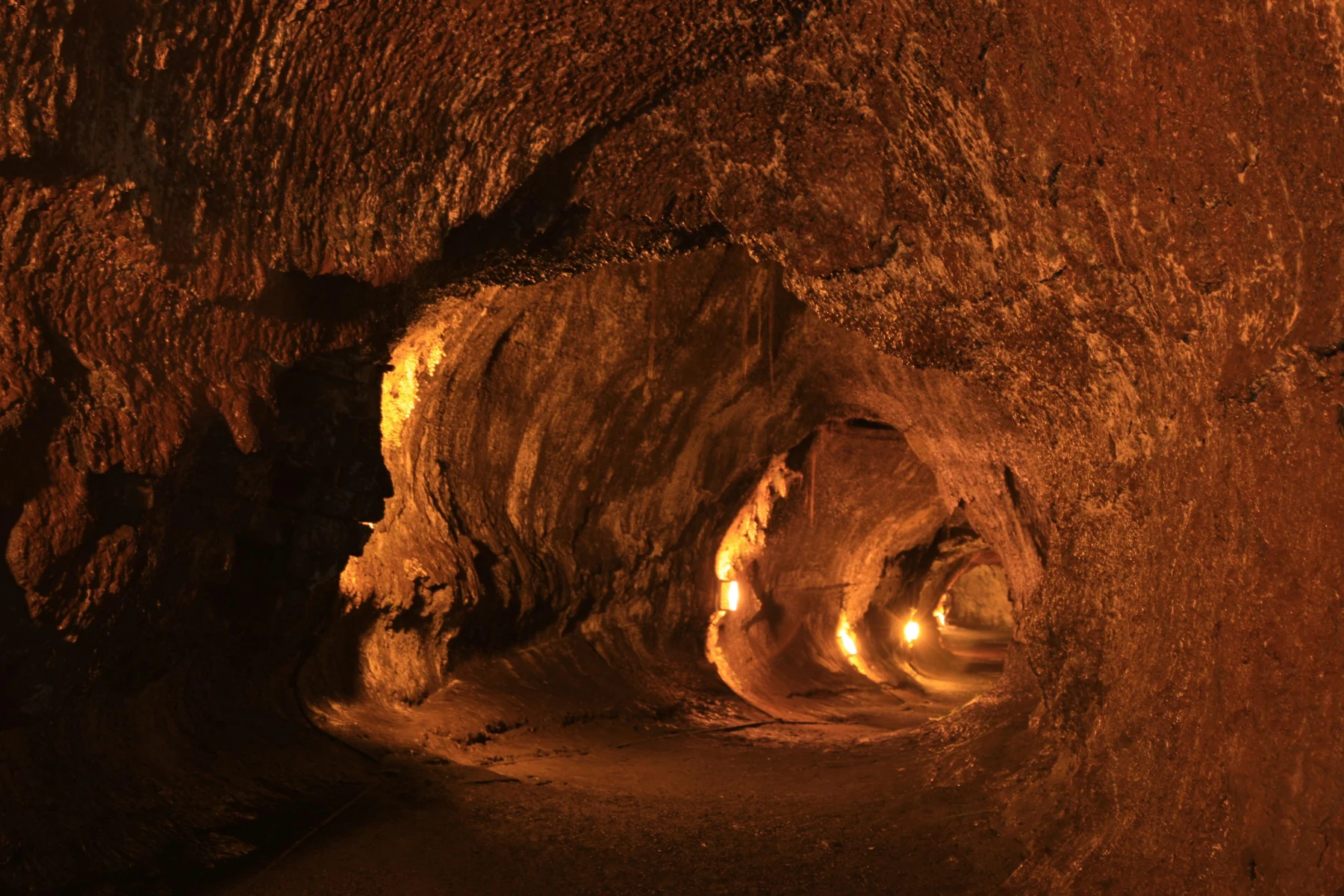

The answer appeared in a photograph of Nāhuku, also known as Thurston Lava Tube. Warm lights illuminated a passage through dark rock.
Augie searched the picture.
“No train.”
“Not that kind of tunnel,” Ana said.
A flowing lava channel could develop a cooling crust on top while hot lava continued moving inside. The crust helped insulate the flow. If the lava supply stopped or changed and the molten material drained away, an empty passage could remain.
Andy drew a river wearing a roof.
“Excellent for rainy days.”
“It wasn’t built as shelter for the lava,” Allie said. “Cooling and flowing made it.”
The comparison with a river helped them picture motion, but the material was molten rock rather than ordinary water. They did not need to imagine an underground sea of lava beneath every cave.
Ana turned back to Death Valley’s arrows beneath the salt crust.
“Another hidden process, but a different one.”
“And next time,” Allie said, “we’ll find a cave made in a different way again.”
Nāhuku was a designated visitor destination when open and suitable. Other caves were not invitations to explore. Some lava tubes protected sensitive habitats or sacred cultural places, including burial sites.
Their grown-ups checked current access information and would choose whether a visit fitted the family. The photograph already let everyone investigate the shape without needing to go underground.
Augie drew a front door on his tunnel, then erased it.
“Not our house.”
“That’s a good explorer rule,” Ana said.
Andy added a tiny sign to the picture: MADE BY LAVA. NO TRAIN SERVICE.
6. The ocean doesn’t hold still
“So the volcano wins?” Andy asked.
“Wins what?”
“The island-building race. It keeps adding rock.”
Allie shook her head. “That’s only one part of the story.”
Waves wore away coastlines. Weathering broke down rock, and erosion moved material. Large collapses and gradual sinking could also change volcanic islands over time.
Ana drew an arrow adding rock and another carrying material away.
“Building and changing happen together.”
“And adding new land doesn’t happen at every place, every day,” Allie said.
Sometimes lava reached the sea and helped extend a shoreline. The children studied this through historical educational material. They were not watching a guaranteed event or planning to stand beside an ocean entry.
Hot lava meeting water could be violent. Newly formed ground could be unstable. The bright, spectacular photographs did not show a safe place for a picnic.
Andy crossed a picnic blanket off his imaginary coastline.
“Lunch will remain in the approved lunch department.”
Augie drew a wave pushing his lava’s running shoe away.
“The sea took it.”
Their race was a metaphor for different processes acting over time, not a scoreboard that stayed the same forever. An eruption could build rock while also destroying homes, roads, plants, and places important to people.
Mom let that idea settle before they turned the page.
“Making new ground can still mean losing something precious.”
Ana wrote both BUILDING and LOSS beside the lava arrow. A good explanation had to make room for both.
Andy quietly removed the trophy from his volcano drawing.
“Not that kind of race.”
7. A red brush in the green department
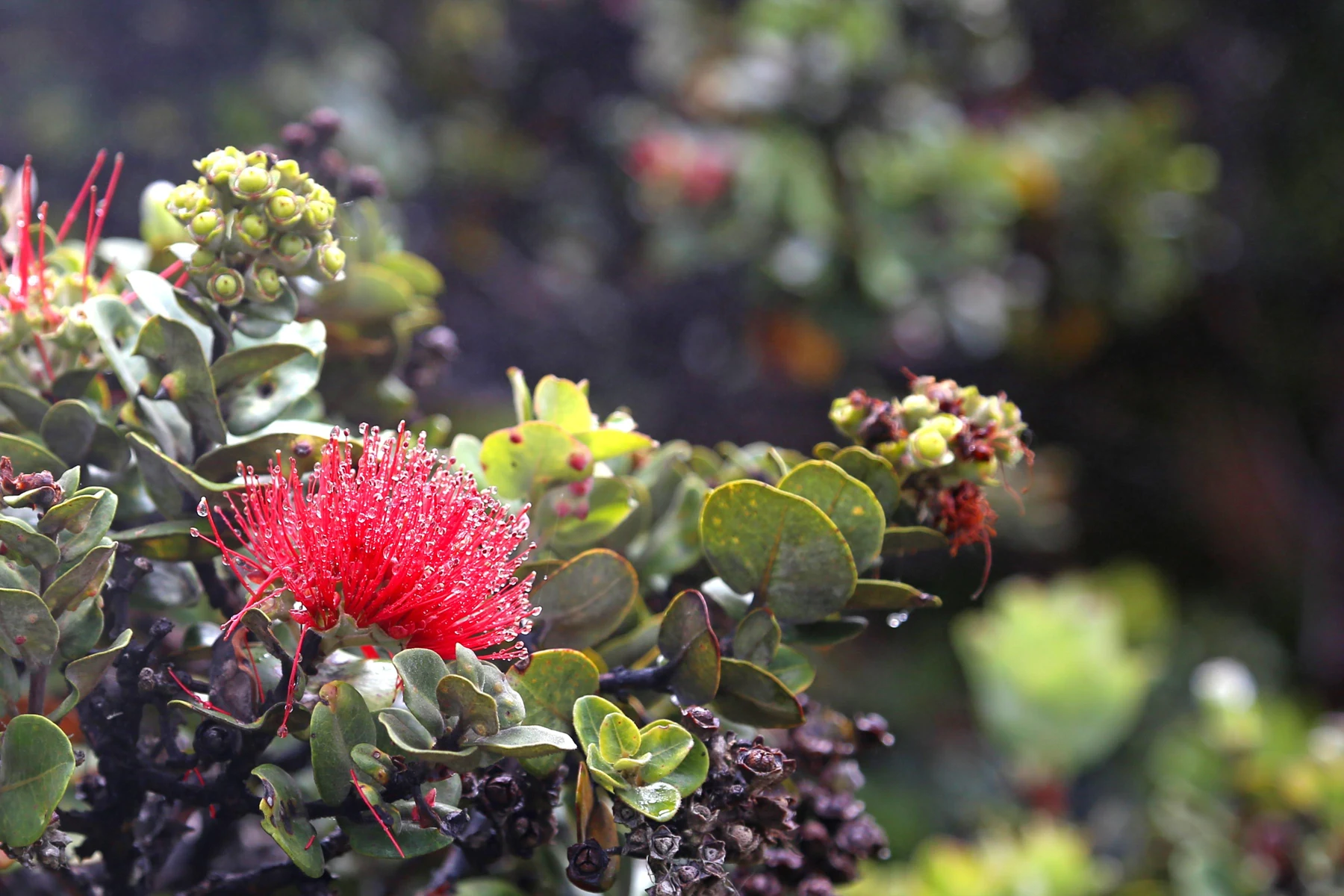

After so much rock, Augie found a photograph that looked like a celebration.
“Red fireworks!”
“An ʻōhiʻa lehua blossom,” Allie said.
The flower’s bright strands stood out against green leaves. The ʻōhiʻa tree was important in native Hawaiian ecosystems and culture. Birds could visit its flowers for nectar, and the tree helped make habitat for other life.
Andy drew a bird ordering a drink.
“No straw required,” Ana reminded him, remembering Redwood.
The park held many environments, not one endless lava field. Rainforest, drier coastal areas, and high mountain habitats supported different communities of plants.
Seeds and spores could arrive on cooled ground. In suitable places, pioneer plants began growing in cracks and patches where conditions allowed. Over time, weathering and living material helped change those growing places.
“Not instant forest,” Allie said.
Augie looked at the flower photograph again.
“Needs patience.”
“And different sites have different stories,” Ana added. “It isn’t a fixed schedule that every flow follows.”
A kīpuka offered another surprise: older land surrounded by younger lava. Vegetation there could survive while the surrounding landscape changed, creating a refuge and a source for later recolonization.
Andy drew an island of green inside an island of rock inside an ocean.
“My map has layers of islands.”
The children left flowers, branches, and rocks in place. Following park biosecurity guidance helped protect native plants from threats that visitors might accidentally carry between places.
Ana wrote: LIFE DOES NOT WAIT FOR A LANDSCAPE TO LOOK FINISHED.
Augie gave the little fern in her drawing a flag.
“Starting here.”
8. More than a science experiment
In the cultural material, the kids encountered Pelehonuamea, often called Pele, the Hawaiian volcanic deity associated with the creation and transformation of these lands.
Allie paused over the description.
“For many Native Hawaiians, this is a sacred landscape, with living traditions and family connections.”
“So not just our giant rock laboratory,” Ana said.
“Exactly.”
Mom explained that moʻolelo—stories and accounts passed through Hawaiian traditions—could hold histories, relationships, and meanings that a geology diagram did not contain. Versions could differ. The family would learn from Native Hawaiian voices and carefully attributed park material rather than inventing a traditional story of their own.
Andy folded away his joke drawing of a volcano with a hat.
“The hat belongs on my imaginary mountain.”
Ana added names and sources to the notebook. Hawaiian place names were part of the landscape’s meaning, not decorations to skip because the words looked unfamiliar.
Augie tried saying Kīlauea slowly with help.
“Words need practice.”
“All of ours did,” Allie said.
They also considered how to behave when someone else’s home or sacred place was part of a park visit. Listening, respecting boundaries, leaving things in place, and following guidance were real actions, not just polite ideas on a page.
The children’s pretend race could help them ask questions about land-building. It could not contain everything that the place meant to people.
Ana drew two open notebook pages rather than squeezing every discovery into one box.
“More than one way to learn,” she said.
Andy put a small ear beside her drawing.
“Our most portable explorer tool.”
9. The finish line moves
By the end of their investigation, Andy’s original volcano picture had changed completely.
It had no pepper shaker, no shovel, and no trophy. Instead, it showed a broad volcanic mountain, a larger shape beneath the ocean, arrows for a moving plate, hardened lava, a hollow tube, and a little patch of green.
Augie pointed at the blank corner.
“You forgot snacks.”
“I left room on purpose.”
Ana read their opening question: HOW CAN AN ISLAND GROW OUT OF THE OCEAN?
“Repeated volcanic eruptions can build a mountain from the seafloor upward,” Allie answered. “Lava cools into rock. Eventually, part of the mountain can stand above the sea.”
“And the plate moves,” Ana added.
“Waves and other processes keep changing the land,” said Andy.
“Plants move in,” Augie finished.
“Under suitable conditions,” Allie said with a smile.
The family could appreciate a volcano without demanding that it perform. Scientists monitored activity using instruments and observations. Official updates helped people understand changing conditions, but this was not a landscape that followed a visitor’s schedule.
Their grown-ups would keep checking guidance. The chapter’s photographs would remain pictures of particular moments, not predictions of what the next family would see.
Ana turned back through their book. Rivers had removed rock. Ice had split it. Fog had helped trees. Water had left salt behind. Here, molten rock had added another way for a landscape to change.
“Earth has a very crowded toolbox,” Andy said.
Their next chapter would take them to Mammoth Cave National Park, where rainwater had worked through limestone to create a maze underground.
Augie considered their lava-tube drawing.
“Another tunnel?”
“A different kind of cave story,” Allie said.
Ana wrote THE RAINWATER MAZE on a clean page.
Andy added a small question mark at its entrance.
“Good. I was worried we had run out of hidden mysteries.”
Explorer’s notebook
Nine discoveries to keep
- The island of Hawaiʻi is built from volcanoes whose foundations extend beneath the ocean.
- The Pacific Plate’s movement over the Hawaiian hotspot helps explain the island chain.
- Molten rock below the surface is magma; at the surface it is lava.
- Repeated flows can build broad shield volcanoes.
- Pāhoehoe can look ropy; ʻaʻā is rough and jagged.
- A lava flow can form an insulating roof and later leave a lava tube.
- Eruptions build rock while erosion, collapse, and other processes change or remove land.
- Native plants and kīpuka connect volcanic landscapes with living habitats.
- Hawaiʻi Volcanoes is a sacred cultural landscape with continuing Native Hawaiian relationships.
Five ways to explore
- Compare photographs of pāhoehoe and ʻaʻā without touching or collecting rock.
- Draw a volcano both above and below a blue ocean line.
- Use a paper model to discuss plate movement; label what the model leaves out.
- Choose a suitable viewpoint, cultural learning activity, or designated walk using current official guidance.
- Compare a lava-tube photograph with the limestone caves in the next chapter. Keep the two formation stories separate.
Talk it through
- Why does the island’s story begin below the ocean surface?
- Can an eruption build land and still cause loss?
- What does learning respectfully add to a science investigation?
Words for your backpack
Hotspot: a region of volcanic activity linked to heat rising within Earth’s mantle.
Tectonic plate: a large moving section of Earth’s rigid outer layer.
Magma: molten rock beneath Earth’s surface.
Lava: molten rock that has reached the surface.
Lava tube: a conduit formed within a lava flow that can remain as a cave after lava drains.
Kīpuka: older land surrounded by younger lava flows.