1. Who tiled the desert?
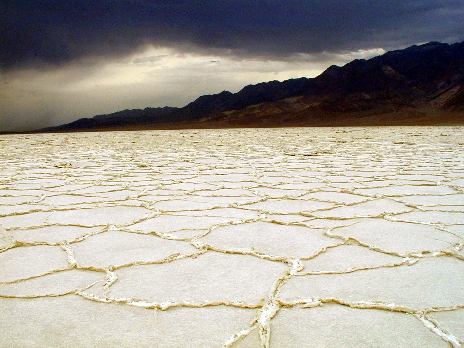
“Did someone spill the salt?” asked Augie.
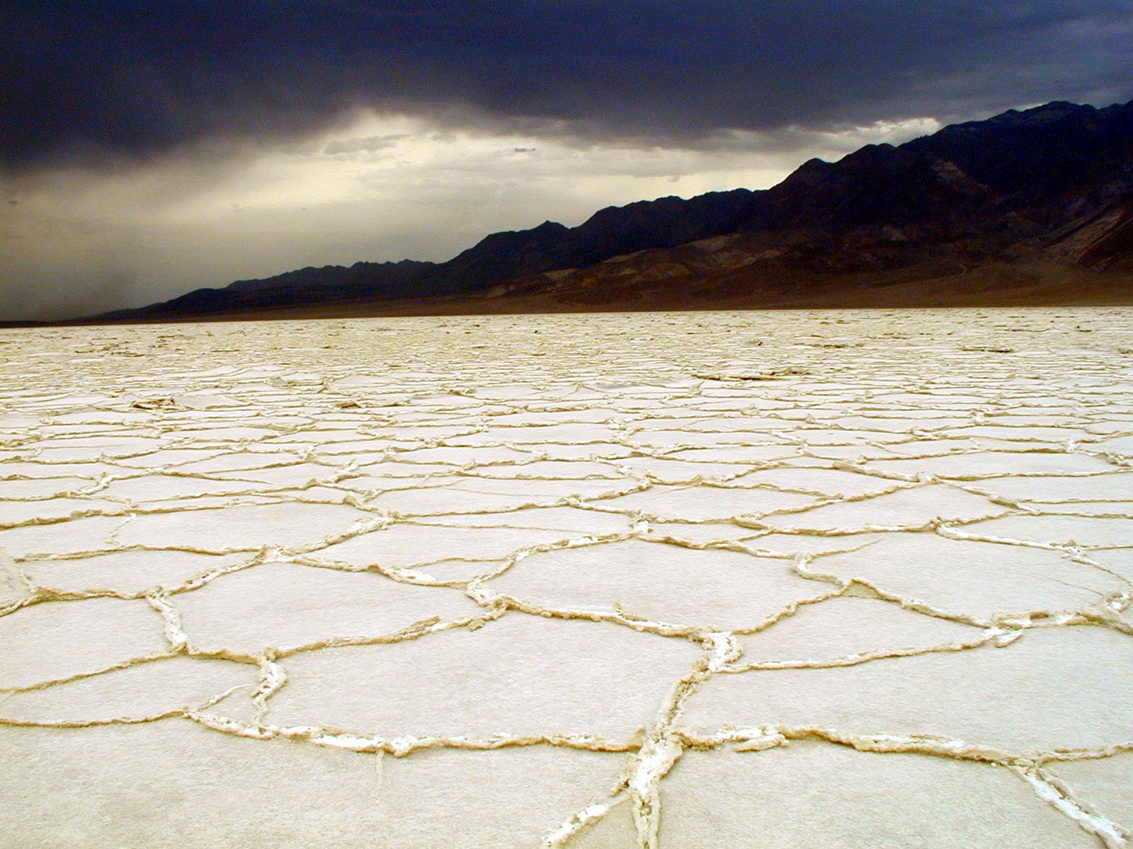
He had asked the question at the end of their Redwood adventure. Now, looking at a photograph of Badwater Basin, he decided the spill must have involved an extremely large saltshaker.
White ground stretched toward dark mountains. Raised edges divided the surface into shapes that fitted together like an enormous, uneven floor.
Andy studied the picture. “Someone tiled the desert.”
Ana opened the notebook. “Then forgot the kitchen.”
“No refrigerator,” Andy agreed. “A serious planning mistake.”
Their family had reached Death Valley National Park, which stretches across parts of California and Nevada. Mom and Dad had planned around the conditions, not around a list of places to collect. The children’s investigation would combine visitor-center learning, photographs, and suitable stops chosen with current park guidance.
Allie wrote their question: WHO MAKES THE SHAPES ON THE SALT FLATS?
“First,” she said, “we need to check what the white stuff is.”
“Snow?” Ana suggested.
“Frosting?” said Andy hopefully.
“Salt,” Augie announced. “Case closed.”
“Identity is only the first clue,” Allie said. “We still need to know how it got there—and why it has borders.”
Nobody tasted the ground to test the answer. They used official information and their eyes. The salt crust was a natural surface, not a snack display, and it could be fragile.
Ana drew a large shape with several straight sides.
“A polygon is a closed, flat shape made of straight line segments.”
Andy added a tiny front door.
“Mine is also a salt house.”
Augie drew a saltshaker taller than a mountain. Under it, Ana wrote: SUSPECT NUMBER ONE. VERY UNLIKELY.
2. Below the ocean, without the ocean
“Badwater Basin is below sea level,” Allie read.
Andy looked around their picture. “Where’s the sea?”
“Not here.”
“Then who forgot to fill it?”
Sea level was a reference height, not a rule saying that every lower place had to contain ocean water. Land between a basin and the sea could keep them separate.
Ana drew a low spot inside a rim.
“Like a bowl on a table. The bottom can be lower than something nearby without having a pipe to it.”
Augie peered at her drawing. “No drain.”
“Exactly the clue we need.”
Badwater is part of an enclosed drainage basin. Water arriving here does not simply flow onward to the ocean. Much of it eventually leaves through evaporation, while dissolved minerals remain behind.
But the bowl itself had a story. Death Valley lies in the Basin and Range region, where stretching of Earth’s crust and movement along faults helped create alternating mountains and low valleys.
“Not a giant taking a scoop,” Ana said.
“And not a hole dug by a very ambitious dog,” Andy added.
The motion was geological, spread through a long and complicated history. Even the modern landscape was still changing. The tall mountains and low basin were parts of the same investigation.
Allie drew arrows beside blocks of rock, then wrote SIMPLIFIED beside them.
“One drawing can help us understand without showing every fault.”
Augie added a bathtub plug.
“Still no drain.”
“That is becoming our strongest clue,” Ana said.
Andy looked at the imaginary salt house.
“Terrible plumbing. Excellent view.”
3. A delivery service with wet wheels
“If nobody brought a saltshaker,” Ana asked, “who delivered the salt?”
“Water,” Allie said.
Andy turned a page back toward their photograph of Redwood’s Pacific coast.
“The ocean made a delivery?”
“Not directly. Water moving through this drainage system can dissolve minerals from rocks and carry them toward low ground.”
Rain and runoff could bring dissolved material into the basin. Groundwater was another part of the water story. Over many cycles of water arriving and evaporating, salts accumulated.
Augie drew a delivery truck with raindrop wheels.
“No driver.”
“Gravity helps water travel downhill,” Ana said. “The truck can retire.”
The white crust contained mostly sodium chloride, the same chemical compound found in table salt. Other minerals occurred there too. That did not make the surface something to collect for dinner.
Andy closed his imaginary restaurant.
“Health inspector: Allie.”
Allie described evaporation: liquid water becoming water vapor and entering the air. Dissolved salt did not travel away with the water in the same way. As water was lost, a solution could become concentrated enough for salt crystals to form.
“So a crystal is an orderly arrangement of tiny building parts,” Ana said.
“A very tidy construction crew,” Andy replied.
Augie drew a drop floating upward and a salt crystal staying below.
“Water goes. Salt waits.”
“That’s our simplified big picture,” Allie said. “But the surface can change again when water returns.”
A flood could dissolve some salt, and later evaporation could leave a new crust. The desert floor was not a tiled kitchen installed once and finished forever.
Ana crossed out PERMANENT FLOORING CONTRACTOR.
Andy sighed. “Another imaginary company gone.”
4. The secret under the floor
Ana tapped the raised lines in the photograph.
“We have salt. We have a basin. We have evaporation. Why these shapes?”
“Drying cracks?” Andy suggested.
“A useful possibility to investigate,” Allie said. “But researchers found that cracks alone don’t explain the regular patterns in many salt pans.”
The children turned to a simplified account of a scientific study. Beneath a salt crust, the soil could contain salty water in the spaces between grains. What looked dry from above might still have water below.
Augie stared at the white surface.
“Secret wet.”
Evaporation near the surface could leave that water saltier and denser than the less salty water beneath it. Under suitable conditions, denser water sank while less salty water rose. This circulating motion was called convection.
Ana drew down arrows and up arrows.
“Not a river under every line. Water moving through the tiny spaces in the ground.”
Experiments, field observations, and computer models supported this hidden circulation as a driver of salt-polygon patterns. Salt transport and crystal growth could build raised boundaries above the circulating cells.
Andy imagined elevators full of salt crystals.
“Downstairs: extremely salty. Upstairs: also salty, but less salty.”
“These are arrows in a model, not actual elevators,” Allie reminded him.
Augie looked disappointed. “No buttons again.”
They did not need to dig into the crust to see if the drawing was right. Scientists used careful measurements. The family could learn from that work while leaving the place intact.
Ana wrote: A SURFACE PATTERN CAN HAVE AN UNDERGROUND CAUSE.
“Important,” said Andy. “Especially if you were about to blame a giant saltshaker.”
Augie quietly made his saltshaker smaller.
5. The mountains kept some of the rain
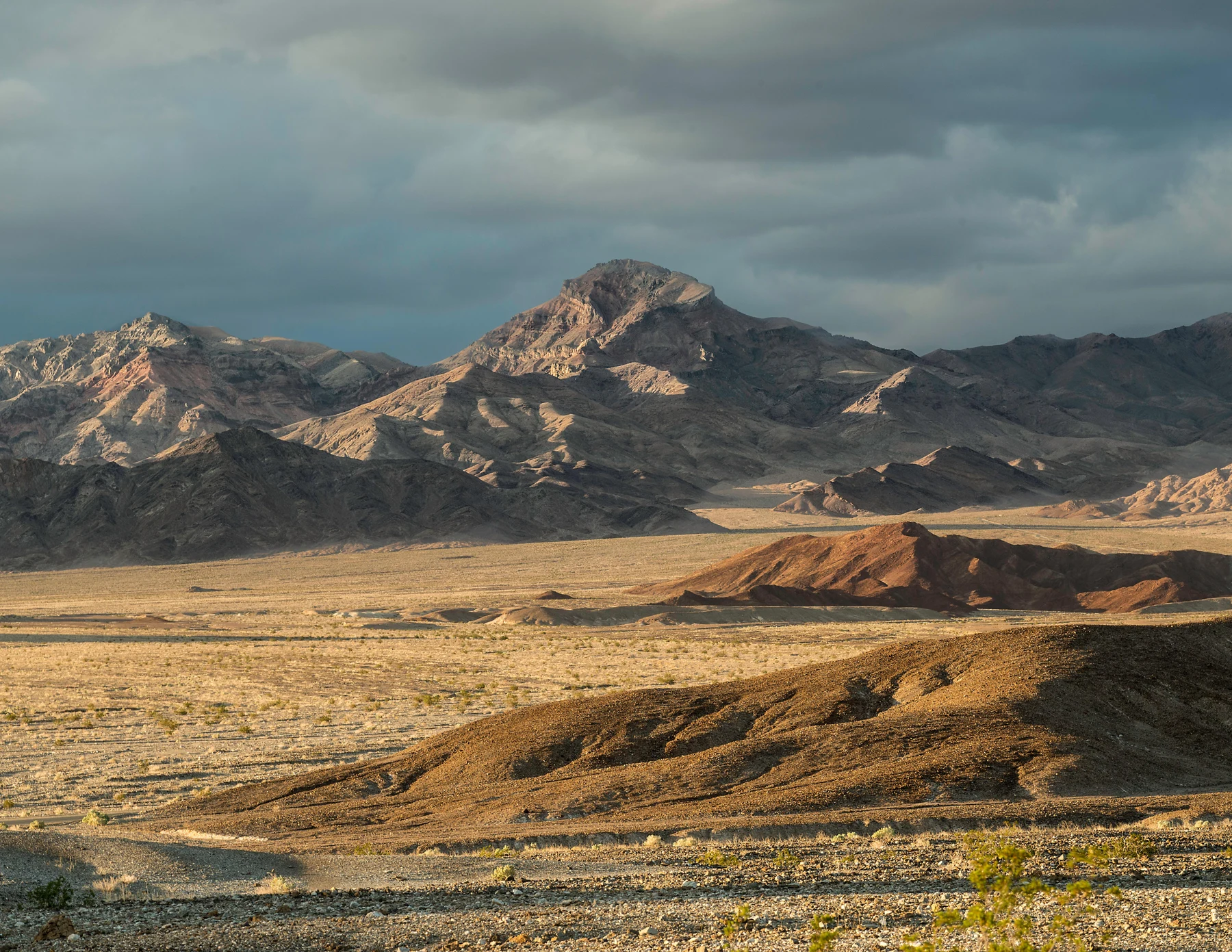

Their next picture showed mountains rising beyond a broad, dry basin.
Andy traced their outlines without touching the screen.
“Those mountains look like they belong in a different weather report.”
“Elevation changes conditions,” Allie said. “The park isn’t one flat place with one temperature.”
Why was the low valley so dry? The family compared it with the coastal redwood forest. Moist air moving inland from the Pacific had mountain ranges to cross. As air rose, it cooled; moisture could condense and fall as rain or snow. Air reaching the other side often had less moisture available.
“A rain shadow,” Ana said.
Augie looked for a dark patch in the photograph.
“Where?”
“The name doesn’t mean a shadow you can stand inside,” Allie explained. “It describes a drier area on the sheltered side of mountains.”
Andy drew a cloud handing raindrops to a mountain.
“Sorry, valley. We spent the water allowance.”
“Funny picture,” Ana said. “But not every storm follows the same route or drops all its water.”
Dry did not mean rain never happened. Storms could bring dangerous flash floods. A place with little average rainfall could still receive a sudden rush of water.
Mom checked their plan again. Weather, road conditions, heat, and closures determined the family’s stops. They were not going to wait in a wash for a demonstration.
“The desert does not need to prove its power while we stand in the way,” Dad said.
Andy wrote that down.
Augie added a cloud wearing a teacher’s hat.
“No outdoor test today.”
6. The desert forgot its sand blanket
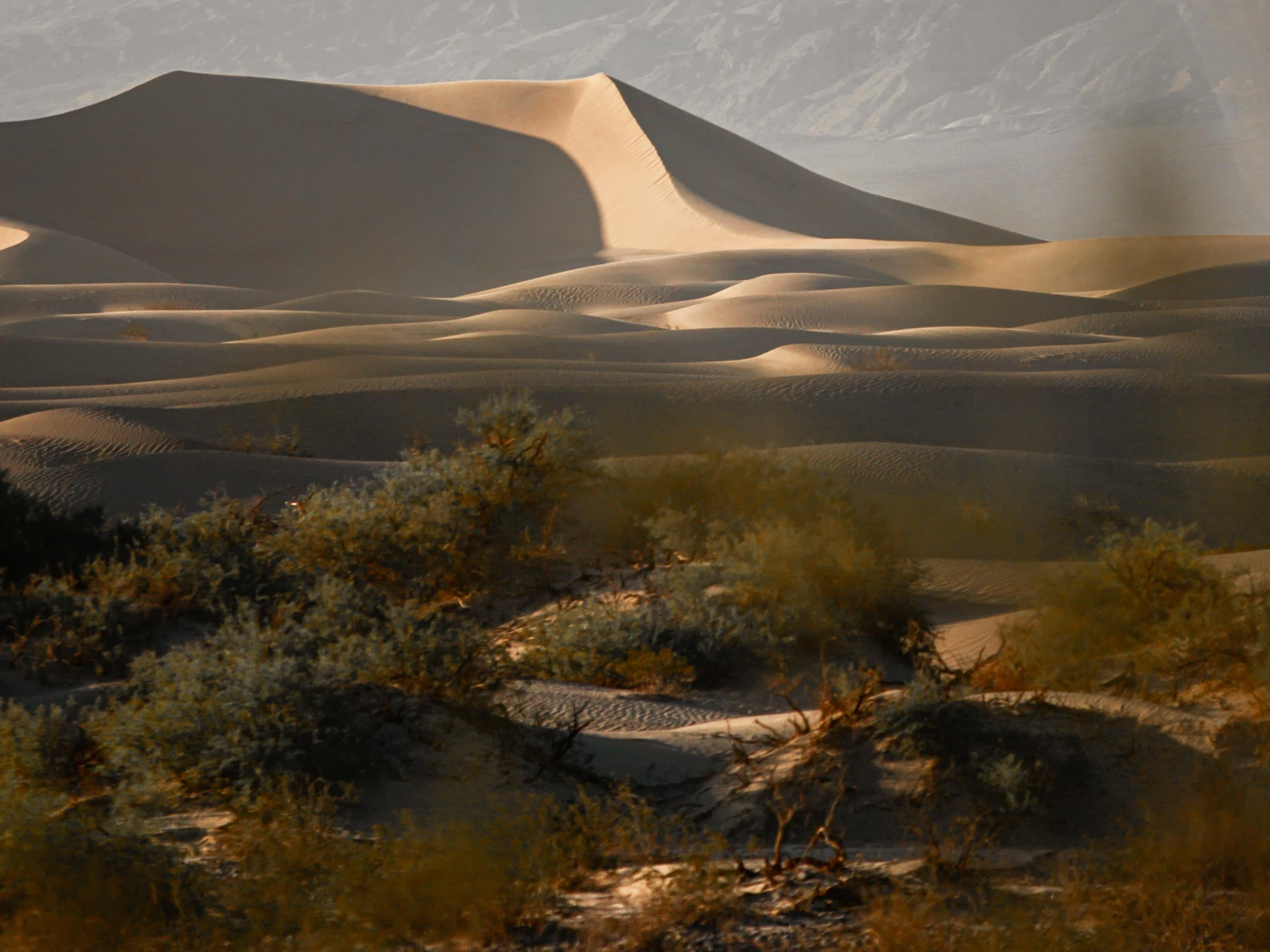
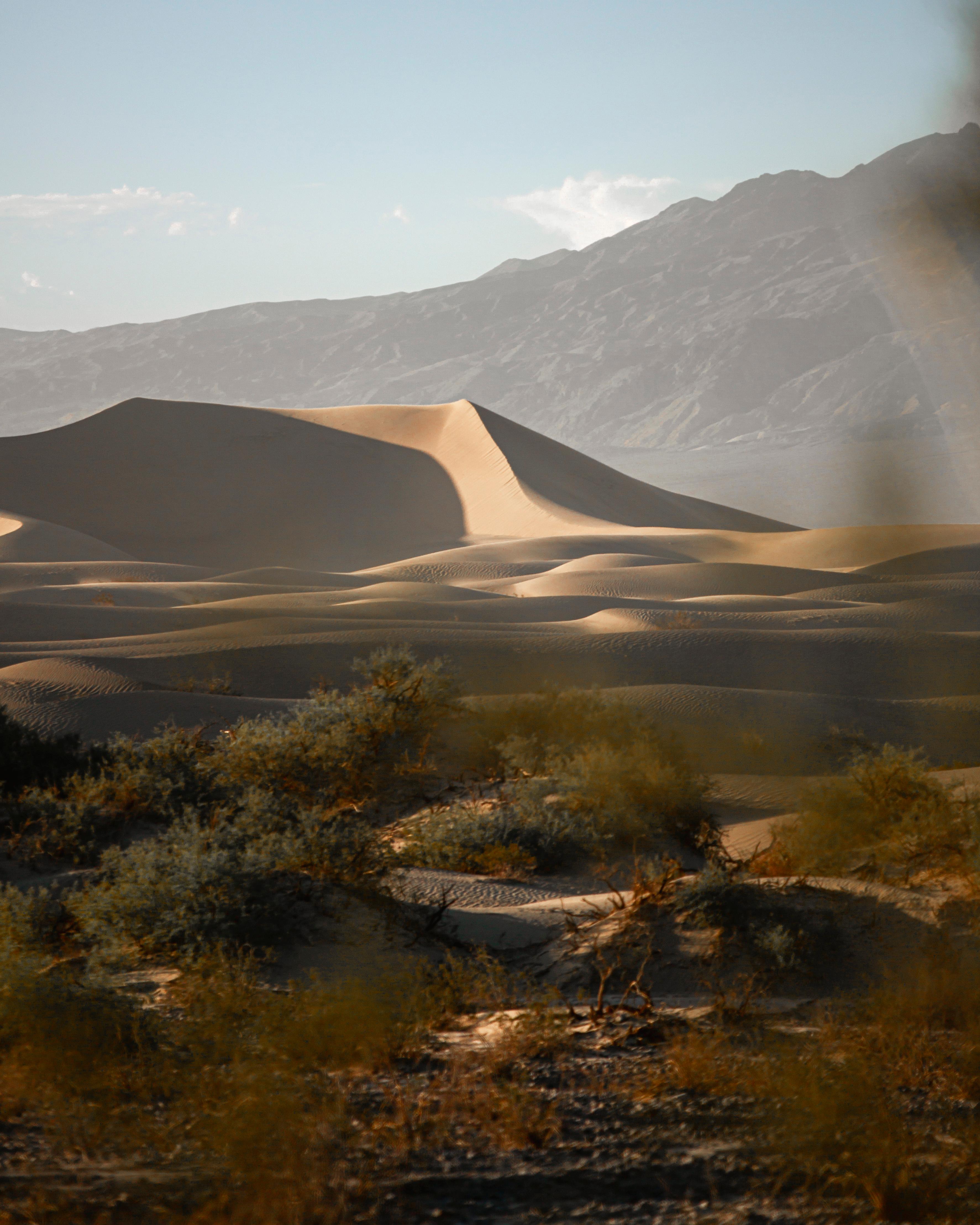
At the next photograph, Andy perked up.
“Now that is a desert.”
Curving dunes rose above shrubs. Light skimmed their ridges, and shadows filled the hollows. Ripples patterned the sand like tiny waves.
Ana pointed back to the salt flats and rocky mountains.
“Those were desert too.”
A desert was defined by its dry climate, not by a requirement to wear a sand blanket. Death Valley included many kinds of surfaces. Dunes occupied only particular areas where conditions allowed sand to accumulate.
Allie listed the ingredients: a supply of sand, wind to move it, and a place for it to collect.
Andy added a mixing spoon.
“Optional,” Ana said.
“Wind moves grains along the ground and through little hops,” Allie explained. “As grains collect, dune shapes develop. The land around them helps influence where sand gathers.”
Augie drew a grain with a backpack.
“Going for a walk.”
“More of a hop,” Andy said.
The Mesquite Flat dunes had different shapes and ripples, not one perfectly repeated hill. A change in light could make the same ridge look dramatically different.
They compared the dune patterns with the salt polygons. Both were natural patterns, but the mechanisms were different. A resemblance was a reason to ask a question, not permission to use the same answer everywhere.
Ana wrote a new explorer rule: MATCH THE EXPLANATION TO THE MATERIAL.
“Salt, sand, stone,” Andy read. “Very different sandwiches.”
“None of them sandwiches,” Allie said.
Augie added bread to the snack list, safely outside the geology diagram.
7. Fish in the wrong-looking place
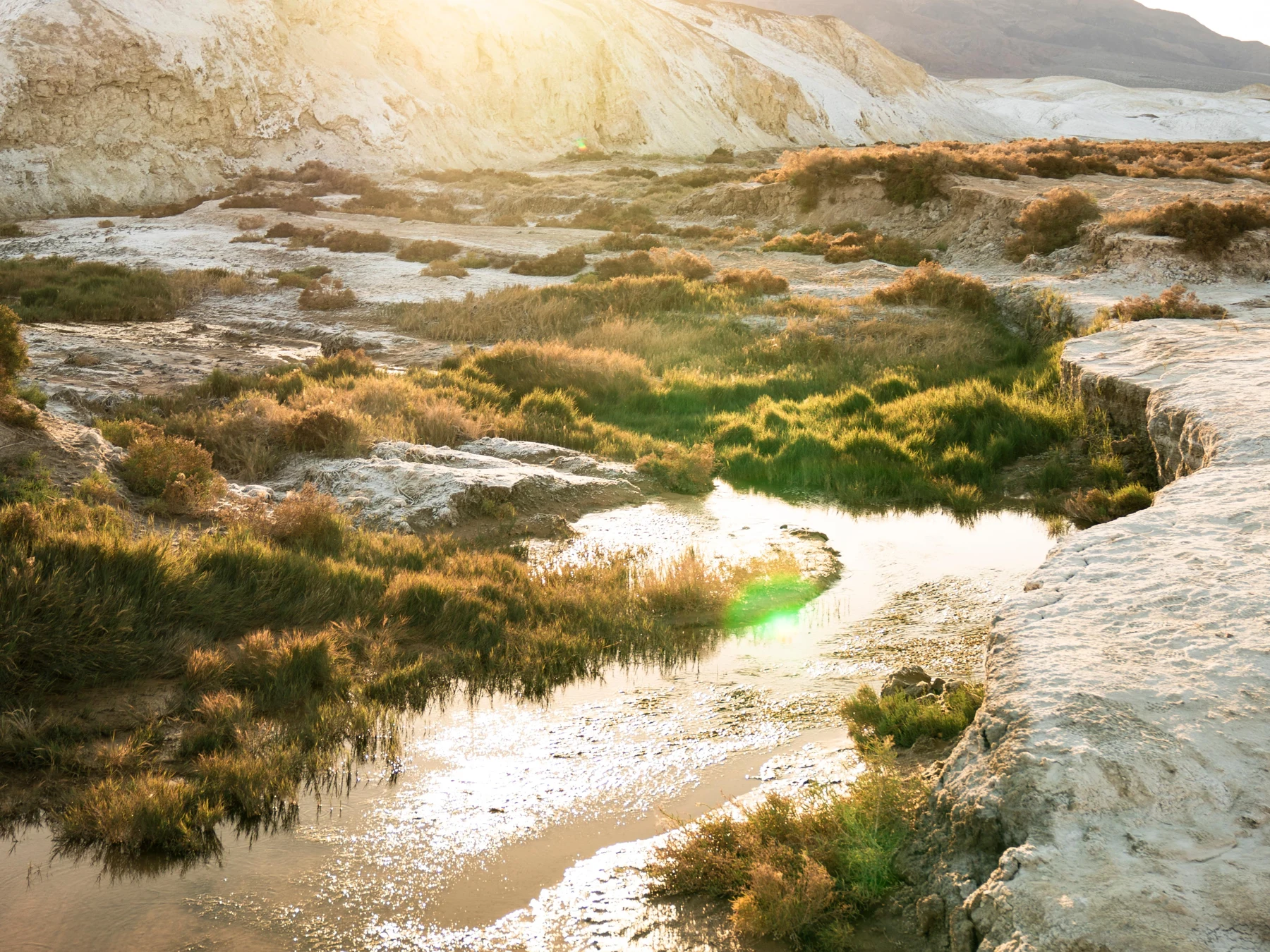
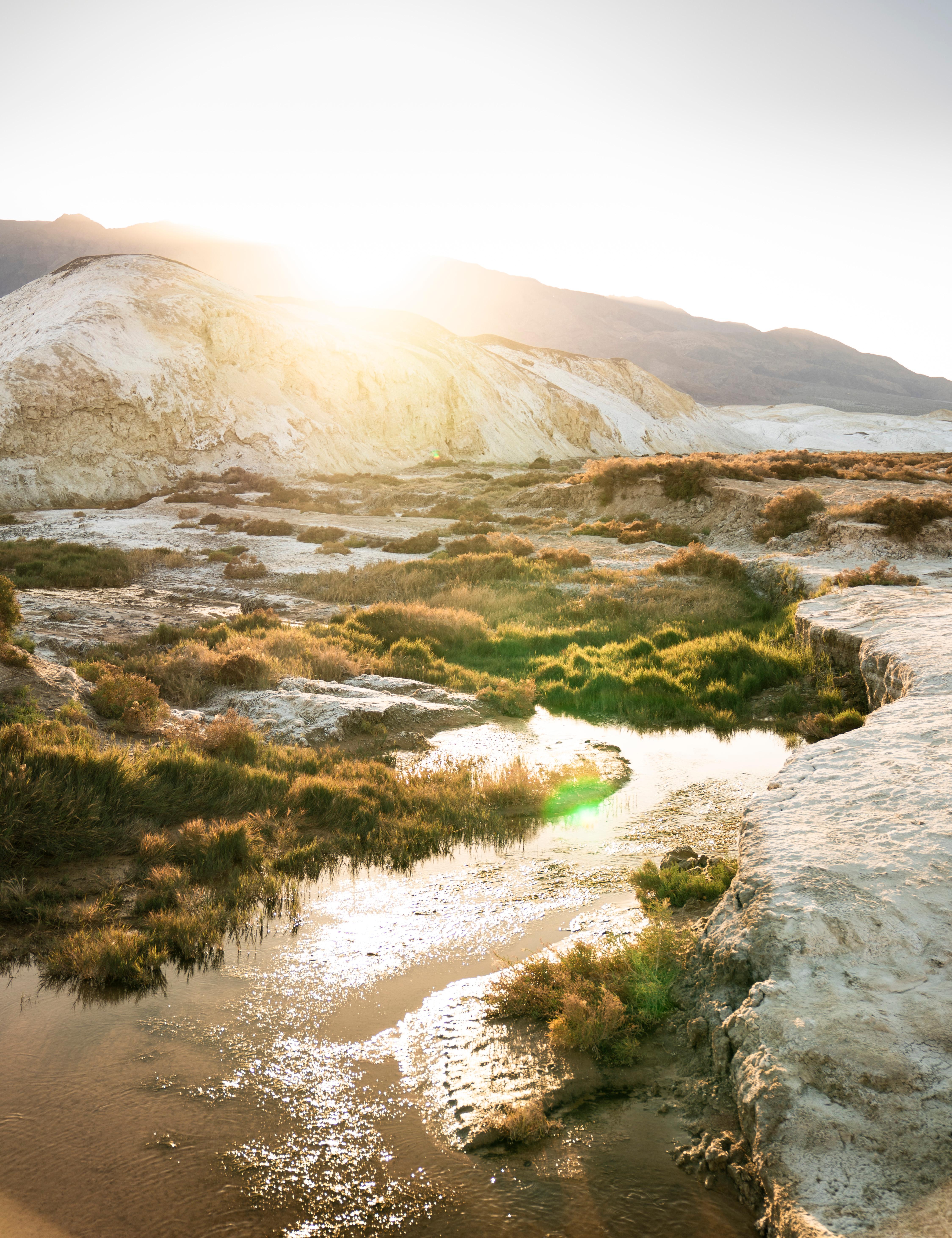
A green-lined creek in a park photograph stopped the children’s desert discussion.
“Someone put the forest back,” Augie said.
“It’s a wet habitat within a dry region,” Allie replied.
Ana turned to a page about pupfishes. These small fish lived in particular waters of the Death Valley region. Different kinds had different homes and adaptations.
Andy stared at a fish picture, then at the mountains.
“Fish. In Death Valley. That is a very misleading address.”
The family learned about Salt Creek pupfish and other pupfishes associated with the park. Some could tolerate conditions that would challenge many familiar fish, including very salty water. That did not mean every pupfish could live in every hot or salty pool.
“All fish are not interchangeable,” Ana said.
“Neither are all bathtubs,” Augie added.
Devils Hole pupfish had an especially limited natural home in a separate part of the park, not in Badwater’s white crust. The children studied them through educational material rather than planning a guaranteed sighting.
“Being adapted to a difficult place doesn’t make an animal unbreakable,” Allie said.
Changes to water and habitat could threaten these fishes. The kids would never add food, touch the water, release an animal, or move rocks to improve a fish’s home according to their own guesses.
Andy drew a tiny fish beside their huge polygon.
“One park. Very different living conditions.”
“Small places can matter a lot,” Ana replied.
Augie gave the fish a mailbox.
“Correct address.”
Below it, Allie wrote: NOT EVERY PART OF A DESERT IS DRY, AND NOT EVERY WET PLACE IS THE SAME.
8. A name is not a whole story
The park’s name had suggested emptiness to Andy. The fish had already disproved that idea. Learning about the Timbisha Shoshone changed his picture further.
“This is a homeland,” Ana read.
The Timbisha Shoshone people had deep, continuing connections to the valley and surrounding mountains, springs, and other places. Their knowledge and lives were not a footnote added after the park appeared on a map.
Mom shared a passage of background from a statement by Pauline Esteves, a former Tribal chairperson. The family discussed her account of belonging to the homeland, loss of access to important places, and the struggle for a secure future.
They did not turn her words into dialogue for their imaginary adventure or pretend that one exhibit could explain a whole people.
“We can listen to the person telling her own history,” Allie said.
Ana wrote Pauline Esteves’ name beside the source in their notebook.
Dad explained that the Timbisha Shoshone Homeland Act recognized important rights and a land base. It was part of an ongoing history involving living people, not the end of every question about the region.
Andy looked at the large word DEATH on the guide’s cover.
“A name can leave a lot out.”
“Especially if we stop asking questions after reading it,” Ana said.
Augie drew a plant, a fish, a person, and a spring around the word HOME.
Nobody added a joke to that page. Some discoveries asked for quiet attention.
When they returned to the salt puzzle, their map felt fuller. It held landforms and water, but also names, knowledge, and people whose connections were older than the park’s modern boundaries.
9. Case closed, floor still moving
Back with the Badwater photograph, Ana counted the sides of several shapes.
“Not all identical.”
Nature’s polygons did not have to match a worksheet’s perfect hexagon. Their boundaries could vary, break, and change. Flooding, crystal growth, sediment, and conditions beneath the surface all belonged in the bigger story.
Allie reviewed the evidence. Water delivered dissolved minerals into a basin without an outlet to the sea. Evaporation concentrated salts. Crystals formed. Research helped explain how circulating salty water below a crust could help organize raised polygonal ridges.
Andy crossed out DESERT TILE COMPANY.
“Suspect released.”
Augie crossed out GIANT SALTSHAKER.
“Taking it home.”
“Imaginary only,” Mom said.
Their real souvenirs were notes and pictures. The family followed designated access and current guidance, leaving fragile surfaces and wildlife habitat alone. They had not needed a long walk across the flats to solve the mystery.
Ana drew arrows from Redwood’s fog page to Death Valley’s salt page.
“In the forest, we asked how water arrives and helps life. Here, we asked where water goes and what it leaves behind.”
“Same water cycle,” Allie said. “Different clues.”
Andy looked at the next empty page.
“Please tell me the next park is not made of pepper.”
Their next chapter would visit Hawaiʻi Volcanoes National Park, where lava and the ocean met in a story about building land.
Augie sat upright.
“An island-building race?”
“A mystery with a very different kind of moving material,” Allie said.
Ana wrote THE ISLAND-BUILDING RACE.
Andy shut the notebook.
“Good. I have retired from the imaginary seasoning business.”
Explorer’s notebook
Nine discoveries to keep
- A polygon is a closed plane shape with straight sides; natural examples are often irregular.
- Being below sea level does not mean a basin is connected to the ocean.
- Faulting and crustal stretching helped form Death Valley’s mountains and low basins.
- Water can carry dissolved minerals toward an enclosed basin.
- Evaporation leaves salts behind and can lead to crystal formation.
- Research supports underground salty-water circulation as a driver of salt-polygon patterns.
- Mountain rain shadows help explain the region’s dry climate.
- Dunes need sand, moving wind, and somewhere for the sand to collect.
- Death Valley includes living habitats and is the continuing homeland of the Timbisha Shoshone.
Five ways to explore
- Count sides in a salt-flat photograph. Compare the shapes without expecting perfect hexagons.
- Draw arrows for water arriving, evaporating, and leaving dissolved material behind.
- Compare photographs of dunes, rocky mountains, salt flats, and a creek. Which clues suggest different processes?
- Use official visitor information to choose suitable activities; a visitor center or photo investigation can be the adventure.
- Learn about a particular pupfish and locate its habitat on a map without confusing it with another species’ home.
Talk it through
- How can dry-looking ground have water below the surface?
- Why doesn’t a rain shadow mean rain never falls?
- What did the word “Death” fail to tell us about this place?
Words for your backpack
Basin: a low area that can collect water and sediment.
Dissolve: become dispersed in a liquid as a solution.
Evaporation: liquid changing to vapor.
Crystal: a solid whose building particles have an ordered arrangement.
Convection: circulating fluid motion driven by differences in density.
Rain shadow: a relatively dry area on the leeward side of a mountain range.