1. A reef without a swimsuit
Augie had packed an imaginary snorkel.
“I am ready for the reef,” he announced.
Ana looked out at the red cliffs. “Your fish may need walking shoes.”
After investigating Canyonlands, the four explorers had arrived at Capitol Reef National Park in south-central Utah. There were cliffs, pale domes, and rows of green trees. There was no ocean waving hello behind the visitor center.
Andy checked the map upside down, then right side up. “Perhaps the ocean is on the back.”
Allie opened the notebook. At ten, she liked a mystery with enough room for several answers. Ana, nine, liked checking whether those answers survived the first question. Andy, seven, had already drawn a shark wearing hiking boots. Four-year-old Augie was deciding whether to lend it his imaginary snorkel.
Their parents had checked current conditions and chosen a gentle visit around Fruita, with suitable stops and time to rest. Remote roads and long canyon hikes were not on today's plan. Everyone had drinking water, hats, and a remarkably strong interest in lunch.
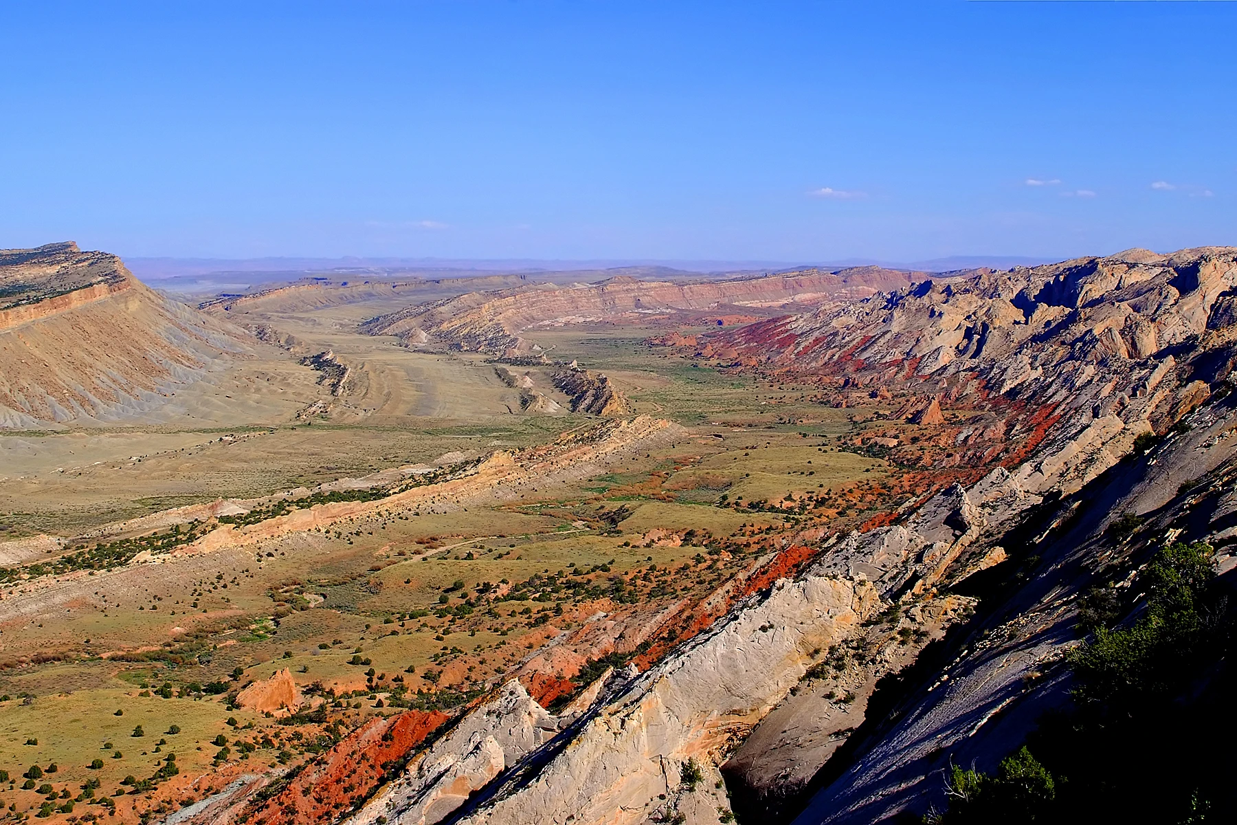
At the visitor center, a map introduced the Waterpocket Fold. Its tilted layers stretched far beyond what the family could see from one place.
Augie examined his shorts. “My pockets don't fold mountains.”
“Mine mostly fold crackers,” Andy said.
Allie wrote their chapter question: How can solid rock have a wrinkle?
Ana added a second: Why are fruit trees growing in a desert?
Andy wanted a third question about sharks. The committee allowed a small shark in the margin, provided it was labeled imaginary.
Through the window, the cliffs looked solid and still. The notebook suggested otherwise. There was a story here about moving land, moving water, and people learning to live with both.
Augie put away his snorkel.
“I'll need looking eyes,” he decided.
“Excellent equipment,” Allie said. “Already installed.”
2. The mountain's misleading name
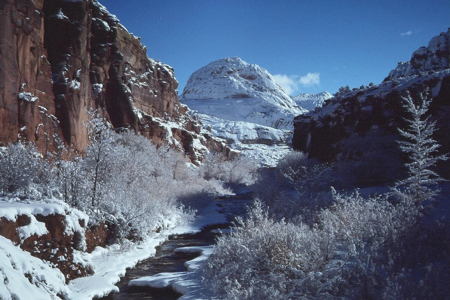
The first answer was hidden in the park's name.
A photograph showed Capitol Dome, a pale sandstone formation whose rounded top had reminded early newcomers of a capitol building. The word reef described cliffs that formed a difficult barrier to travel, rather like a reef obstructing a boat.
“So the name is a comparison,” Ana said. “Not a promise of coral.”
Andy drew a little boat approaching a wall of rock. Then he gave the boat wheels.
“That still doesn't solve the cliff,” Allie said.
“It improves parking.”
The children compared the photograph with their view of nearby formations. Some rose in rounded masses; others had sharper edges or broad slopes. A nickname could help someone remember a shape without explaining how the shape formed.
Augie suggested that the dome looked like a scoop of ice cream.
“It doesn't melt into a cone,” Ana said.
“Very disappointing ice cream.”
Allie made two notebook columns: what it reminds us of and what the evidence tells us. In the first went buildings, scoops, and Andy's enormous stone helmet. In the second went sandstone, layers, and questions for the exhibits.
Their parent pointed out that names also reflected particular people and moments in history. A later traveler's name for a place was not the beginning of that place's human story.
Ana drew a long line before the words Capitol Reef.
“Room for what came before,” she explained.
They would return to that line. First they needed to investigate the wrinkle.
Augie gave the imaginary shark a new job: carrying the notebook pencil. It was becoming a very adaptable shark.
Allie turned to a diagram of rock layers.
“Let's start before the fold existed,” she said.
Andy sighed. “Before breakfast?”
“Considerably.”
3. A blanket with a very long memory
The exhibits described a changing region: ancient sandy landscapes, rivers, muddy lowlands, and shallow seas. Material accumulated in layers and eventually became sedimentary rock. Today's desert did not mean the area had always been a desert.
Ana pointed to the different layers in the diagram. “These are evidence of different environments at different times.”
“Not every environment happening in the same afternoon,” Allie added.
Andy drew a beach, a river, and a swamp squeezed onto a calendar square. Ana crossed out the calendar, keeping the pictures.
At a rest stop, their parent brought out a small clean cloth and two closed books. Allie drew parallel lines on scrap paper first, then laid the cloth across the books, which started at the same height.
“Pretend the stripes are layers,” she said. “Now watch the shape.”
Their parent slowly raised one book while the other stayed lower. The cloth draped between the two levels, making a bend with a steeper section.
“A blanket staircase!” Augie said.
That was a useful beginning for monocline: a step-like bend in rock layers. Movement on a deeply buried fault helped lift one side of this landscape relative to the other. Overlying layers bent across the change.
Andy looked suspiciously at the cloth. “But a cliff isn't laundry.”
“That's the important limitation,” Allie said. “The cloth shows a shape. It doesn't behave like buried rock under pressure, and our seconds aren't geologic time.”
Ana labeled the model helps us imagine the bend—not an experiment that makes a mountain.
They remembered Canyonlands: old layers could exist before a younger canyon cut through them. Here they needed another distinction. Making the layers, bending them, and exposing them at the surface were different parts of the story.
Augie pressed his own shirt flat.
“I have finished my geology.”
Andy inspected it. “One remaining wrinkle.”
“Protected habitat,” Augie replied.
The family left it undisturbed.
4. Why the fold isn't a folded sandwich
Outside again, Ana tried to follow the layers with her eyes. Some formed long slanting bands rather than neat horizontal shelves.
Allie traced a line in the notebook. “We should picture the larger structure, not expect one tiny crease we can point to.”
The Fold extended for nearly a hundred miles. Their view was a small part of a very large feature. A photograph of Strike Valley helped them see the pattern across a broader landscape; studying it did not mean the family had driven to that remote viewpoint.
Andy drew a sandwich folded in half.
Ana shook her head. “That makes the layers double back much more sharply. Our cloth step was closer.”
“Then my sandwich is an inaccurate lunch model.”
“Still edible, if it's your actual sandwich.”
The park's present scenery also needed erosion. Once uplifted rock was exposed, water and gravity helped remove material. Layers resisted breakdown differently, leaving cliffs, slopes, and striking shapes. The fold was the large underlying arrangement; erosion helped reveal and reshape it.
Augie pointed to a paper flap left over from their model. “Take away the cover. Find the stripes.”
“That's part of the idea,” Allie said. “But in real life, removing material changes the landscape too.”
They made a sequence with three notebook boxes: layers accumulate; layers are lifted and bent; exposed rocks are weathered and eroded. Arrows connected the boxes. Their parent reminded them that real processes could overlap, and the simple sequence left out many details.
Andy added a fourth box: children arrive with questions.
“That part is accurate,” Ana agreed.
Allie looked back at the cliffs. Their stillness no longer felt like evidence that nothing had happened. It felt like a page whose earlier events needed careful reading.
Augie added a fifth box, very small: snack.
The sequence had reached the present.
5. A green surprise called Fruita
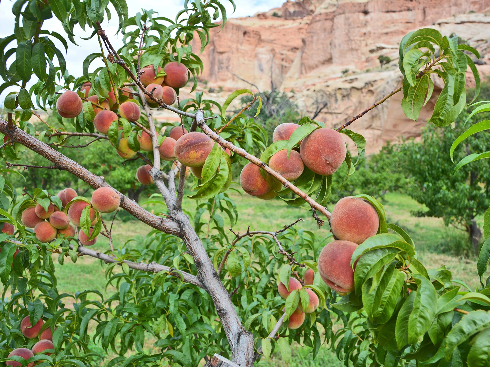
The trees near Fruita looked especially green against the surrounding rock. Andy shaded a notebook tree so enthusiastically that its leaves resembled a broccoli cloud.
“Why here?” Allie asked.
“The river,” Ana said. “And people moving water to the trees.”
They learned that the Fremont River had supported people in the area long before the orchards. Later, Latter-day Saint settlers planted fruit trees in the valley. Historic orchards still formed part of the landscape the park cared for.
A photograph showed peaches among leaves, red cliffs beyond them. The family's own stop did not come with a guaranteed harvest. Seasons, weather, and orchard conditions mattered. Their parents checked signs and current information rather than promising fruit on every branch.
Augie studied the picture. “A peach is wearing fuzz.”
Andy stroked his chin. “A very young beard.”
Ana firmly removed fruit grooming from the day's activities.
The orchard's water story interested Allie. Gravity-fed ditches carried irrigation water where growers needed it. The trees depended on work as well as water: pruning, planting, and continued care.
At the picnic table, Ana drew a river, a ditch, and a tree. She added arrows showing movement downhill. Andy put a tiny delivery truck beside an arrow.
“The water doesn't need that,” she said.
“It's for the peaches.”
Their parent asked what else a tree might need. Sunlight, suitable soil, and space joined their list. Allie added pollinators for many fruit crops, and seasons that allowed flowers and fruit to develop.
They could admire the orchards without treating them as a limitless snack cupboard. Picking was allowed only in orchards marked open for that purpose, under posted rules. Nobody climbed the trees. The family could enjoy this visit even if all they harvested was a new question.
Augie held up the packed apple their parent had brought.
“This one was reserved.”
“An excellent reservation system,” Andy said.
6. Two kinds of history on one page
After their break, the children looked at information about people who had lived in this region long before Fruita's orchards were planted.
Communities associated with the Fremont Culture grew corn, beans, and squash, while also gathering and hunting. Rock imagery and other surviving evidence helped tell part of their story. Present-day Indigenous peoples maintained connections with this landscape; the past was not a sealed box containing people who had simply disappeared.
Ana returned to the long line she had drawn beside the park's name. “The orchard story belongs here, but it doesn't fill the whole page.”
Allie added separate labels rather than squeezing many different communities into one description. They read about connections involving Hopi, Zuni, Paiute, Ute, and Navajo peoples. Those were distinct communities, with their own histories and knowledge.
At the designated viewing area for rock imagery, the family stayed on the boardwalk and respected barriers. They could look without approaching or touching the rock surface.
Andy noticed a shape he wanted to identify.
“Could it mean—”
“It might be a question to learn more about,” their parent said. “Seeing a familiar-looking shape doesn't mean we know what its maker intended.”
Allie left room in the notebook for things they did not know. They would use publicly shared interpretation and community resources, rather than inventing a translation.
Augie quietly announced that his hands were staying in his pockets.
“Excellent pocket use,” Ana said.
For a moment, everyone watched without trying to turn the images into a guessing contest. The cliff held marks made by people, and those marks deserved care.
Back at the table, Andy drew his own original family symbol: four circles around a notebook. He did not copy a sacred image or add anything to a real rock.
“Mine means we have lots of questions,” he said.
“And one pencil,” Ana replied. “Please return it.”
7. The pocket that isn't for paddling
Augie had been patient about the Waterpocket Fold's second word. Now he wanted to understand its first.
A park educational photograph showed a rock basin that could hold water. Waterpockets were depressions in rock, some temporary and some able to hold water much longer. They were not sewn-in storage for a mountain's gloves.
“Does the water wrinkle?” Augie asked.
“The fold and the pockets are related to this landscape, but they aren't the same feature,” Allie said. “The big fold describes bent layers. The smaller pockets are basins in the rock.”
They recalled Canyonlands' tiny pool habitats. Here too, a basin could hold a community far more complicated than a glance suggested. Educational images showed small aquatic animals, including crustaceans such as tadpole shrimp.
Andy immediately drew a shrimp carrying a school backpack.
“Not a tadpole that turns into a shrimp,” Ana said after checking the caption. “Another name that could trick us.”
The family was learning about these basins from exhibits rather than scrambling up to inspect a real one. They would not swim, bathe, stir sediment, or put sunscreen-covered hands into a waterpocket. The organisms needed their habitat left alone.
Allie drew two boxes: water for a habitat and safe drinking water for us. One did not automatically mean the other. Their own drinking supply came from appropriate drinking-water sources, not a pool that looked clear.
Augie placed his bottle beside the notebook.
“This pocket has a lid.”
“And a responsible owner,” their parent said.
Ana looked at their original questions. Water helped shape the rock, could collect in small basins, flowed through the valley, and supported orchards. One word connected several stories, but each story needed its own explanation.
Andy circled water and drew branching arrows.
This time, none of the arrows invented a bridge.
8. The rock that arrived from somewhere else
Another exhibit introduced dark boulders that looked different from the red and pale sedimentary layers around Fruita.
Andy leaned closer to the picture. “Wrong costume for this rock party.”
The boulders had come from volcanic rocks in higher country west of the park. Large landslides and debris flows had helped transport material into the valleys. Some deposits had later been reworked by flowing water.
“So a rock can be part of this landscape without forming right where we see it,” Allie said.
Ana added a notebook question: Where did it come from, and how did it get here?
Their parent helped them compare that question with the sandstone mystery. Tilted layers recorded one kind of history. A transported volcanic boulder recorded another. The family did not need to squeeze everything into the same explanation.
Augie drew a suitcase for a boulder.
“No wheels?” Andy asked.
“Too heavy.”
“Fair.”
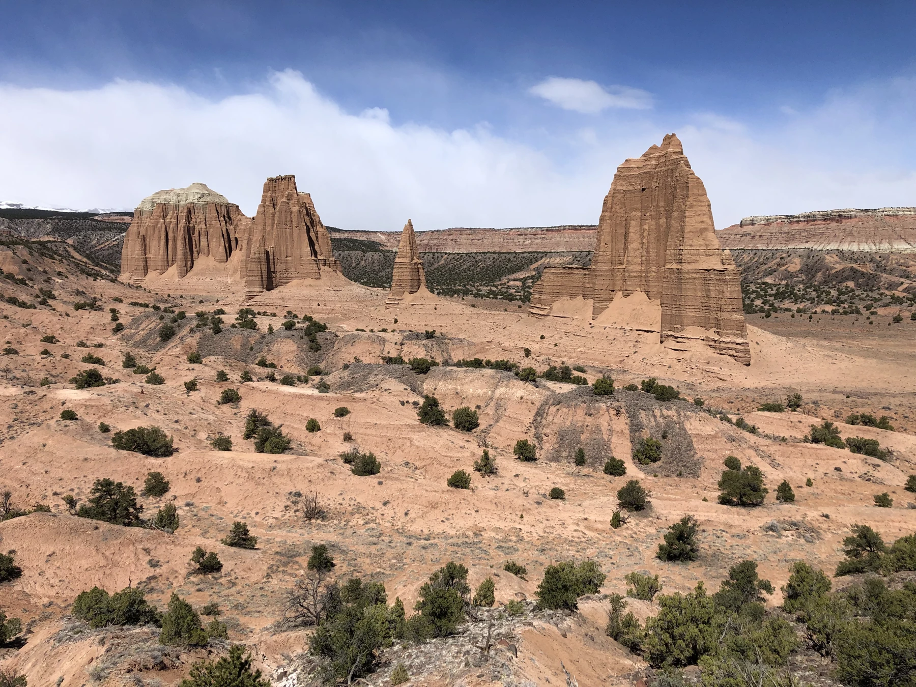
The children also studied a photograph of Cathedral Valley's tall monoliths. It was another part of the park they would investigate through pictures today. A dramatic photograph did not show whether a road was suitable, whether a crossing was safe, or whether a family had the preparation needed to travel there.
Their parents had chosen their route before setting out and checked it against current advice. A blue sky above their heads did not rule out dangerous runoff from rain elsewhere. They would postpone canyon plans when storms threatened and never drive into floodwater.
Andy crossed out a proposed notebook slogan: if it looks dry, it's fine.
Ana suggested a replacement: look, check, ask, and be ready to change the plan.
Augie drew a large tick beside it.
Their journey had plenty to investigate without making a risky shortcut. The shark in hiking boots remained their least sensible traveler, and even it was staying on paper.
9. A wrinkle worth keeping
At the end of their visit, Allie asked everyone to choose the discovery that had changed their first idea.
“The reef,” Ana said. “A name can compare things without meaning they're the same.”
“The bend,” Andy said. “I thought folded rock would look like my sandwich. It's a bigger pattern, and erosion changes what we can see.”
“The green trees,” Allie said. “Water and people's work belong in that picture.”
Augie considered the choices. “No ironing the mountain.”
“That would be an unreasonable household job,” Ana agreed.
Their notebook held a cloth-model sketch, a river-and-orchard diagram, a carefully labeled imaginary shark, and room for things they still wanted to learn. Each page had changed as they found evidence.
Andy examined his original folded sandwich drawing. Rather than erase it, he wrote first idea beside it, then added the improved step-like fold.
“Now we can see the thinking,” he said.
Allie liked that. A notebook did not have to look correct from the first pencil mark. It needed a way to show what they had learned and why they had changed their minds.
Their parent checked the picnic area for wrappers and stray belongings. The cloth went back into the bag. The books went beside it. No rocks, fruit without permission, or cultural objects were joining their luggage.
Their next chapter would visit Haleakalā National Park, where a mountain and the clouds would raise a new collection of questions.
Andy gave his shark a tiny airplane ticket.
Ana looked at the drawing. “Imaginary passengers only. We haven't packed for that trip yet.”
Augie watched the real cliffs for one last moment.
“The wrinkle can stay,” he said.
It would. The family was leaving with a more useful kind of souvenir: a changed idea, a fuller notebook, and four pairs of looking eyes ready for the next mystery.
Explorer’s notebook
Nine discoveries to take home
- Capitol Reef is in south-central Utah. Its name refers to dome-like rock shapes and a rocky barrier, not a modern coral reef.
- The Waterpocket Fold is a large monocline: a step-like bend in rock layers.
- Sediment accumulated before the layers became rock and were later bent. Exposing and eroding the layers added further chapters to the story.
- A cloth model can illustrate a bend's shape, but cannot reproduce real rock behavior, forces, or time.
- Water and gravity help reshape the exposed landscape; different layers wear away differently.
- The Fremont River and irrigation support Fruita's historic orchards, which need continuing care.
- Indigenous history precedes the orchards, and distinct Indigenous communities retain connections to the region.
- Waterpockets are sensitive habitats. A clear-looking natural pool is not automatically safe drinking water.
- Some dark volcanic boulders traveled from higher country, rather than forming where they now rest.
Five small adventures
- Make a step-fold model. With a grown-up, drape a cloth across two closed books. Gently raise one book. Draw the bend and explain two things the model cannot tell you. Do this at a table, not on park rocks.
- Build a water-story diagram. Draw a river, an irrigation ditch, and an orchard. Add arrows and label which parts are natural and which involve people's care.
- Keep a first-idea page. Sketch what you imagine a monocline looks like. Compare it with a reliable diagram, then add an improved drawing without erasing the first.
- Investigate a place-name. Choose a familiar place, learn where its name came from, and distinguish a comparison from a literal description. Ask whose perspectives the name includes or leaves out.
- Plan a gentle park visit. With a grown-up, use current official information to choose suitable stops, water, shade or rest opportunities, and an alternative for unsuitable weather. Remote scenery can be studied through photographs too.
Talk it over
- How is bending a set of layers different from eroding those layers?
- Why doesn't the orchard photograph guarantee fruit will be available during your visit?
- What can a photograph tell you about a remote place, and what important travel questions can it leave unanswered?
- Why is “I don't know yet” sometimes a better notebook entry than a confident guess?
Words for your explorer pack
- Monocline: a step-like bend in rock layers.
- Fault: a break in rock along which movement has occurred.
- Sediment: loose material such as sand, silt, or mud that can accumulate in layers.
- Uplift: upward movement of part of Earth's surface.
- Erosion: removal and transport of material by processes such as moving water.
- Irrigation: supplying water to crops or other planted areas.
- Waterpocket: a natural depression in rock that can collect water.
- Debris flow: a moving mixture of water, sediment, and rock fragments.