1. A very inconvenient shortcut
Andy placed one finger on the park map and drew an imaginary straight line.
“We go here, then here, then there.”
Ana looked over his shoulder. “Your route has crossed two canyons and possibly invented a bridge.”
“Efficient planning,” Andy said.
“Excellent drawing. Terrible road.”
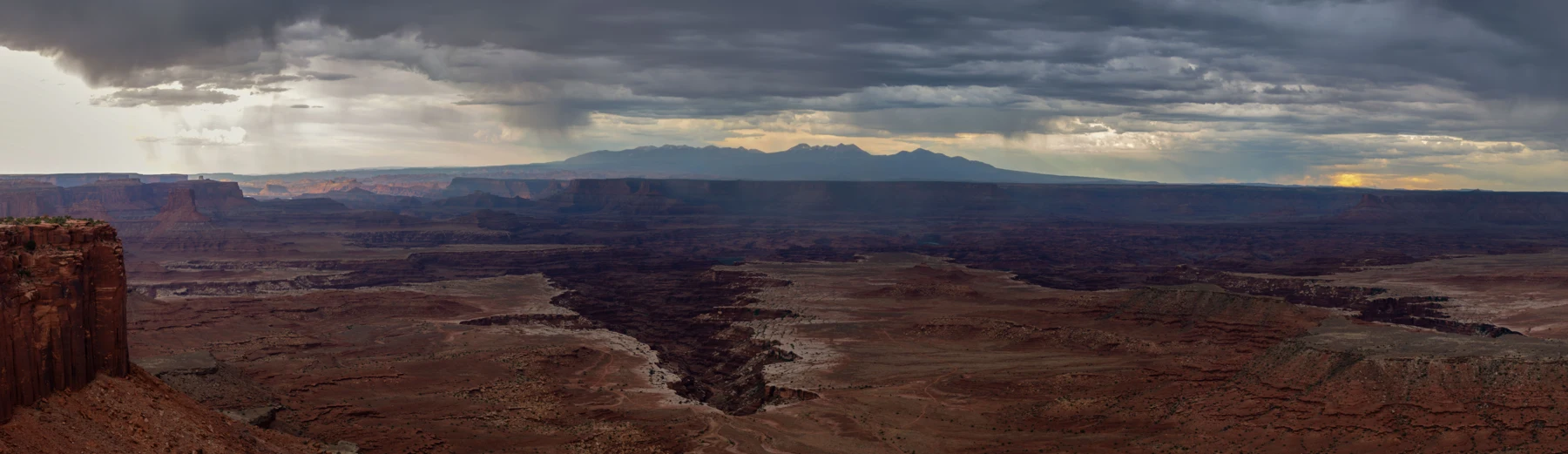
The four explorers had arrived at Canyonlands National Park in southeastern Utah. After the moving sand of Great Sand Dunes, they were looking at rock that seemed determined to stay put: broad mesas, steep cliffs, and an extraordinary network of canyons.
From their safe place at an Island in the Sky overlook, the land appeared to have been sliced into shelves and branching passages. Far below lay a world that could not be understood by drawing one line across a page.
Augie peered at the map. “Who made the maze?”
Allie opened their notebook. The River That Cut a Maze. How did moving water shape all this rock?
Their parents kept the children well back from the edge. They had checked weather and current conditions, packed water and sun protection, and chosen suitable overlooks and short routes. Nobody would follow Andy's pencil line downhill.
At the visitor center, they learned that the Colorado and Green Rivers were central to the park. They also learned that the park's districts were not joined by roads across the canyons.
“Map distance isn't driving distance,” Ana said.
Andy added a bridge to his drawing, then crossed it out.
Augie suggested a flying picnic basket.
Allie gave both proposals their own column: things we are not using for navigation.
Their real route would stay in Island in the Sky. Maps, exhibits, and photographs would help them investigate the other parts of the park without pretending they could visit them all before lunch.
Andy looked out again. “The landscape has strong opinions about shortcuts.”
2. Two rivers, one meeting place
Allie traced the Colorado River on the map. Ana found the Green River approaching it.
“Here,” Ana said. “They join.”
The meeting place of streams or rivers was called a confluence. The Green joined the Colorado inside Canyonlands, and the combined water continued downstream as the Colorado River.
Augie moved two fingers together. “River handshake.”
Andy drew two rivers wearing tiny mittens.
Their parents helped them separate the map from the view. The family could learn where the confluence was without claiming to see it from every overlook. A distant ribbon of water and a diagram of a whole river system were different kinds of information.
Allie added labels before Andy could name the rivers Lefty and Righty.
The rivers helped divide Canyonlands into its major districts: Island in the Sky, The Needles, The Maze, and the rivers themselves. Their names described very different experiences, not four neighboring rooms with doors between them.
“An island without an ocean,” Andy said, considering their district's name.
“A high mesa between deep canyons,” Ana replied. “Names need investigation.”
Augie asked whether the rivers knew they were inside a park.
“No signs for the water,” Allie said. “The rivers connect this place to land far beyond its boundaries.”
They remembered Congaree's watershed. Water could arrive from distant places and continue into others. Canyonlands was one chapter of a much larger river journey.
Andy drew arrows entering and leaving the map. Then he placed a lunch symbol beside their visitor-center stop.
“What does that show?” Ana asked.
“A critical tributary of my happiness.”
Augie approved the symbol. Their parent approved the actual lunch, which remained safely packed for later.
3. The layers arrived before the maze
The canyon walls had bands, ledges, and slopes. Allie wondered aloud whether the layers had formed because the rivers were cutting them.
Ana studied an exhibit. “The rock layers came first. The canyons exposed them later.”
Long before today's deep canyons, sediment had accumulated in different environments. Sand and mud carried by water, and sand moved by wind, had contributed to layers that eventually became sedimentary rock.
Andy remembered Great Sand Dunes. “So loose sand can become part of a very different future.”
“Given the right conditions and a great deal of time,” Allie said. “Not because we leave a bucket outside overnight.”
At a picnic table, they made a model using strips of scrap paper. Different colors represented different rock layers. They stacked the strips without pretending their thicknesses matched the park.
Augie put a paper sandwich on top.
“That layer is very recent,” Ana observed.
Allie asked an important question: How old is the rock, and when was the canyon cut into it? Those were not the same question.
Andy thought of cutting a doorway in an old cardboard box. The cardboard existed before the opening.
“An old wall doesn't mean an equally old door,” he said.
Their model helped them understand the order of events, but it did not give them actual ages. Researchers used rocks, relationships among layers, and other evidence to investigate the landscape's long history.
Allie wrote three broad stages: deposition, uplift, erosion. Materials accumulated; the region rose; processes removed material and exposed what had been buried.
Augie pointed at the sandwich.
“Which stage is eating?”
Andy suggested that his lunch was about to experience rapid removal.
Ana insisted the scientific diagram survive until they finished discussing it.
4. The river did not work alone
Andy looked from the tiny-looking river far below to the enormous canyon walls.
“That water has been extremely busy.”
“It has also had help,” Allie said.
As the land rose, rivers cut into the emerging plateau. Tributaries and rainwater worked on smaller drainages. Water entered cracks; weathering weakened material; gravity moved loosened pieces downslope. The result was more complicated than one river neatly slicing a narrow groove.
Ana drew a large channel with smaller branches joining it.
“Like the branches on a tree,” Augie said.
“A useful comparison,” Allie agreed. “Although rivers flow through valleys instead of growing wood.”
Different layers resisted breakdown differently. More resistant rock could form cliffs and shelves, while less resistant material beneath it wore away more readily. That helped explain the stair-step shapes they could see from the overlook.
Andy drew an enormous staircase and a tiny person carrying shopping bags.
“Not an actual trail,” Ana labeled it.
They used their paper layers again. This time, their parent helped them remove short sections from different strips to suggest a stepped profile. It was a thinking model, not a realistic experiment in erosion. Paper behaved nothing like a cliff in rain.
Allie added weathering breaks material down; erosion moves it to the notebook. The two processes often worked together.
Andy wanted to know whether the canyon would eventually be finished.
The exhibits showed an ongoing landscape. Cliffs could retreat, spires could change, and material could continue moving. The view was not a completed sculpture waiting for visitors to admire it forever.
Augie drew a hard hat on a raindrop.
“Working,” he explained.
Their parent reminded them that this long-term story did not make sudden changes harmless. A rockfall or storm could be dangerous right now, even in a landscape whose history extended far beyond a human lifetime.
The family admired the staircase from its safe viewing area.
5. The Needles and the paper grid
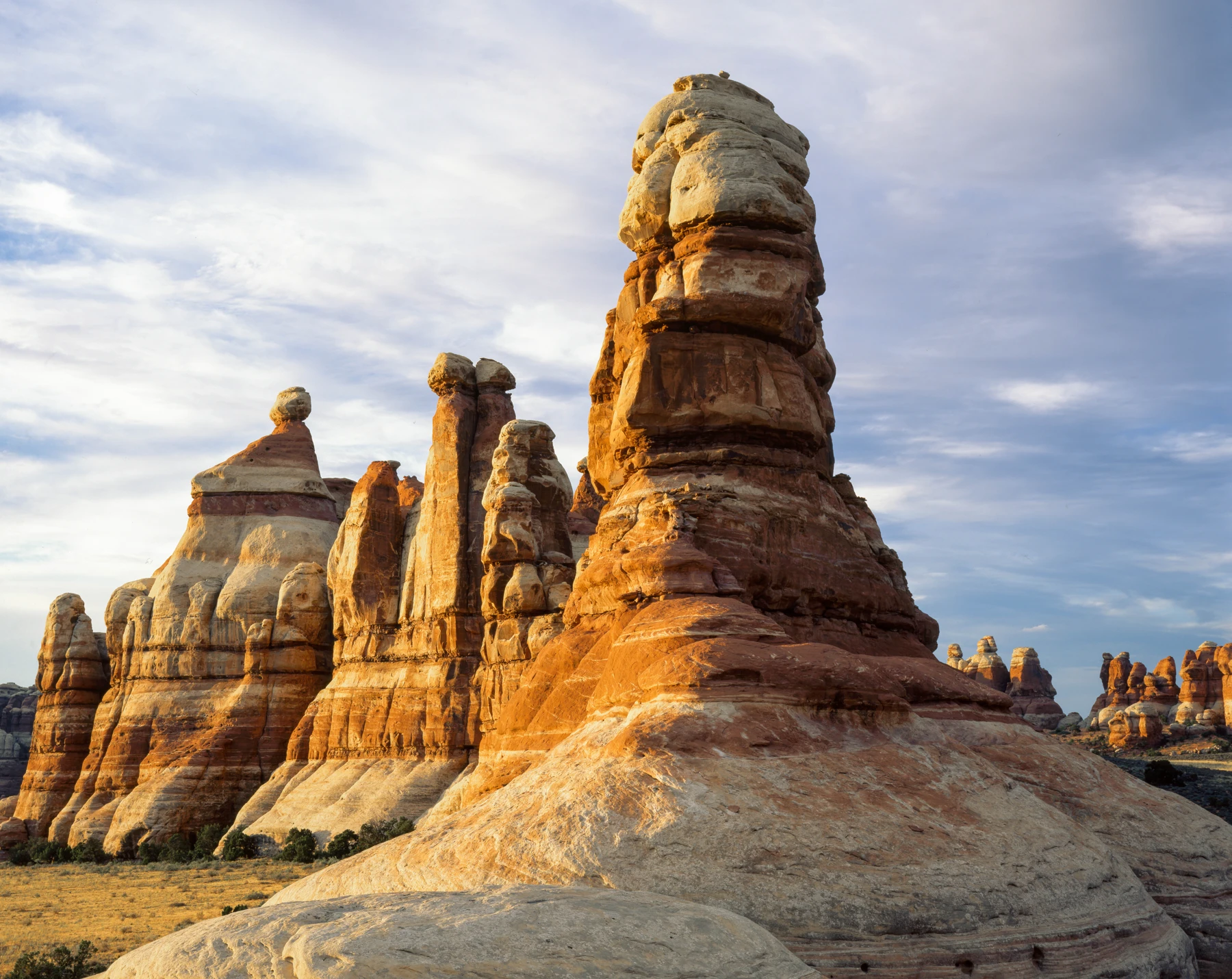
A photograph of red-and-pale rock spires made Augie sit up.
“Those are very big crayons.”
They were in The Needles district. The family was studying them through photographs and exhibits rather than driving there as part of their short Island in the Sky visit.
Andy noticed the stripes. Ana noticed the spaces between the towers. Allie asked how a more continuous mass of rock could become separate spires.
They learned about joints, fractures in rock. At The Needles, intersecting sets of fractures helped divide sandstone into blocks. Water could attack weaknesses and gradually enlarge the separations.
The cracking had a deeper story involving uplift and movement of buried salt layers. Salt far below the surface could deform slowly, helping stretch and fracture the overlying rock.
“Not a table-salt shaker under the park,” Ana said.
Andy quietly erased the enormous shaker he had started drawing.
On a new sheet, Allie drew lines crossing in two directions. She numbered some of the blocks. Their parent helped explain that the grid was a simplified way of imagining fractures, not a map of the real district.
Augie chose a block and added a pointed top.
“Crayon number six.”
Ana drew arrows along the gaps. The model helped them ask where breakdown might happen more readily. It did not predict the exact shape or lifetime of a spire.
Andy wanted to color every tower a different color. Allie suggested keeping the natural bands and putting his artistic towers on a separate page.
Their notebook now held a distinction worth remembering: a fracture helped create a starting weakness, while later weathering and erosion changed the shapes around it.
“First the cracks,” Ana said. “Then a very long reshaping.”
Augie regarded the photograph respectfully.
“They sharpen themselves slowly.”
6. The tiny neighborhood under a shoe
After looking at enormous cliffs, the explorers turned their attention downward.
Beside the permitted route, a patch of ground looked bumpy and dark. Their parents reminded them that not all ground that looked bare was empty.
Biological soil crust was a living community that could include cyanobacteria, lichens, mosses, algae, and fungi. Tiny organisms helped bind soil particles together, resist erosion, and support the desert ecosystem.
Andy held his shoe above his notebook drawing.
“This has become a large vehicle again.”
Ana remembered the tiny lives at Great Sand Dunes. “The shoe problem follows us.”
The family learned that young crust could look less distinctive than mature, dark, knobby crust. Being unable to recognize it confidently was a reason to follow the designated route, not a reason to assume the next patch was safe to step on.
Augie put his feet side by side.
“They are parked.”
Allie drew a close-up of soil grains linked by tiny threads. The picture was imaginary and enlarged, based on an educational image. She did not scrape or collect any real crust to inspect it.
Andy suggested a sign for his drawn shoe: oversized visitor—please use proper route.
The lesson also complicated their canyon mystery. Erosion helped create the dramatic scenery, but that did not mean every bit of erosion was desirable. Living crust helped keep soil in place where plants and animals depended on it.
“Nature isn't trying to make the biggest possible canyon everywhere,” Ana said.
Allie liked that observation. The landscape included processes that moved material and living communities that helped stabilize it.
Augie asked whether the crust was like bread crust.
“No,” Andy said. “This one has a neighborhood.”
“And neither one belongs under your boot,” Ana added.
Their parent considered the picnic table and decided that was excellent advice for both meanings.
7. A puddle with a waiting room
A park guide introduced another surprisingly small world: sandstone depressions called potholes. These could collect water after rain and support tiny communities.
Andy looked at a picture. “A swimming pool for things much smaller than us.”
“Without swimming privileges for us,” Allie said.
Even a finger, a shoe, soap, or sunscreen could disturb or contaminate the habitat. Dry potholes deserved care too. Some organisms or their drought-resistant life stages could persist through dry conditions, waiting for suitable water again.
Augie studied an illustration of fairy shrimp.
“Where are the wings?”
“The name is not an equipment list,” Ana explained.
The family compared several strategies for surviving dry periods. Different organisms could leave, resist water loss, or survive in resting stages. They did not all use the same method, and an empty-looking patch of dried mud could hold more than a visitor noticed.
Allie wrote dry does not necessarily mean lifeless.
Andy drew a waiting room with very small chairs. He labeled it fictional shrimp furniture before Ana had to ask.
The family did not add water to a real pothole to make something happen. They would learn from the guide and observe only from an appropriate distance, keeping feet and hands out whether it was wet or dry.
Ana thought about the difference between their own visit and the lives they were studying. The explorers could leave and find a tap, shade, and a packed meal. A small animal's whole world might depend on conditions in one temporary pool.
Augie drew a roof over his imaginary waiting room.
“For shade,” he said.
Allie added another question beside it: What does this organism actually need?
Andy looked at their page of drawings.
“Sometimes imagination helps us notice. Then evidence has to check it.”
Ana gave that sentence a star.
8. A maze on paper, a homeland in real life
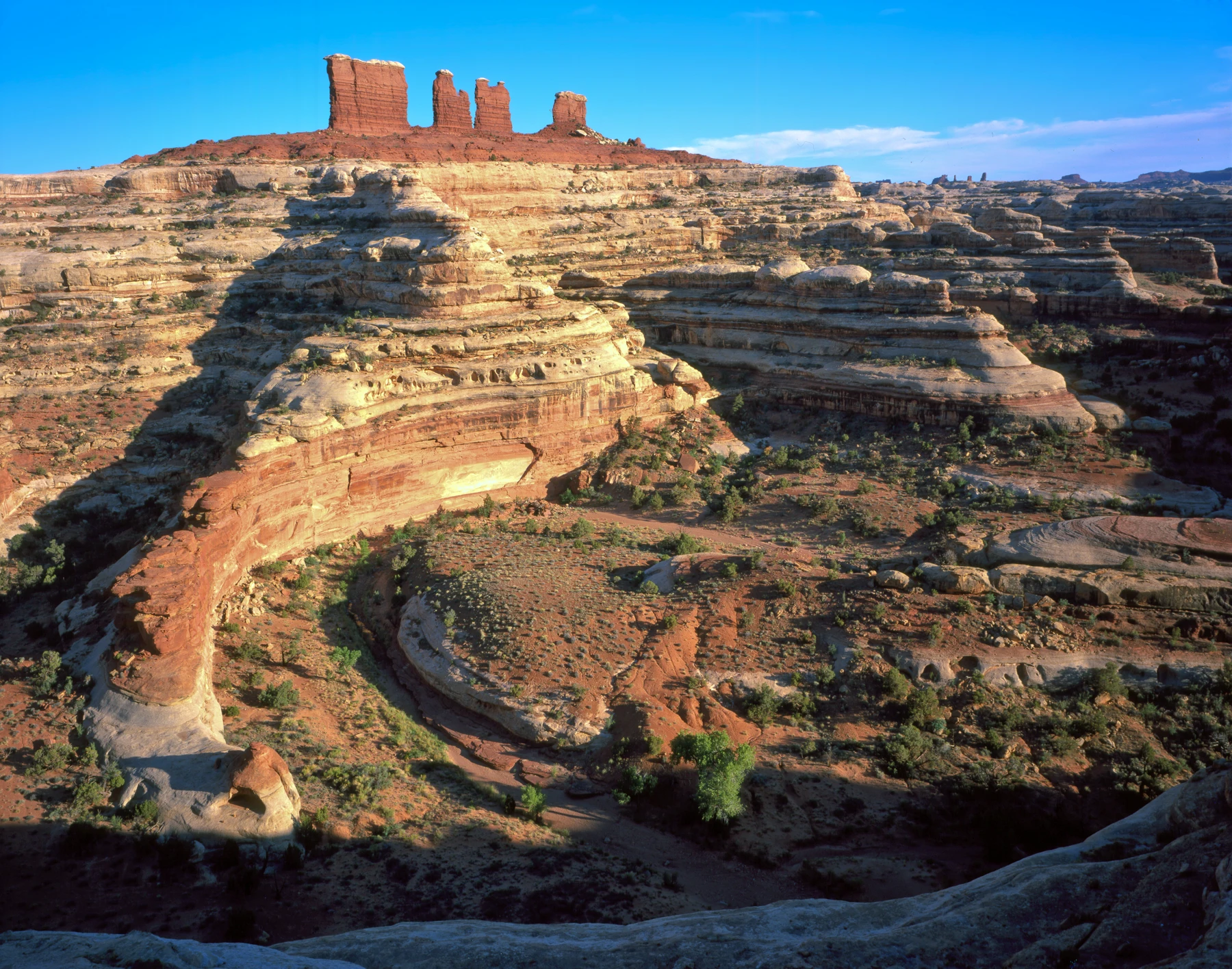
Their map still showed a region labeled The Maze. A photograph revealed intricate canyons and rock forms in that remote district.
Augie wanted to know where the entrance ticket for the maze was.
“The name doesn't make it a playground puzzle,” Allie said.
Remote travel required expertise, equipment, careful navigation, and much more preparation than their family's short visit. They could study the landforms without taking an imaginary map challenge onto real canyon terrain.
At a rest stop, Andy made a pencil maze on scrap paper instead. Ana drew a route through it, then deliberately stopped at a dead end.
“Turning back,” she announced.
“That's allowed?” Augie asked.
“On paper and on adventures,” their parent said. “A good decision isn't the same as reaching every planned destination.”
The exhibits also reminded them that canyon country had never been simply an empty maze waiting for newcomers. Indigenous communities had long-standing connections with the land, and those relationships continued today.
The family read names including Hopi, Navajo, Ute, Zuni, and Pueblo communities. Those names represented distinct peoples and histories, not one interchangeable story.
Ana thought about people knowing routes, seasons, water sources, and important places through knowledge shared across generations.
“We're trying to understand one view,” she said. “Other people have much deeper relationships with this landscape.”
Their parents helped them learn how to respect cultural places: leave objects where they were, do not enter restricted sites, and never touch, mark, or trace rock imagery. They could ask questions and learn from publicly shared community resources without inventing meanings for an image.
Andy put his pencil maze away.
“Mine fits in a notebook,” he said. “The real place needs more respect than a game.”
Augie nodded and drew four very small visitors beside a very large canyon.
9. The case of the missing rock
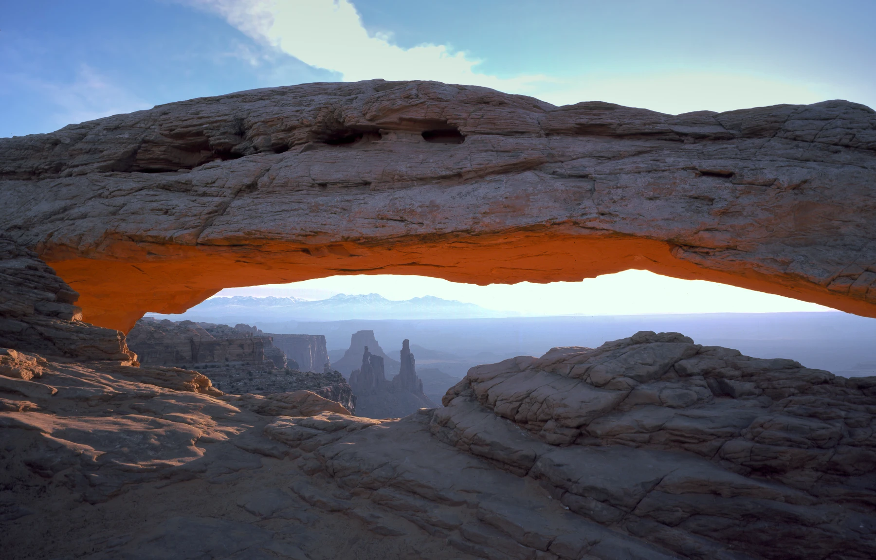
At their final suitable overlook, Allie asked the question that connected everything.
“If these canyons were cut into a larger landscape, what happened to the material that was removed?”
Andy pointed toward the river on the map. “Some of it traveled.”
Sediment could move downstream, be deposited, and be moved again. The landscape involved both removal and accumulation, at different places and times. They had followed sand at the previous park; now they were thinking about rock becoming material that could continue a journey.
Ana reviewed their notebook. “The rivers matter. But rain, cracks, weathering, gravity, and the different rock layers matter too.”
“And the small neighborhoods,” Augie added.
Allie wrote their answer beneath the original question. The river in their title stood for part of a larger team of processes. The Colorado and Green Rivers, their tributaries, and the surrounding landscape had a much more complicated story than one giant water knife.
Andy drew a knife, crossed it out, and replaced it with arrows, rock layers, a rain cloud, and a very tiny shrimp.
“The shrimp did not carve the canyon,” Ana clarified.
“It requested representation.”
Before leaving, they checked bottles, wrappers, hats, and their actual return route. Nobody had used the imaginary bridge. Nobody had entered the remote Maze to prove they were brave.
Their next chapter would take them to Capitol Reef National Park and a feature called the Waterpocket Fold.
Augie looked at his pocket. “Can water fold?”
“Excellent next question,” Allie said.
Andy checked the map one last time.
“This time,” Ana said, “please use the roads that exist.”
He did.
The canyons remained behind them, intricate, enormous, and full of journeys still continuing.
Explorer’s notebook
Nine discoveries to take home
- Canyonlands lies in southeastern Utah. Its districts include Island in the Sky, The Needles, The Maze, and the rivers.
- The Green River joins the Colorado River at their confluence inside the park.
- Sedimentary rock layers formed before canyons exposed them. The age of a rock is different from the age of a canyon cut into it.
- Deposition, uplift, weathering, erosion, and gravity all belong in the landscape's story.
- Different resistance to breakdown helps create cliffs, ledges, and slopes. Rivers did not shape the whole landscape alone.
- At The Needles, intersecting fractures and later erosion helped shape spires; uplift and buried salt movement contributed to the cracking.
- Biological soil crust is a fragile living community. Some young crust looks like ordinary ground, so follow designated routes.
- Wet and dry sandstone potholes can be sensitive habitats. Keep hands, feet, and added water out.
- Canyonlands is a living cultural landscape connected with distinct Indigenous communities, not merely a maze for visitors to solve.
Five small adventures
- Make a paper layer model. Stack colored scrap-paper strips, then remove sections to suggest ledges and slopes. Explain that paper is not rock and the model cannot give actual erosion rates.
- Trace a confluence. On a map or your own labeled drawing, join two rivers. Mark upstream, meeting place, and downstream. Do not assume every overlook can see the junction.
- Draw a fracture grid. Sketch crossing lines, then imagine some gaps widening. Label what the model helps explain and what it leaves out.
- Design a responsible pencil maze. Include a route, a turn-back point, and an imaginary closed area. Solve it on paper; never make an off-trail challenge in a real park.
- Ask where material goes. Choose a photograph of a canyon. Draw arrows for possible movement of water and sediment, and identify one question the photograph alone cannot answer.
Talk it over
- Why isn't the age of a canyon necessarily the age of the rock in its walls?
- How can erosion help shape a canyon while living soil crust helps resist erosion elsewhere?
- Why might two places close together on a park map require a long drive between them?
Words for your explorer pack
- Confluence: a meeting place of streams or rivers.
- Tributary: a stream or river flowing into another.
- Deposition: the settling or accumulation of transported material.
- Uplift: upward movement of part of Earth's surface.
- Weathering: breakdown or alteration of rock where it is.
- Erosion: removal and transport of material by processes such as moving water.
- Joint: a fracture in rock.
- Biological soil crust: a living surface community that binds soil and supports an ecosystem.