1. A sandbox above the Arctic Circle
Augie had packed a paper snowflake in his notebook.
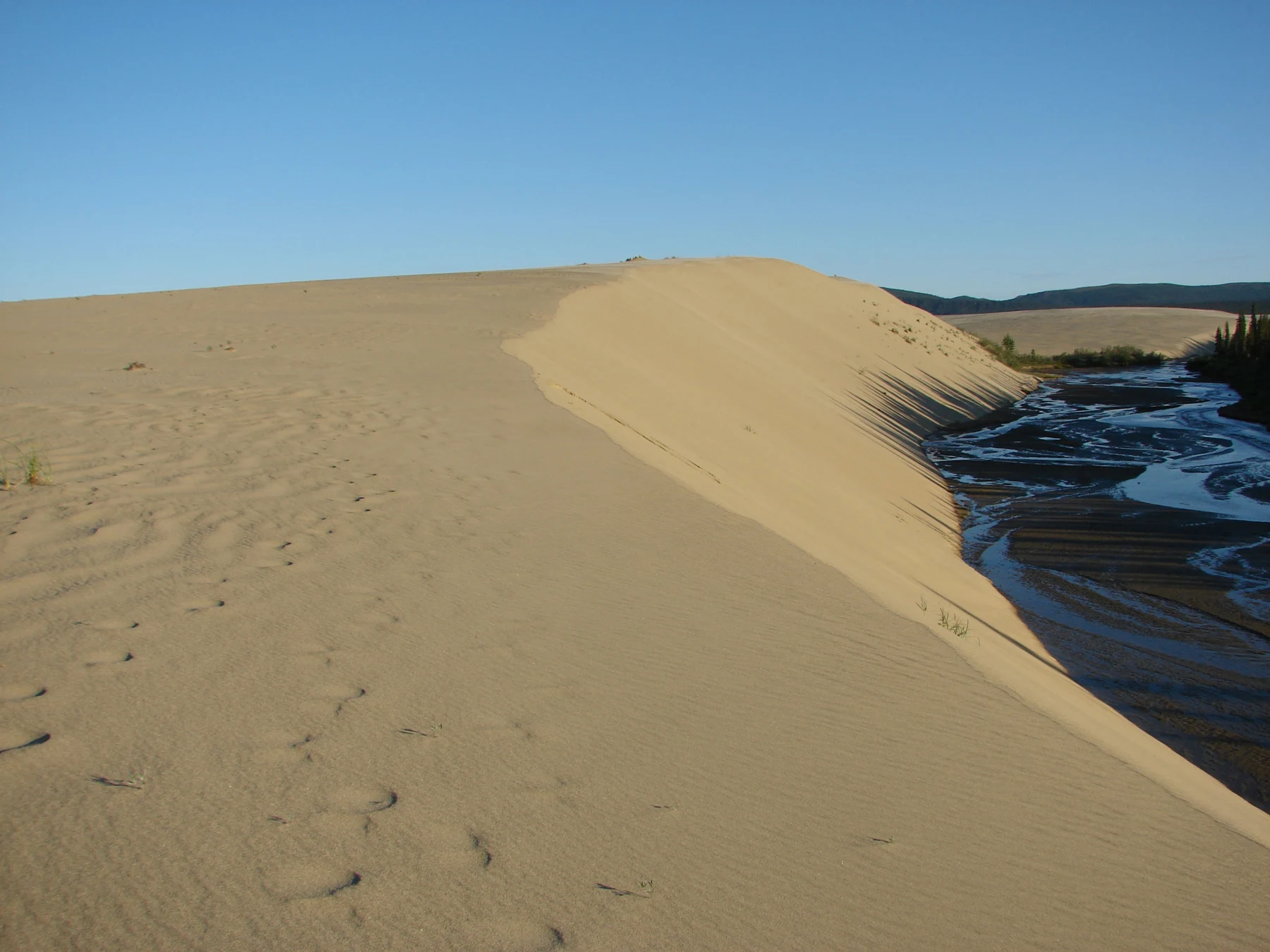
Their next adventure led north, to Alaska’s Kobuk Valley National Park above the Arctic Circle. He expected cold-weather questions. Then Allie opened a park photograph of sweeping golden dunes.
Augie looked from the snowflake to the sand.
“Who put a sandbox in the Arctic?”
Andy leaned over the picture. “A very patient builder.”
The children had just followed volcanoes, glaciers and salmon rivers through Lake Clark. Now they were investigating another landscape shaped by moving material. These dunes rose among trees, wetlands and tundra in the Kobuk River valley, far from an ocean beach.
Their grown-up had arranged suitable experiences and official interpretation. Photographs would take the investigation beyond their own short observations. Remote travel required experienced planning, local knowledge and current guidance; the family would not set out across unmarked country simply because it looked open in a picture.
Ana found the Kobuk River on the map and marked the Great Kobuk Sand Dunes south of it.
“Sand here does not mean we found a tropical beach.”
Allie wrote their challenge: How did so much sand arrive in a northern valley, and how do moving dunes connect with a river, migrating caribou and a living homeland?
Augie drew a caribou carrying a bucket.
“Did the caribou build it?”
“Let’s find the sand’s travel history first,” Andy said.
Ana made three blank spaces in the notebook: ingredients, delivery, sculpting. The family would need more than one process to fill them.
Augie kept his snowflake. He placed it beside the dune photograph instead of throwing it away.
“Both clues can stay.”
2. The ingredients began with rock
The first part of the mystery reached back to Ice Age landscapes.
Glaciers in the surrounding mountains moved under their own weight. Ice could carry rock fragments, and pieces dragged along a glacier’s base could scrape and grind against other rock. Over time, those processes produced sediment of different sizes.
Andy drew a rock caught beneath a broad blue glacier.
“Rocks rubbing rocks. The ice supplies the enormous moving mitten.”
Sand was a size category, not one special substance that could only form beside the sea. A sand grain might come from different kinds of rock or other material. Here, park information linked the dunes’ ingredients to glacial grinding and the movement of sediment through the region.
Allie drew large fragments, smaller grains and fine particles in separate groups.
“Not every broken piece becomes sand.”
Ana added that a glacier’s work included more than grinding. Ice could remove blocks, transport debris and leave material behind. Their simple picture illustrated one part of a complicated landscape history.
Augie tried drawing a glacier with a pepper grinder.
“A mountain-sized kitchen.”
“A useful joke,” Andy said. “But no handle to turn.”
The family also learned an important distinction. The Kobuk Valley held ice-free areas during periods when glaciers occupied nearby mountains. They should not assume that a glacier once sat directly on every dune simply because glacial processes helped make its sand.
Allie drew the mountain ice beside the valley, then connected the places with a sediment arrow.
“The ingredient can travel away from where it was made.”
Their first notebook space now read: Rock broken and ground through glacial processes contributed sediment.
It was a beginning, but not the answer. A pile of ingredients did not explain why dunes stood in this particular valley. The children still needed a delivery route.
3. Water and wind shared the delivery
Meltwater and rivers moved sediment away from glaciated landscapes. Water could carry material downstream and leave some behind where conditions changed, including on river bars and broad valley surfaces.
Ana traced a blue line and added small dots.
“A river carries more than water.”
Different grain sizes moved under different conditions. A fast current could transport material that a slower current might deposit. The family did not need a rule saying every river sorted every grain perfectly; real channels changed with flow, bends, floods and the material available.
Andy placed a paper sandbar beside the Kobuk River on their model.
“Delivery does not always mean straight to the final address.”
Exposed sediment could dry. Wind could then pick up and move suitable loose particles. During colder, drier periods, sparse vegetation and strong winds helped sand move across the region. Park information described wind sweeping sand from river deposits into dune fields.
Allie added a second arrow, this one for air.
“Water can make a deposit available. Wind can move it again.”
Augie drew the two arrows passing a tiny parcel.
“Team delivery.”
They avoided making the history into one neat afternoon. Glaciers, rivers, wind and changing vegetation acted over long spans, sometimes leaving material available for later movement. The dunes preserved a history of repeated transport and reshaping.
Ana wrote more than one journey beside a sand grain.
Their grown-up helped them use paper tokens for the model. No loose sand needed to be blown across a room to prove that moving air could transport particles.
Allie filled the second notebook space: Water and wind moved sediment, sometimes in successive stages.
Andy looked at the dune photograph again.
“Now we know how sand could arrive. We still need to explain how it stacks itself into hills.”
Augie drew a small sign on the parcel: Some assembly required.
4. A hill that moves grain by grain
A dune was a landform made from sediment piled by wind.
The children investigated how loose sand could move close to the ground. Some grains bounced in short hops; others rolled or slid when moving particles struck them. Very fine particles could be carried farther through the air.
Ana drew a row of small arcs.
“The sand does not need to fly like a bird to travel.”
Where wind slowed or encountered an obstacle, some grains settled. As a dune grew, wind could push sand up a gentler side. Grains reaching a steep slope could slide downward in small avalanches.
Andy moved paper dots across a dune drawing.
“The hill changes because its pieces change position.”
Augie gave one dot hiking boots.
“A very short expedition.”
The shape of a dune depended on several things: wind direction and strength, available sediment, moisture, obstacles and vegetation. The children would not expect every dune to look alike or every windy hour to move it the same amount.
Allie drew small ripples on a larger dune and added two clocks.
“A ripple can change faster than the whole landform.”
A fresh track could become blurred by moving sand. But a smooth surface was not proof that nobody had ever passed there, and a preserved track was not a complete account of the animal that made it.
Ana made another detective note: Missing evidence is not the same as a finished explanation.
The Great Kobuk Sand Dunes could rise roughly a hundred feet above their surroundings, according to park interpretation. The family used that as an approximate scale, not a measurement of every dune.
Augie stacked pretend copies of himself beside a drawing, then stopped counting.
“Sandbox for giants.”
Allie filled the final notebook space: Wind sorted and piled loose sediment, creating dunes that continue to change.
Their three-part mystery now had an explanation. The valley still had more to teach them.
5. Sand is not a weather forecast
Augie returned to his snowflake.
“Does it belong on the dune?”
Kobuk Valley experienced strong seasonal changes. Winters could be intensely cold, while exposed sand could become hot during sunny summer weather. A desert-like appearance did not establish a hot climate, and Arctic location did not mean every summer afternoon felt cold.
Andy drew a thermometer with a question mark instead of choosing one temperature for the entire park.
“The sand is not the forecast.”
Allie compared photographs of the surrounding landscape. Forest, tundra, wetlands and rivers bordered or interrupted sandy areas. The dune field was part of a varied northern valley, not a replacement for everything around it.
Ana added spruce trees to the edge of a drawing.
“Plants can affect how the sand moves.”
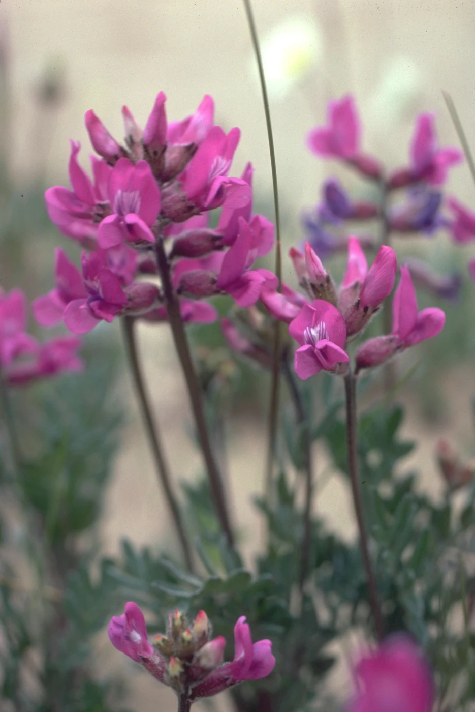
Roots helped hold material. Stems and leaves changed air movement near the ground and could trap particles. Vegetation could stabilize some dune surfaces and edges, while more exposed areas remained active.
The relationship worked in both directions. Moving sand could bury plants or make establishment difficult. Moisture, temperature and the supply of sand also influenced where vegetation survived.
Augie drew a tree holding a sign: Please slow down.
“Not a command the wind has to obey,” Allie said, smiling.
The children traced the boundary between green vegetation and open sand in a photograph. That edge was evidence of neighboring conditions, but it was not a permanent line guaranteed to stay in place.
Their grown-up helped them think about observing carefully. Fragile plants at a dune edge deserved more than becoming props in a sand experiment. The family could compare images and make models without pulling up roots or making new tracks through vegetation.
Ana put the snowflake and a paper sun beside the dune.
“Different seasons, different conditions. Both clues still belong.”
6. The travelers with wide hooves
The next notebook page belonged to caribou.
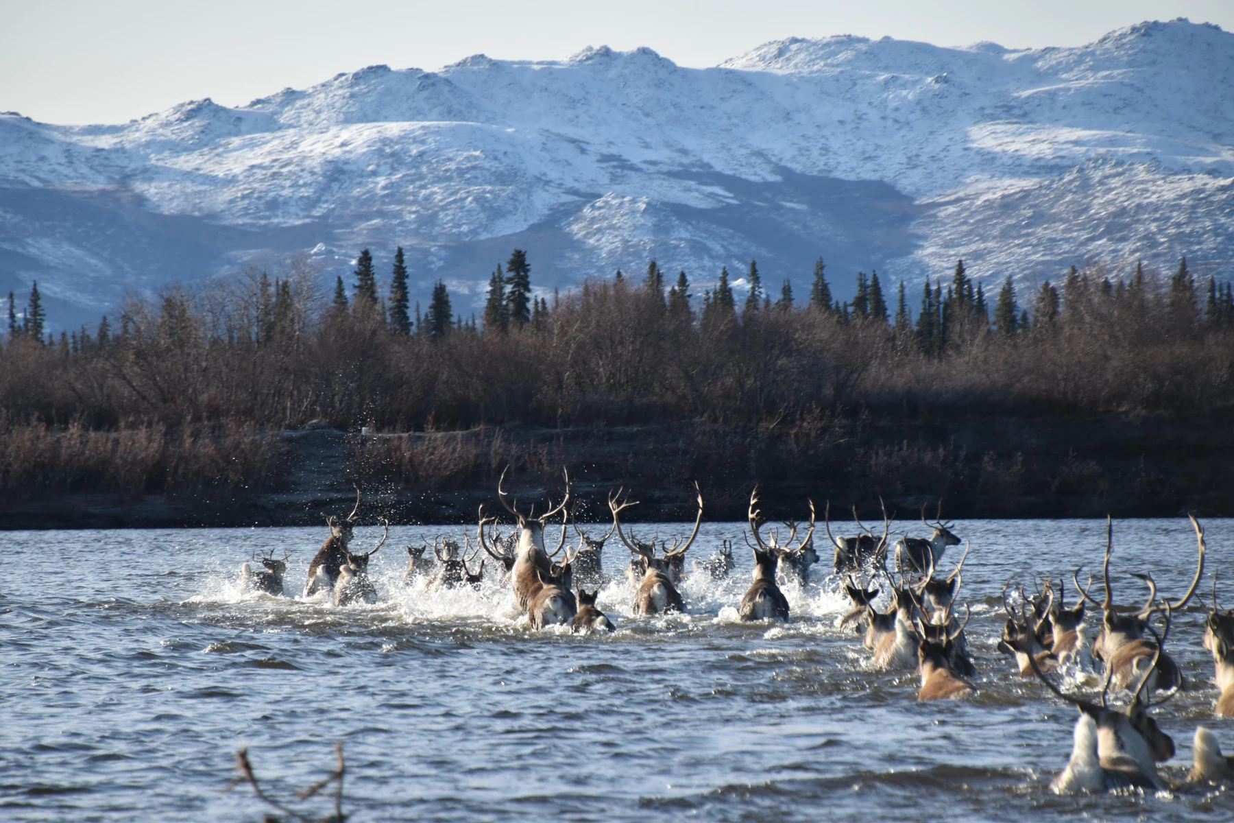
The Western Arctic Herd used a vast seasonal range, and caribou traveled through Kobuk Valley as part of their migrations. Seasonal movement connected feeding areas and places important for calving and summer or winter life.
Andy spread his arms across the map.
“The dune field is one part of a much bigger journey.”
Broad hooves helped caribou move across varied ground. Their coats provided insulation, and their seasonal movements helped them reach changing resources. But an adaptation was not a guarantee that every animal would succeed through every set of conditions.
Ana drew a route with a wide shaded band instead of one thin railroad line.
“Migration is not a timetable with every animal following the same footsteps.”
Routes, timing and group size could vary. Snow, weather, food, insects and other factors influenced movement. A place known for migration did not promise a visitor a particular sighting on a particular day.
The family used park photographs to investigate crossings rather than approaching a herd. They would leave animals space and avoid blocking their routes. A river crossing was work the caribou needed to do, not a performance for an audience.
Augie drew a tiny ticket booth, then crossed it out.
“No admission line.”
Allie connected the caribou page to the dune map. Tracks could cross sandy places, but the title did not mean every caribou traveled across the highest dunes. The river valley, nearby terrain and larger seasonal ranges all belonged to the story.
Andy added water to his hoof drawing.
“A journey can include swimming too.”
The children kept their own map dry and their investigation on safe ground. An animal’s ability to cross a river did not make the same route suitable for people.
Allie wrote: To understand a migrating animal, look beyond the place where you first notice it.
7. A river crossing with a long human story
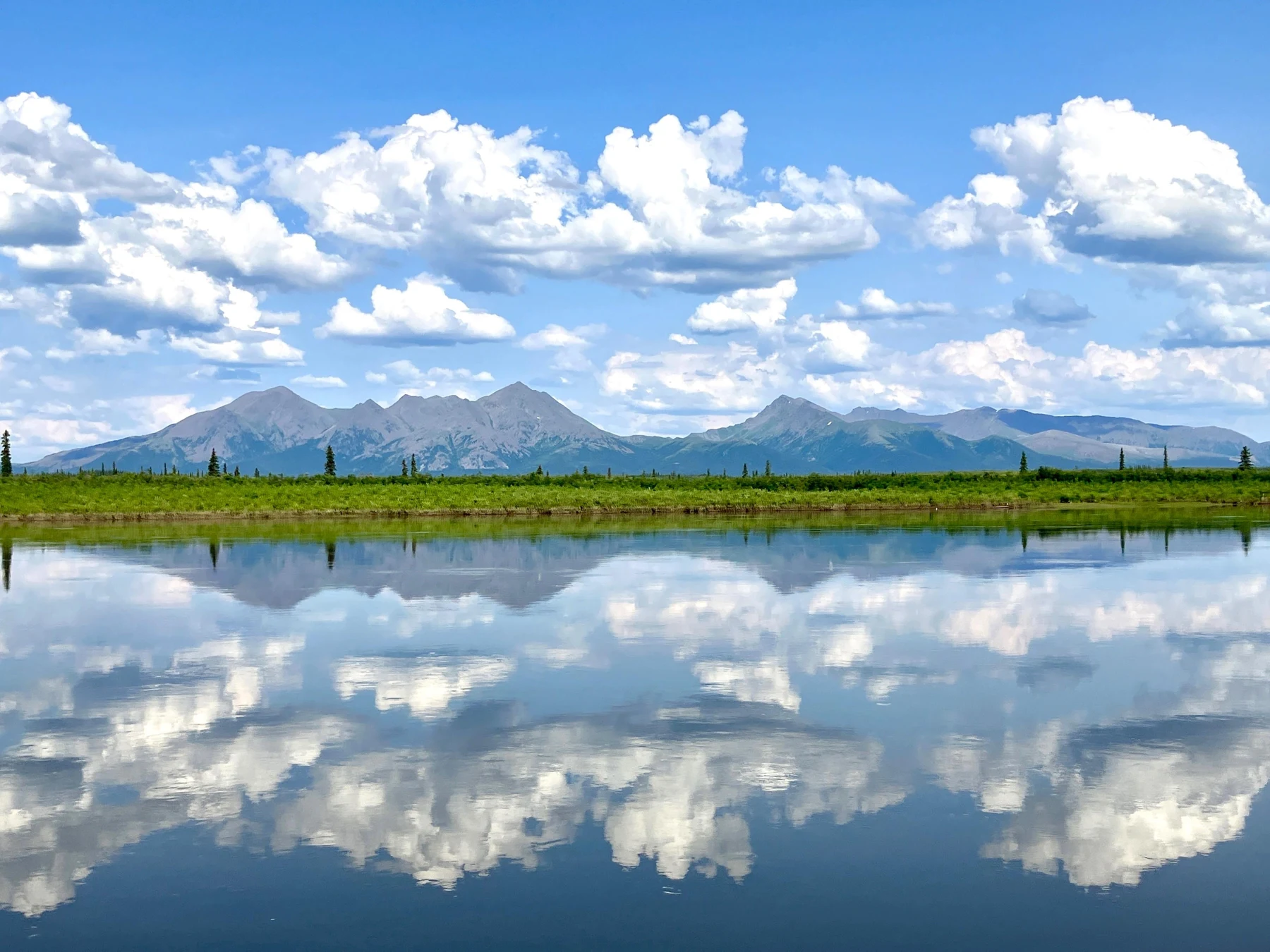
Onion Portage, also called Paatitaaq in park interpretation, brought the family’s map to a place where caribou movement and human history met.
People had returned to this part of the Kobuk River over thousands of years. Archaeological evidence recorded repeated use, and the river crossing remained important within a living landscape.
Augie drew a very long timeline beneath a much shorter notebook.
“The page needs an extension.”
The children learned about continuing Iñupiat relationships with caribou, fish, plants and the river. Subsistence involved more than gathering calories. Knowledge, skilled work, sharing, family responsibilities and respect connected people with the places and resources supporting their lives.
Ana placed this page beside the whole map.
“People are part of the valley’s present, too.”
Allie read the official interpretation about respectful practices at the crossing. She recorded the source and wrote questions without turning community knowledge into a game for visitors to imitate.
“How are skills passed on? How do people share food? What do visitors need to understand before entering a place?”
Their grown-up explained that archaeology depended on context: where objects and traces were found, and how they related to surrounding evidence. Moving something could remove information even if the object itself remained unbroken.
Andy drew a small artifact with a location label still attached.
“The address is part of the clue.”
The children did not collect objects, dig into a bank or search for souvenirs. They could learn from interpretation while leaving cultural places intact and respecting homes and working areas.
Augie looked at his caribou highway drawing.
“It was missing the people who know the crossings.”
Allie added living homeland across the top. The valley’s openness did not mean it was empty of history, knowledge or responsibility.
8. Three clocks in one valley
Andy lined up their notebook pages.
“I think we have several clocks.”
The first clock measured long landscape history: glaciers making and moving sediment, rivers rearranging deposits, and wind forming dune fields through changing conditions.
The second clock measured seasons. Snow and thaw, plant growth, river conditions and caribou movement shaped repeating patterns, with real differences from one year to another.
The third clock measured shorter events: a gust shifting grains, a track becoming blurred or a cloud shadow moving over the sand.
Augie drew one clock with a sand grain for a hand.
“This one needs tiny numbers.”
Ana added a warning about the model. Three paper clocks helped organize ideas, but real processes overlapped. A short storm could contribute to a much longer history. Repeated seasonal movements could shape enduring cultural relationships.
Allie chose one photograph and asked what it could reveal.
“It shows a dune’s shape at that moment. It doesn’t measure how far it moved in ten years.”
Researchers could compare repeated photographs, measurements and other records to study change. Community knowledge could also reveal patterns and differences across seasons and generations. A single family visit offered only a small window.
Andy added a question beside the green dune edge: What would we need to observe again?
The children discussed keeping notes precise. They could record what an image showed, what a source explained and what they still wondered. A confident guess should not quietly become a fact in the next sentence.
Their grown-up returned to the practical map. There were no roads into the park or established trail system to make remote travel simple. Plans needed appropriate expertise, equipment and communication, with current local and park guidance.
Augie put his three clocks away.
“The valley has a lot happening, even when it looks quiet.”
9. An Ice Age story written by wind
The family returned to Augie’s first picture: a caribou holding a sand bucket.
“We can retire the bucket,” Ana said.
Allie read their explanation aloud. Glacial processes helped create sediment. Water moved and deposited it. Wind carried exposed sand and built dunes. Plants stabilized some surfaces while open areas continued changing.
Andy followed a different route across the page. Caribou moved through the wider valley and seasonal ranges. River crossings connected that movement with enduring human knowledge and ways of life.
Augie drew three teams under his dunes: ice, water and wind.
“Ingredients, delivery, sculpting.”
The words were memorable because each stood for something specific. No single team had worked alone, and the sequence did not happen in one afternoon. The sand’s history reached back beyond the tracks visible today.
Their title, The Dunes Where Caribou Cross, now pointed to a landscape of movement rather than one guaranteed wildlife scene. Grains traveled, rivers shifted, animals migrated and people maintained relationships with a changing place.
Allie set the snowflake beside the paper sun one more time.
“Sand can belong in the Arctic without turning the whole Arctic into a hot desert.”
Their grown-up asked what the family would carry home.
Andy chose the idea that an ingredient could travel far from its source. Ana chose the three clocks. Allie chose the importance of keeping an object with its context. Augie chose a drawing of a sand grain wearing hiking boots.
They left actual sand, plants, wildlife and cultural objects in place. The notebook held enough to keep their questions traveling.
One chapter remained in their national park reading journey. Gates of the Arctic would invite them into questions about daylight, frozen ground, seasonal life and a wilderness that was also a homeland.
Augie closed the notebook.
“Arctic sandcastle science.”
“And an old story,” Allie said, “still being written grain by grain.”
Explorer’s notebook
Nine discoveries to keep
- Kobuk Valley’s dunes lie above the Arctic Circle among forests, wetlands, tundra and river landscapes.
- Sand describes a grain size; it does not have to come from an ocean beach.
- Glacial processes in surrounding mountains helped produce sediment, even where the valley itself remained ice-free.
- Water and wind moved and redeposited material through a long landscape history.
- Dunes grow and change as wind transports grains; small ripples and larger landforms can change at different rates.
- Vegetation and moisture influence sand movement, and moving sand can also affect plants.
- Caribou migration connects Kobuk Valley with a much wider seasonal range; routes and timing vary.
- Paatitaaq, or Onion Portage, connects caribou crossings with long human history and continuing Iñupiat relationships.
- Careful observation respects wildlife routes, fragile vegetation and the context of cultural evidence.
Five family adventures
- Follow a paper grain. Make cards for mountain rock, glacial grinding, meltwater, a river deposit, wind and a dune. Move a paper dot between them and explain each arrow. Add a second journey from a deposit back into moving water to show that the story is not always a single straight line. Do not grind rock or collect sand from protected places.
- Build a dune on paper. Draw a dune profile and use paper dots to show grains moving up one side and sliding down a steep slope. Add wind arrows, a plant obstacle and a damp patch. Predict which might change transport, then explain what the model cannot establish about a real dune’s speed or shape. No blowing powders, sand or loose particles is needed.
- Make a three-clock timeline. Draw one clock for landscape history, one for seasonal cycles and one for short events. Place cards such as glacial erosion, caribou migration, plant growth, a gust and a track becoming blurred beside them. Allow a card to touch more than one clock when you can explain the connection.
- Plan a migration investigation. Make a pretend valley map with a river, forest, dunes and broad seasonal areas. Draw several possible caribou routes, then add a weather-change card. Discuss why animals might change timing or direction and what observations would help you learn more. Label it an invented model, not an actual route map or a wildlife-viewing plan.
- Keep the clue with its context. Read official interpretation about Paatitaaq and Iñupiat subsistence with a grown-up. Record the source, one continuing relationship and one question. Then place a paper “artifact” on a household map and explain what information disappears if it is moved without a record. Make a guest-care promise to leave real cultural objects and places intact.
Four questions for the road
- How can a glacier help supply a dune without ever covering the place where that dune now stands?
- What different jobs can a river and the wind do during one grain’s journey?
- Why does a sand-dune photograph tell you so little about next week’s temperature or next season’s caribou route?
- How do context and living community knowledge change what we can learn about a river crossing?
Eight words for your explorer kit
- Sediment: Pieces of rock and other material moved or deposited by water, ice, wind or gravity.
- Sand: Sediment within a particular range of grain sizes, rather than one single kind of substance.
- Dune: A mound or ridge of sediment, commonly sand, piled by wind.
- Deposition: The settling or laying down of material that was being transported.
- Stabilize: To make something less likely to move, as plants can help stabilize sandy ground.
- Migration: Movement between places, often associated with changing seasons and resources.
- Subsistence: Obtaining and sharing resources from land and water as part of physical sustenance and continuing cultural life.
- Context: The surroundings and relationships that help give a clue or object its meaning.