1. A ship with nowhere to sail
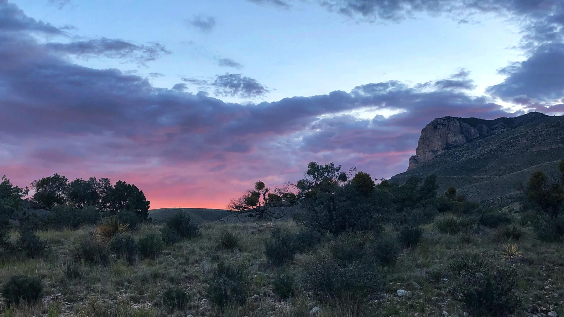
Augie looked up at El Capitan and decided that someone had parked a ship in the desert.
“The front is pointing that way,” he said, drawing an imaginary route through the air.
Andy inspected the great pale cliff. “Excellent ship. Slight problem with the harbor.”
The family had arrived at Guadalupe Mountains National Park in western Texas. Mountains rose above a dry landscape where plants seemed to leave plenty of space between their neighbors. There was no ocean at the foot of the cliff, no line of boats and no beach umbrella belonging to a fish.
Allie opened the notebook they had used at Pinnacles. Their last investigation had followed volcanic rocks carried along by moving ground. This time, the rock itself held clues to an ancient sea.
“Our challenge,” she said, “is to explain how a reef became part of these mountains.”
Ana studied the skyline. “We need more than a missing-water explanation.”
“Maybe the mountain learned to swim upward,” Andy suggested.
Augie gave the cliff an imaginary captain’s hat.
Their grown-up had planned short explorations and time with park exhibits. They would look at El Capitan from an established viewing place and investigate the broader reef story through maps, photographs and interpretation. They were not setting off to climb Guadalupe Peak or scramble up the cliff.
Allie drew two scenes: a reef beneath water, and a mountain above dry ground. Between them she left a very large question mark.
“Something happened here,” she said.
“Several somethings,” Ana replied. “Remember Pinnacles? Making the rocks, moving them and shaping the view were different parts of the story.”
Andy wrote their new case title beneath the pictures: The Reef on Top of Texas.
Augie added a small note to the imaginary ship: No sailing today.
2. Texas before the desert
At a park exhibit, the children studied a map of a world much older than their usual road maps. The coastline did not look familiar. Neither did the arrangement of the continents.
“Where is our parking place?” Augie asked.
“It wasn’t a parking place yet,” Ana said.
During the Permian Period, more than 260 million years ago, a sea covered parts of what are now western Texas and southeastern New Mexico. The Delaware Sea occupied a basin connected to the wider ocean. A reef grew along its margin over a long span of time.
“So we shouldn’t draw modern Texas and simply add a puddle,” Allie said.
“A rather ambitious puddle,” Andy replied.
The children imagined warm water, living communities and sediment accumulating in different places. Their map was a reconstruction based on geological evidence, not a photograph someone had taken during the Permian.
Ana drew a camera with an enormous calendar attached.
“Unavailable equipment,” she labeled it.
Allie remembered the age questions from Kings Canyon and Pinnacles. The reef’s growth belonged to one part of the timeline. Burial came later. The events that helped produce the modern mountains came much later still.
“One place,” she said, “with very different chapters.”
Augie pointed toward the real landscape outside. “And this is the desert chapter?”
“The chapter we can visit now,” Ana answered.
They were not looking for a secret ocean hidden just behind El Capitan. They were asking what evidence in the rocks could help scientists reconstruct an environment that no longer existed there.
Andy added an ancient shoreline to their drawing. He carefully left out the parking space.
“The fish would complain about the traffic anyway.”
3. The reef had a different building crew
“We know reefs,” Andy announced. “We just investigated Biscayne.”
Ana raised a pencil. “Then we know to ask who built this one.”
The Capitan Reef was not simply a modern Florida coral reef copied into the distant past. Algae, microbes and other organisms helped bind and build its carbonate structure. Sponges and many other marine animals belonged to the community. The mix and roles of the builders differed from the coral frameworks they had learned about at Biscayne.
Augie drew a construction crew made of tiny shapes.
“Do they need hard hats?”
“Many supplied their own hard parts,” Allie said. “But our drawing is a comparison, not an actual building site.”
Skeletal material, sediment and natural mineral cement contributed to the growing reef. Later changes turned and altered these materials into rock. Limestone was made mostly of calcium carbonate, the same broad kind of material found in many marine shells and skeletons.
Andy drew a sack labeled reef ingredients. Ana stopped him before he added a kitchen spoon.
“No single recipe explains every layer,” she said.
The reef grew through living activity and accumulation over generations. It was a community and a structure, with different organisms occupying different spaces. It did not arrive as one enormous animal that happened to resemble a mountain.
“So reef doesn’t always mean coral,” Allie said.
“And a sponge isn’t a kitchen sponge,” Ana added.
Augie looked relieved. He had been trying to imagine who squeezed the ancient sea out afterward.
They put two reef drawings side by side. One represented the living reef community they had studied at Biscayne. The other represented the ancient Capitan setting.
Some comparisons helped: living things, hard structures, shelter and food webs. Some details needed their own explanation.
Andy wrote: Ask before recycling an answer.
“Especially,” Ana said, “an answer from 260 million years later.”
4. A reef is more than its tallest edge
Allie turned to a diagram showing a slice through the ancient reef system. There was a shallower area landward of the reef, the reef itself, a slope toward deeper water and the basin beyond.
Andy traced the slope with his finger. “An underwater neighborhood with different floors.”
“Different conditions,” Ana said. “Not actual apartment floors.”
The back-reef lay toward the ancient shore. The fore-reef lay on the seaward side, where broken material could accumulate down the slope. Farther into the basin, finer material settled in deeper water.
“Pieces could leave the reef while the reef was still growing?” Andy asked.
“Yes,” said Allie. “Building and breaking didn’t take turns on a perfect timetable.”
Augie drew a tiny sign beside his slope: Mind the falling crumbs.
Different settings left different rock layers and fossil clues. Scientists could study their relationships to reconstruct more than one little patch of the old sea. A limestone cliff and a nearby layer of different rock might record neighboring environments rather than identical places.
Ana added two questions to the diagram: Where was this material deposited? What was happening beside it?
“Like our Biscayne map,” Allie said. “A reef belongs to a larger system.”
The diagram was a simplified cross-section, an imagined slice through the landscape. It was not an aerial map and did not show every bend, crack or later change.
Augie turned the page sideways.
“Now the sea is falling off.”
“Only the notebook sea,” Andy reassured him.
The children put their drawings flat again. They were learning a useful habit: a picture could make an idea easier to understand, provided they kept track of what kind of picture it was.
The ancient neighborhood was becoming clearer. The large question mark between reef and mountain remained.
5. The sea changes and the reef disappears
“Now we need the missing-water part,” Allie said.
Andy drew a giant plug at the bottom of the basin.
Ana shook her head. “An interesting plumbing proposal. Please keep it out of the evidence column.”
Conditions changed over geological time. The connection between the sea and the wider ocean became restricted. Evaporation helped concentrate dissolved minerals. Mineral deposits and other sediments accumulated as the basin filled, and the reef became buried.
Augie considered that carefully. “The reef went underground.”
“Under later layers,” Allie said. “It didn’t dig a tunnel.”
Their grown-up stacked a few sheets of paper over the reef drawing. The papers represented later deposits, but nobody mistook a second of paper stacking for the real process.
“That is an exceptionally fast geological service,” Andy said.
For a very long time, much of the reef lay concealed. A reef could stop being visible without its entire record vanishing. Burial helped preserve a story that scientists would eventually read in exposed rock.
“But if the water went away,” Ana asked, “would that alone put the reef high above the desert?”
Allie looked at the two scenes on their first page. The reef began under water; the mountain now rose high above the surrounding landscape. Removing water changed what was covered. It did not, by itself, explain all the movement of the rocks.
Andy crossed out the plug.
“The plumbing explanation has resigned.”
Augie added two more boxes to their timeline: buried and still waiting.
The children did not need a precise birthday for every sheet of sediment to understand the main sequence. They did need to separate the reef’s growth from its burial and from the much later changes that exposed it.
Their mystery now had a hidden middle chapter.
6. Raising the rocks, unwrapping the view
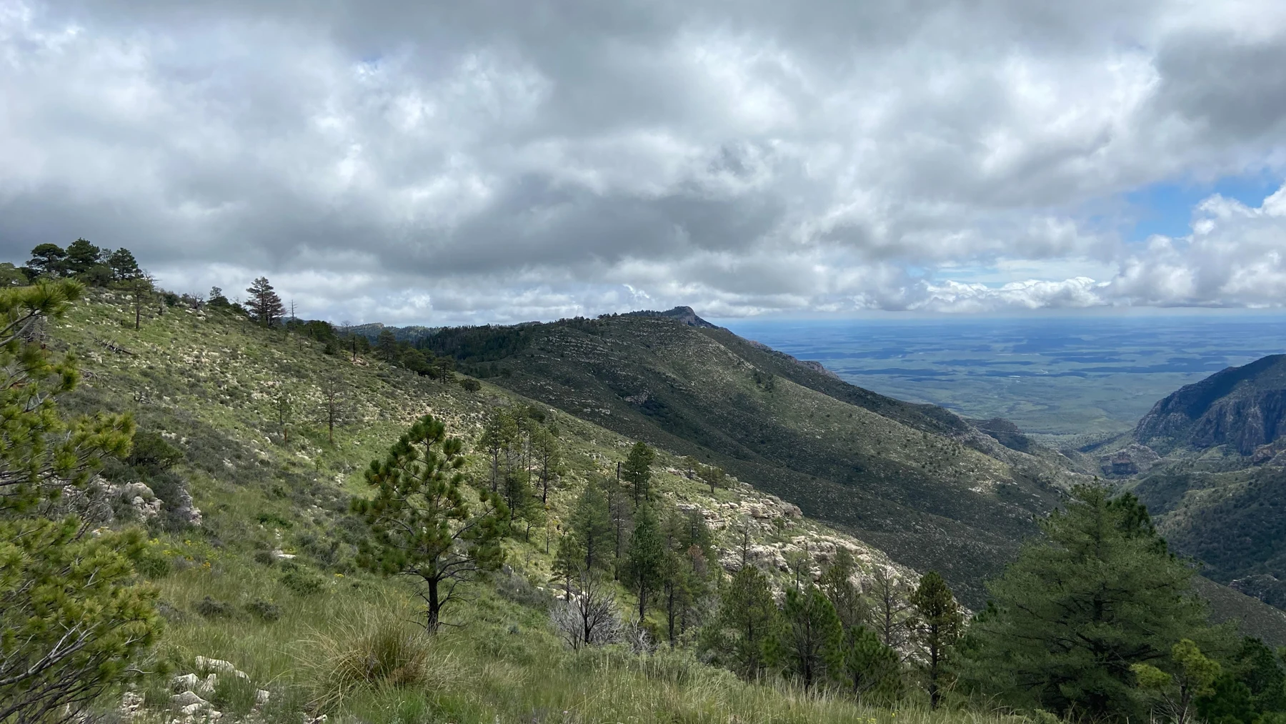
At their viewing place, El Capitan looked massive and unmoving. Allie tried to imagine the rocks containing it much lower and covered by other material.
“We’ve met the vehicle,” Andy said. “Moving ground.”
“But a different movement story from Pinnacles,” Ana reminded him.
Long after the reef formed, tectonic forces affected the region. Uplift and movement along faults raised blocks of rock. Over time, erosion removed overlying material and exposed parts of the ancient reef system.
At Pinnacles, their paper sheets had modeled sideways displacement. Here, they needed to imagine changes in height as well. Fault movement could have different directions, depending on the setting.
Augie raised the reef drawing above the table.
“Promotion!”
“A model of uplift,” said Allie. “Not the actual speed.”
Ana pulled away the paper cover one sheet at a time. That represented exposure by erosion, although real erosion carried rock particles away rather than lifting entire neat pages.
“Two jobs,” she said. “Raise the rocks. Remove the cover.”
“Ancient reef unwrapped by weather,” Andy added.
It was a useful comparison, but the modern mountain was not simply the original reef wearing exactly the same outline. Rock layers had been displaced, exposed and cut by later processes. Canyons helped reveal relationships within the old reef complex.
Guadalupe Peak, the highest point in Texas, belonged to this mountain landscape. El Capitan was another prominent feature, not a second name for the summit. The family could investigate both through park information without climbing either one.
Augie looked at the cliff again. His imaginary ship had acquired a very complicated travel history.
“Did the mountain finish rising?” he asked.
“The landscape keeps changing,” Allie said. “Our drawing just helps us follow some of the big steps.”
Andy returned the captain’s hat to the cliff. “For long service.”
7. The fossil needs its address
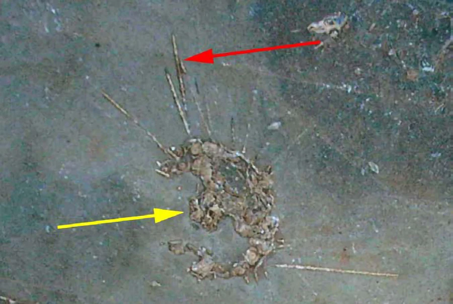
The next part of their investigation began with a photograph of a sea-urchin fossil. Its pattern made Augie lean forward.
“Somebody left a sea clue.”
Fossils preserved remains or evidence of past life. In the Guadalupe Mountains, marine fossils helped scientists investigate organisms and environments from the Permian. Shells, skeletal pieces and other traces belonged to a larger rock record.
“Can we name every shape we see?” Andy asked.
“We can describe it first,” Ana said.
They practiced with an exhibit image. Allie listed the visible pattern. Andy drew its outline. Ana wrote what the label identified and kept that separate from what they could work out themselves.
Augie supplied a magnifying glass made from his fingers. Its scientific power was limited, but his enthusiasm was excellent.
Their grown-up asked why a scientist cared where a fossil was found.
“Its address,” Allie said. “The rock layer and the material around it are part of the evidence.”
One fossil alone might show that a kind of organism had been present. Its position, nearby fossils and surrounding rock could help answer broader questions about time and environment. Removing it separated a clue from some of its context.
Andy drew a puzzle with one piece sitting outside the frame.
“A souvenir for one person,” he said, “can become a missing piece for everyone else.”
The children would leave real park fossils and rocks in place. They could draw, photograph and ask questions without prying, scratching, wetting or pocketing a specimen.
Ana added a useful possibility to their notes: not sure yet.
“That’s allowed?” Augie asked.
“Very much,” she said. “It’s better than giving every round mark a grand scientific name.”
Andy quietly retired his proposal to name the exhibit fossil Sir Ocean Biscuit.
He kept it in the joke column instead.
8. Water still gets special treatment
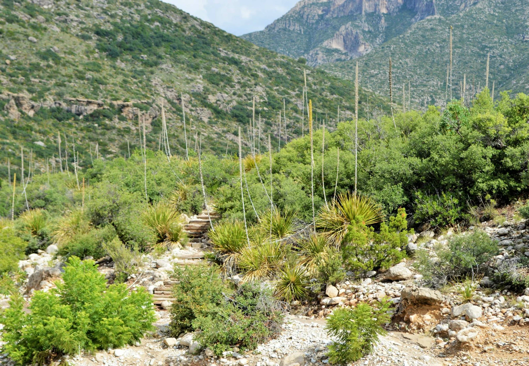
The family’s short exploration near McKittrick Canyon offered a different kind of clue. Desert plants, shaded places and changes in slope made the landscape more varied than a single word like dry suggested.
Their grown-up had checked the nature-trail route and conditions. The group walked only as far as suited everyone and returned together. They were not following the strenuous Permian Reef Trail or climbing from the desert all the way into the high country.
“A reef investigation doesn’t require us to hike every layer,” Andy said.
At the exhibits, they learned that the nature trail passed near an intermittent seep. Intermittent meant that visible water was not guaranteed. A place described as a seep on a map did not promise a drinking fountain when visitors arrived.
Augie gave their own water bottles a respectful look.
“Prepared in advance,” he said.
Water, shade, exposure and elevation helped shape different habitats across the park. Springs and streamside places could support communities unlike those on a sunny, dry slope. Higher parts of the range supported woodlands and forests that the children studied through photographs and park information.
Allie remembered Big Bend’s different habitats. Height mattered, but so did local shelter, sunlight and available water. They could not explain every plant with one elevator button.
“The old sea made part of the rock story,” she said. “Today’s water helps make the living neighborhood.”
They stayed on the designated route and out of water and fragile streamside places. A small wet area in a dry landscape could be important to many residents.
A gust tugged at Andy’s hat. He caught it before it could begin an independent research trip.
“Wind also wants special treatment,” he reported.
Ana checked the notebook. “Water, weather, suitable routes and staying together. That’s our expedition plan.”
“And snacks,” Augie added. “Still important above sea level.”
9. The mountain keeps the ocean’s history
At the end of their visit, Allie reopened the first page. The reef, the mountain and the large question mark were waiting.
“Can we fill the gap?” she asked.
Ana pointed to the timeline. “Living communities helped build a reef in an ancient sea.”
Andy added the paper layers. “Later deposits covered it.”
Augie lifted the drawing. “Moving ground raised the rocks.”
“And erosion helped expose them,” Allie finished.
It was a summary, not a claim that the whole history happened in four tidy turns. The evidence included fossils, different rock layers and their relationships, faults and the shapes revealed by erosion. Scientists combined those clues to investigate the ancient environment and later changes.
“The desert didn’t always look like this,” Ana said.
“And the sea didn’t simply climb a mountain,” Andy added.
Augie studied his ship drawing. He removed the sailing route and added four small labels: built, buried, raised, revealed.
Allie liked them. Each label represented a question they now knew how to ask more carefully.
The reef had also changed their understanding of the word reef. Biscayne’s living coral communities and this ancient rock record shared useful connections, but their organisms and histories were not interchangeable.
“A familiar word can start a new investigation,” she said.
Next in their park order was Wind Cave in South Dakota. There they would explore why air moved through a cave entrance and how a cave could seem to breathe.
Andy blinked. “A traveling volcano. A reef on a mountain. Now a breathing cave.”
“Geography has excellent surprises,” Ana said.
Augie closed the notebook before another gust could turn it into a kite.
El Capitan stood above the desert, keeping evidence of a world the family would never see alive. The ocean was gone from this view. Its history was still there to read.
Explorer’s notebook
Nine discoveries to keep
- Guadalupe Mountains National Park is in western Texas and preserves part of the ancient Capitan Reef complex.
- During the Permian, more than 260 million years ago, a sea occupied parts of present-day Texas and New Mexico.
- The Capitan Reef’s builders and community differed from modern coral reefs. Algae, microbes, sponges and other organisms contributed to its history.
- The reef system included back-reef, reef, fore-reef and basin environments, which left different deposits and fossil clues.
- Later sediments and mineral deposits buried the reef. Losing water alone does not explain a mountain’s present height.
- Much later uplift and faulting raised rock blocks. Erosion removed material and exposed the fossil reef system.
- El Capitan and Guadalupe Peak are different features. Guadalupe Peak is the highest point in Texas.
- A fossil’s location and surrounding rock are part of its scientific context. Leave park fossils and rocks in place.
- Water availability, sunlight, shelter and elevation help shape today’s varied habitats, from desert slopes to streamside communities and mountain forests.
Five family adventures
- Four chapter cards: Draw four cards labeled “built,” “buried,” “raised” and “revealed.” Explain each using a reef drawing. Add a note that the real history took immense time and included overlapping processes. The cards organize ideas; they are not a complete geological timetable.
- Cover and uncover: Place a reef drawing beneath a few sheets of paper. Lift the whole stack to represent uplift, then remove the covering sheets to represent exposure. Explain that real erosion transports particles and does not peel off perfect paper layers.
- Two reefs, careful comparisons: Draw a modern coral reef and an ancient Capitan reef scene. List two useful similarities and two differences to research. Use reliable park sources to check the organisms rather than fill the ancient scene with modern animals by default.
- Give a clue its address: At home, hide a paper fossil drawing between pages of a homemade paper “rock book.” Record its page, what is beside it and what you can observe. Move the drawing elsewhere and discuss the information that would be lost without your notes. Leave real park fossils undisturbed.
- Sun, shade and questions: With a grown-up, compare two nearby safe outdoor spots, one sunny and one shaded. Describe differences in light, surface conditions and visible plants. Do not disturb living things or sample water. Decide what you observed and what would require repeated measurements before making a larger claim about habitat.
Four questions for the road
- Why does discovering marine fossils in a mountain call for an explanation involving more than a missing sea?
- How did the ancient Capitan Reef differ from the coral reef community at Biscayne?
- Why does the rock around a fossil matter as well as the fossil itself?
- How can water shape a place’s history and its living habitats in very different ways?
Eight words for your explorer kit
- Permian: A geological period that ended about 252 million years ago, long before the modern Guadalupe Mountains landscape formed.
- Reef: A resistant structure built or bound through biological activity and accumulation; reefs have had different builders through Earth’s history.
- Limestone: Rock made mainly of calcium carbonate.
- Fossil: Preserved remains or evidence of life from the geological past.
- Sediment: Loose material, such as sand or mud, that can be deposited and later become rock.
- Uplift: An increase in the elevation of land or rock caused by geological processes.
- Context: The surrounding information that helps explain evidence, including a fossil’s rock layer and position.
- Seep: A place where groundwater emerges slowly at the surface; some seeps flow only intermittently.