1. Augie brings the wrong kind of basin
Augie arrived with a rubber duck in his jacket pocket.
“I’m ready for the basin,” he announced. “Does it have a plug?”
Andy looked across the broad Nevada landscape toward the mountains. “We may need a bigger bathroom.”
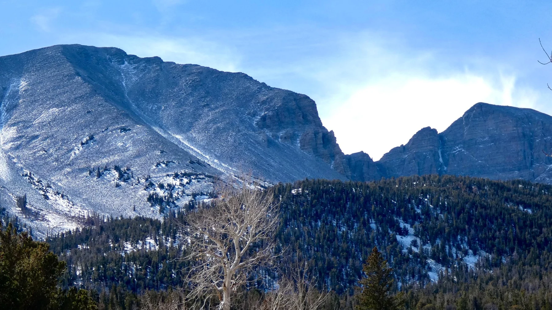
The family had come to Great Basin National Park in eastern Nevada. High slopes rose above a much drier-looking country below. After Kenai Fjords, where glaciers had helped carve valleys that the sea could fill, this adventure began with a surprising idea: here, streams did not follow a surface route to the ocean.
Allie wrote their new title in the notebook: The Basin That Keeps Its Water.
Ana immediately added a question mark.
“Keeps it how?” she asked. “Water can evaporate. We should find out what the title means before putting a lid on the whole region.”
Their grown-up had planned suitable short explorations and time with park information. For high mountain groves, distant lakes and underground places beyond their route, the children would use photographs and interpretation. They did not need to climb Wheeler Peak or enter a cave to begin a water mystery.
Augie placed his duck beside a map.
“All right. Where does a drop go?”
That was a better starting question than looking for a giant bowl. Allie drew a raindrop above the mountains and left its route unfinished.
Andy studied the surrounding ridges and valleys. “At Kenai Fjords, our arrows ended beside the sea. This time, the map may send them somewhere else.”
Ana made three spaces on the page: land, underground and air.
“If we follow only the blue lines on a map,” she said, “we might miss part of the journey.”
2. A boundary drawn by downhill
The children began with a watershed: an area whose water drains toward a common destination. High ground could divide one drainage from another, even when no fence or sign marked the boundary.
Allie imagined putting a drop on each side of a ridge.
“The two drops could head in different directions.”
“Neighbors with different travel plans,” Andy said.
The hydrographic Great Basin was defined by inland drainage. Its streams flowed toward interior destinations rather than connecting by surface rivers to the sea. It was a whole region, much larger than the national park, and it contained many smaller basins.
Augie looked disappointed. “So it isn’t one enormous sink?”
“More like a collection of drainage bowls,” Ana said. “And the real landscape is less tidy than our picture.”
Their map showed the park in the Snake Range. Water on different sides of those mountains could enter different neighboring valleys. Both belonged to the larger inland-draining region.
Andy drew several little bowls instead of one giant bathtub. Allie put ridges between them and arrows pointing down their slopes.
A political border did not have to follow a watershed boundary. Neither did the edge of a national park. Water moving downhill did not stop because a map changed color.
“That means what happens upstream can matter somewhere else,” Ana said.
Augie made a tiny passport for his duck. Then he decided a watershed lesson did not require official duck paperwork.
The family had solved the first part of their question. Great Basin described a drainage pattern, not a container with a ceramic bottom. Their title would need to keep that distinction clear.
Allie added a label to the unfinished arrow: inland surface drainage.
The words were longer than “stays home,” but they did a better job of explaining what the map actually showed.
3. A dry country can have a mountain water supply
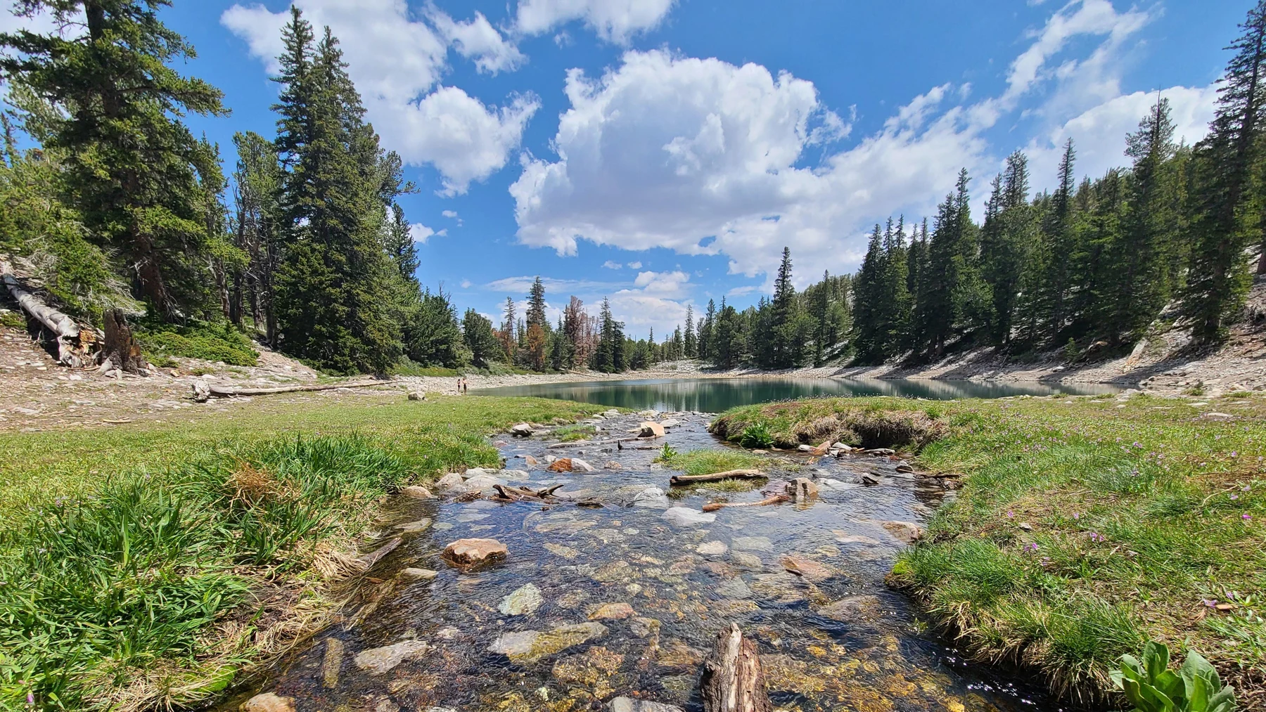
Andy had expected a dry region to look dry everywhere.
A photograph of water near Teresa Lake challenged that idea. A small rocky channel ran between green banks beneath the mountains.
“Someone forgot the desert rule,” he said.
“Maybe our rule was too simple,” Allie replied.
Snow and rain in the mountains contributed water to the landscape. Snow could hold water for a time before melting. Streams, springs and wetter corridors made places where water was visible, even in a region known for dry valleys.
Ana drew snow above the stream in their picture, then marked the snow as an explanation from park information rather than something visible in that photograph.
“A photograph shows one view,” she said. “Our arrows show what we’ve learned about the system.”
They read that the park’s streams were studied for water flow, water quality and living communities. A stream was more than water traveling through a ditch. Its banks, plants, insects and other residents belonged to the same neighborhood.
Augie gave his duck a paper raincoat.
“It’s ready for mountain weather.”
The grown-up checked their real jackets and drinking water. Weather and access could differ between lower places and high routes, and a short family outing should suit the conditions and everyone’s abilities.
Allie compared the new page with their Alaska notebook. Both stories involved mountain snow and flowing water. But sharing an ingredient did not give two landscapes the same drainage destination.
“We have to follow the route,” she said, “not just name the water.”
Andy drew a second arrow beside the first. One followed the visible stream. The other pointed into the ground.
“What if some of the journey disappears from view?”
Ana turned to a clean page. The next part of the basin was hidden below their feet.
4. The water does not vanish when we stop seeing it
Water could soak into soil and move through openings in sediment or cracks in rock. When it reached saturated material below ground, it became part of groundwater.
Augie pictured a cavern containing a gigantic underground swimming pool.
“Sometimes there are caves,” Allie said. “But groundwater doesn’t need a big open room. It can occupy small spaces we can’t see.”
Ana drew pebbles with blue dots in the spaces between them. Then she drew cracked rock with blue lines through its openings.
“Different materials,” she said. “Different possible routes.”
An aquifer was rock or sediment that could store and transmit groundwater. Water could emerge at springs or seeps, connect with streams, or remain below ground for a long time. Underground connections did not always match the neat boundaries of an individual surface basin.
Andy erased the solid floor he had drawn under every bowl.
“That was a bathtub mistake.”
There was another route off the page: evaporation. Liquid water could become water vapor and enter the air. Plants also released water vapor through transpiration. Air could carry that moisture beyond the drainage region.
“So the basin does have an upstairs door,” Augie said.
“A water-cycle connection,” Ana replied, drawing an arrow toward the clouds.
Allie returned to the title and wrote a careful sentence beneath it: The surface drainage stays inland; the water still participates in the wider water cycle.
Nobody had to pretend every drop was trapped forever to understand why the Great Basin was special. The useful mystery was how land shape directed streams, while soil, rock, plants and air supplied other pathways.
Andy gave the duck a new travel ticket marked VAPOR, then crossed it out.
“The duck does not evaporate with the water.”
“Excellent clarification,” Ana said.
5. What the water leaves behind
Allie remembered White Sands and the mineral clues left by traveling water. Another question followed naturally.
“If water carries dissolved minerals into an inland lake, what happens when some water evaporates?”
Andy imagined the minerals boarding the vapor arrow.
“Not the usual journey for dissolved salts,” Ana said.
Evaporation could remove water while leaving salts behind. Over time, water entering a closed drainage destination could deliver more dissolved material. Some terminal lakes became salty, and some low places dried into playas with mineral deposits.
The children were learning about a regional pattern, not finding a salt flat beside every park trail. Not every inland water body was equally salty, and a mountain stream was not the same habitat as a terminal lake.
Augie inspected his duck.
“Freshwater duck. No seasoning requested.”
Their grown-up suggested a home experiment for later: a small amount of salt dissolved in water and left in a labeled shallow dish. The experiment could show that something invisible in solution might become visible after water evaporated. It would not reproduce the full history of a real basin.
Allie drew a lake receiving an inlet arrow. Then she drew water vapor leaving and a small salt symbol remaining.
“No outlet river in this drawing,” she said. “But still movement.”
Andy added a timeline underneath. A single moment could not explain everything the lake contained. Repeated inputs, changing weather, underground pathways and the lake’s history mattered too.
The family had started with a bowl joke. Now their page showed a system with supplies, storage, transfers and losses.
Ana looked pleased. “The word closed describes a drainage relationship. It doesn’t mean nothing happens.”
Augie put the duck beside the timeline.
“It’s the official waiting-for-the-water-to-evaporate supervisor.”
6. The mountain elevator has living floors
Next, the children compared photographs and park descriptions of lower shrub country, forested slopes and high rocky ground.
“Different floors,” Andy said. “Same mountain building.”
As elevation changed, temperature, moisture and growing conditions changed too. Different plants could thrive in different settings. The park held several kinds of habitat rather than one continuous stretch of identical desert.
Ana drew a mountain with broad bands, then softened the lines.
“Not painted stripes,” she said. “A shaded slope and a sunny slope can differ even at the same height.”
Water availability, exposure, soils and other conditions helped shape the pattern. Their mountain elevator was a useful way to organize a page, not a rule that every tree had to obey.
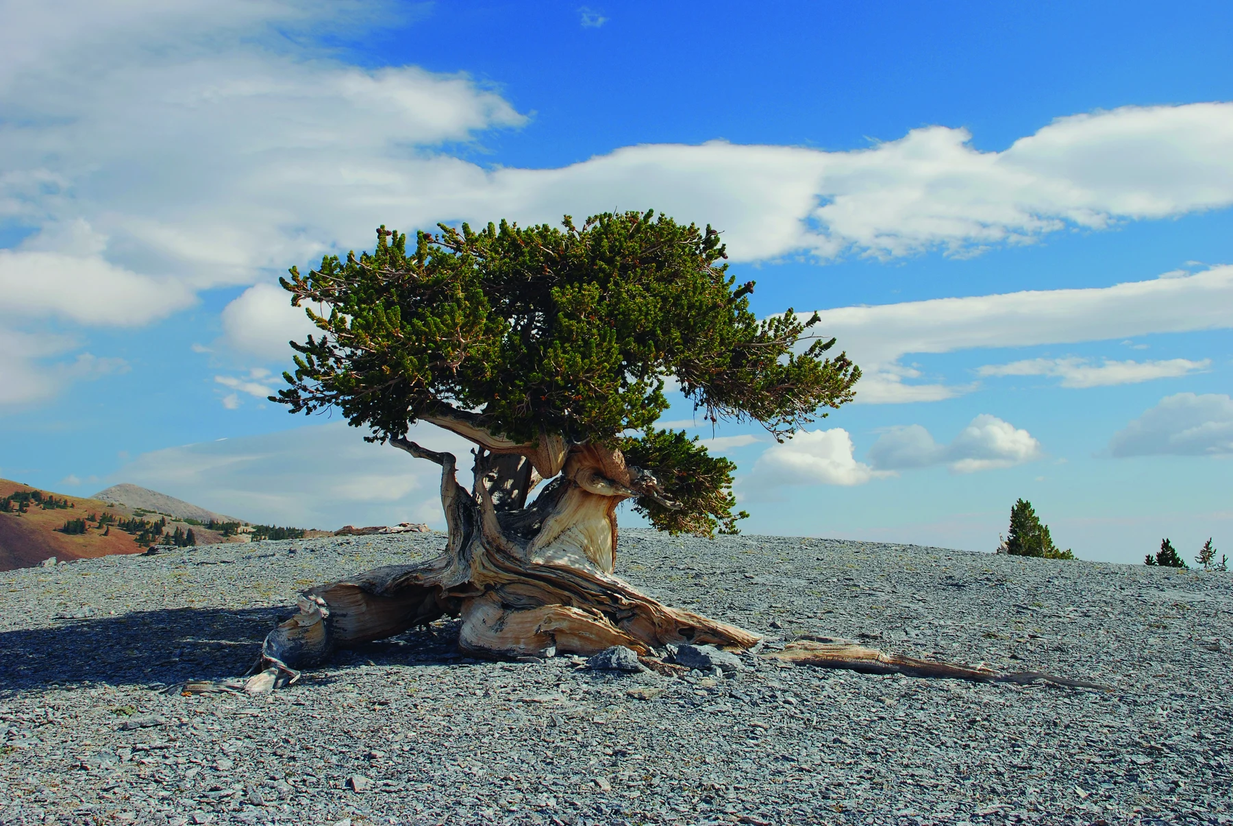
In a bristlecone photograph, a weathered tree stood among pale rocks. Some branches held green needles while exposed wood twisted into surprising shapes.
Augie leaned over the picture. “Is it old, or did it just have a very windy morning?”
Great Basin bristlecone pines could live for thousands of years. Some grew slowly in demanding high-elevation conditions. Dense wood and places with less competition helped explain their remarkable persistence.
“But we can’t give this particular tree an age from its hairstyle,” Allie said.
Andy wrote NO BIRTHDAY GUESSING beneath the photograph.
Bare, weathered wood did not automatically mean an entire tree was dead. Living parts could remain connected while other parts were exposed. The children studied the image without treating every twisted trunk as a puzzle to climb.
Ana compared the tree with the glacier from their previous adventure.
“Both ask us to think beyond our own afternoon,” she said. “But they tell different kinds of long stories.”
Augie drew a birthday cake with far too many candles. Then he replaced the candles with a question mark.
The real trees deserved more care than a funny estimate.
7. A second water story below the surface
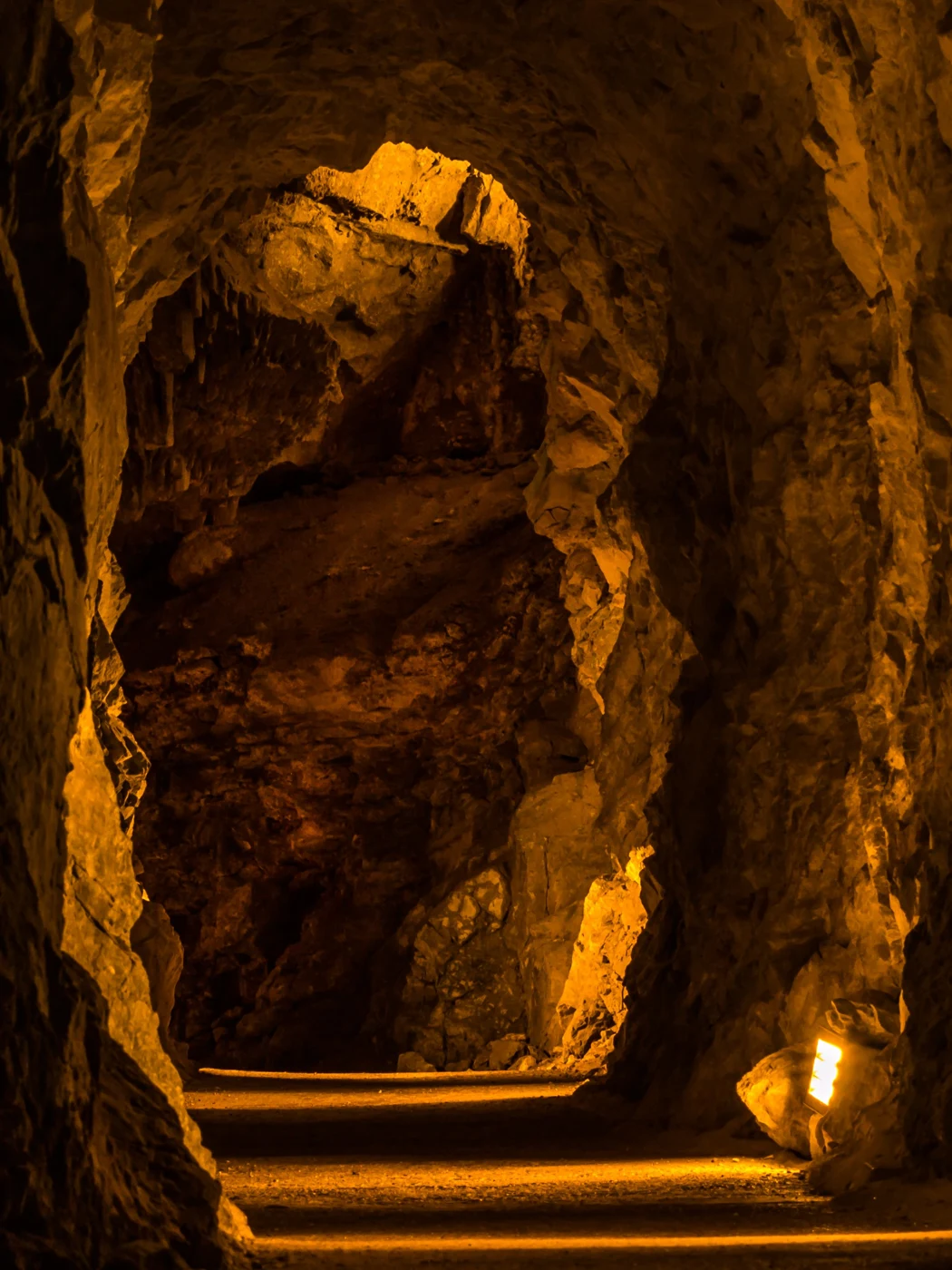
Lehman Caves added another kind of evidence. The family studied park photographs and cave interpretation rather than assuming a cave tour was available during their visit.
Inside the photographs were hanging formations, shapes rising from floors and mineral layers around a pool.
“The cave decorated itself,” Augie said.
“Water helped,” Allie replied. “But making the space and making the decorations are different parts of the story.”
Water interacting with soluble rock could help create underground openings. The origins of Lehman Caves involved a geological history that researchers continued to investigate. The children did not need to squeeze every stage into one imaginary raindrop’s journey.
Later mineral deposition could form speleothems: cave formations with different shapes. A stalactite hung from above; a stalagmite grew upward from the floor. Some could eventually join into a column.
Andy drew an arrow beside each one so he would not confuse the names.
“I need direction labels everywhere on this trip.”
Mineral-bearing water could deposit calcite as conditions changed, including when it released carbon dioxide into cave air. A cave formation was not simply a wet rock that had dried instantly. Repeated tiny deposits and time could build large shapes.
Ana found photographs of cave shields, unusual paired plates. She wrote a question beside them rather than inventing a complete explanation for every curve.
“Some of the most interesting objects still have research questions attached.”
The children agreed to study formations with their eyes. Touching or breaking delicate mineral features could damage something that had taken a very long time to grow. Actual cave visits required authorized access and current park guidance.
Augie drew a tiny sign beside his imaginary cave duck: LOOK, DON’T POKE.
Even below a dry-looking landscape, water had a long and active story.
8. A homeland below a sky full of questions
Before closing the daytime notebook, the children read about people connected with the wider Great Basin. The region included the homelands of distinct Native peoples, including Western Shoshone and Goshute communities, whose connections continued in the present.
Allie wrote the names separately. “One big region doesn’t mean one identical culture.”
Their earlier trips had taught the children to ask whose knowledge and experiences were represented in a landscape’s story. A park map or a visitor’s short outing could not contain everything a place meant to its communities.
Ana left room for learning from those communities’ own accounts. They would not invent a traditional tale to fill an empty notebook space.
Later, their grown-up arranged a brief, suitable skywatching stop. Jackets came out again. The children stayed together at a safe viewing place and used only the light needed to move and read their chart.
Great Basin’s dark skies made it a special place to learn about the night. Artificial light could brighten the sky and hide faint objects. Clouds, moonlight, season and the observer’s eyes also affected what could be seen.
Andy held the star chart under a dim light.
“The stars didn’t switch off in town,” he said. “Some were harder for us to see.”
Augie wanted the Milky Way to appear immediately, like a curtain opening.
“We can look without demanding a particular show,” Ana said.
They compared what they could actually identify with a photograph used in park astronomy information. The photograph was another observer’s view, not proof that tonight’s sky would look exactly the same.
Allie drew stars above their water-cycle arrows.
The basin did not need an ocean outlet to belong to a much larger world. Its air, living communities, people and night sky already made that clear.
9. The duck reports its findings
At the end of the adventure, Augie stood the rubber duck on their notebook.
“It has an announcement,” he said. “There is no bathtub.”
Andy gave a very serious nod. “A major scientific result.”
Allie asked everyone to help finish the raindrop route they had left blank at the beginning.
Ana started at the ridge. “Land shape directs surface water downhill. The hydrographic Great Basin drains toward inland destinations rather than through rivers to the ocean.”
Andy added the hidden route. “Some water soaks into the ground and moves through sediment or rock openings. We shouldn’t draw every basin with a sealed floor.”
Augie pointed up. “And water can join the air. The duck stays here.”
Allie added what they had learned from the rest of the landscape: mountain water supported streams and habitats; elevation changed growing conditions; bristlecone pines carried long living histories; and water helped shape underground spaces and mineral formations.
Their original title still worked, but its meaning had become more precise. The basin kept its surface drainage inland. It did not lock every water molecule inside forever.
“Better than a plug,” Ana said. “A whole explanation.”
They checked their arrows one final time. No single arrow represented every drop, every season or every underground connection. The drawing helped them ask questions and describe patterns; the real place remained larger and more complicated.
Allie wrote their next destination: Katmai National Park and Preserve, where salmon would connect an ocean, hungry animals and a forest.
Augie returned the duck to his pocket.
“Does a salmon need a passport?”
“Let’s start with its life cycle,” Andy said.
The notebook closed on a landscape that looked dry from a distance and held water stories almost everywhere they had learned to look.
Explorer’s notebook
Nine discoveries to keep
- A watershed is land whose water drains toward a common destination.
- The hydrographic Great Basin contains many smaller inland-draining basins; the national park represents part of that region.
- Its streams have no natural surface river connection to the ocean, but the water still participates in the wider water cycle.
- Mountain snow, rain, streams and springs help support wetter places within a dry region.
- Groundwater occupies openings in sediment and rock; it need not fill a giant underground cavern.
- Evaporation can leave dissolved salts behind, contributing to salty terminal lakes or mineral deposits.
- Elevation, moisture, exposure and soils help shape different habitats.
- Bristlecone pines can be extremely old, but a tree’s appearance alone does not give its age.
- Water helps shape caves and deposit mineral formations; people and living communities add other essential stories to the landscape.
Five family adventures
- Build a drainage landscape. With a grown-up, arrange crumpled foil in a washable tray to make ridges and two depressions. Drip a little water onto different slopes and trace where it goes. Compare a low area with an outlet channel and one without. The foil models surface drainage only; it does not model groundwater or evaporation. Keep all water in the tray and dry the area afterward.
- Find the water-cycle exit. Draw a closed surface basin on paper. Add rain, a stream, a lake, soil and a plant. Use different arrow styles for surface flow, infiltration, groundwater movement, evaporation and transpiration. Explain how water can leave through the atmosphere even without an outlet river. Do not assume the underground boundary matches every surface ridge.
- Watch a small salt clue appear. A grown-up dissolves a small spoonful of table salt in a little water and pours some into a labeled shallow dish. Set it safely out of reach of young children and pets. Mark the level and observe over several days without tasting the mixture or using a heater. Compare water loss and any remaining crystals. This models evaporation and residue, not all the chemistry or history of a natural lake.
- Make a mountain habitat foldout. Fold paper into four panels: lower shrubs, woodland, high mountain trees and alpine ground. Use park photographs or descriptions to draw one clue for each. Add arrows for changing conditions, then draw a sunny and a shaded slope to show why habitat boundaries overlap. Keep it a paper exploration; no collecting plants, cones or tree bark is needed.
- Keep a careful night-sky notebook. With a grown-up, choose a safe nearby place, stay together and observe for a short, comfortable time after dark. Record the date, cloud cover, Moon and nearby lights before drawing what you can identify. Use an appropriate star chart and only the light needed for safety. Compare with a second night rather than promising a Milky Way sighting. Never look at the Sun through binoculars or a telescope.
Four questions for the road
- Why is the Great Basin a collection of drainage basins rather than one giant bowl?
- How can a basin lack a surface outlet to the sea while its water remains part of a global cycle?
- Why might a high mountain stream and a terminal lake have different water and habitats?
- What can photographs help us learn about an old tree, a cave or a night sky, and what can’t they establish by themselves?
Eight words for your explorer kit
- Watershed: An area of land whose water drains toward a common destination.
- Drainage divide: High ground separating surface-water routes into different watersheds.
- Closed basin: A drainage area whose surface waters collect inland rather than continuing through an outlet river to the sea.
- Infiltration: Movement of water from the surface into soil or other ground material.
- Aquifer: Rock or sediment able to store and transmit groundwater.
- Evaporation: The change of liquid water into water vapor.
- Transpiration: Release of water vapor from plants, mainly through their leaves.
- Speleothem: A mineral formation deposited within a cave, such as a stalactite or stalagmite.