1. Augie opens the mountain post office
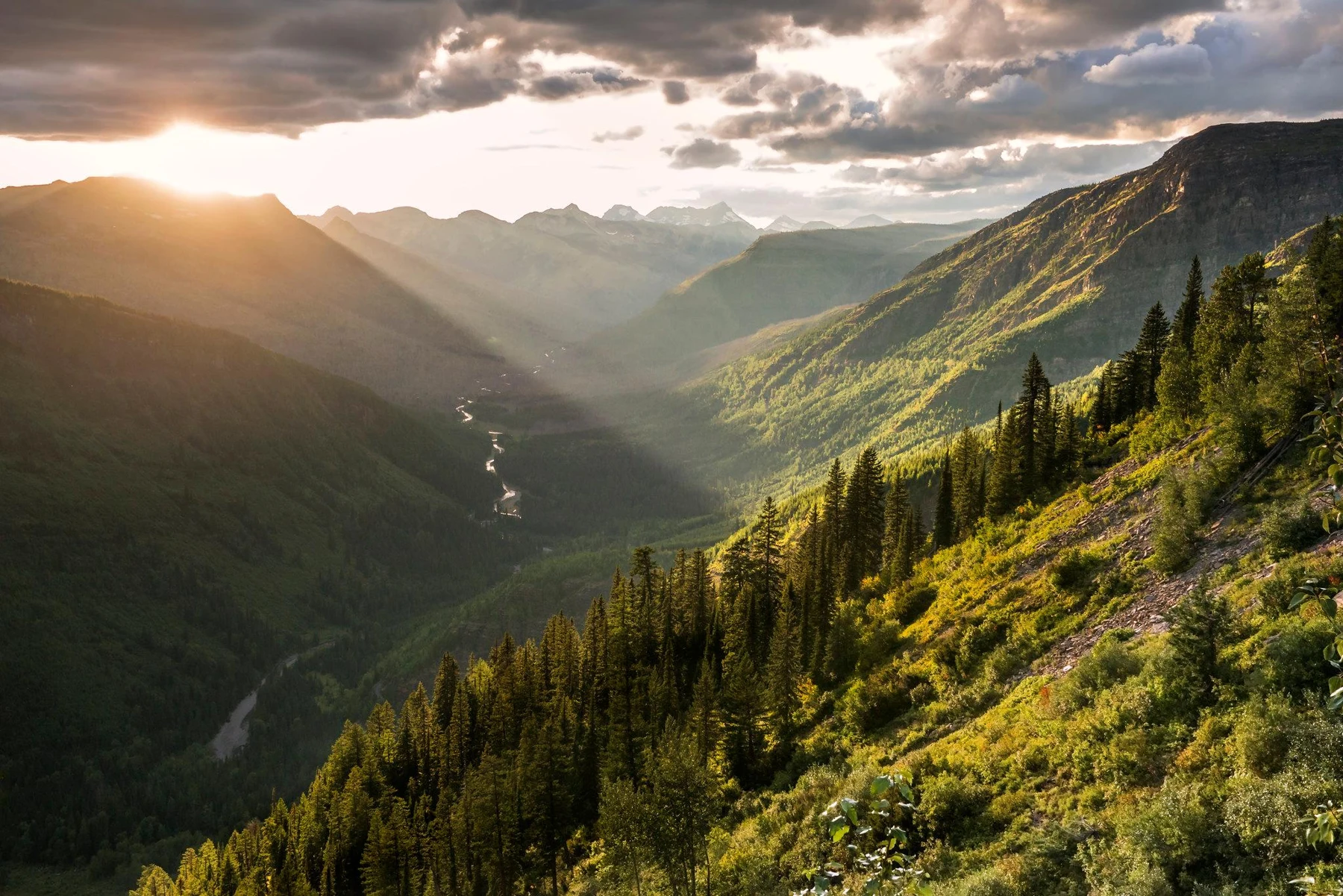
The question mark Augie had drawn at Olympic was still wearing mittens. Allie turned to the next notebook page and gave it a new address: Glacier National Park, Montana.
Andy peered at a photograph of a long mountain valley.
“Does the whole place come out of a freezer?”
“No,” Ana said. “And the name doesn’t mean every white patch is a glacier.”
They had learned that at Olympic. Snow could sit still; glacier ice flowed under its own weight. A photograph needed questions before it became an explanation.
Augie examined the map instead.
“Where does the water go?”
Allie followed one river line, then another on the other side of a ridge. Some lines headed in very different directions.
“Excellent question.”
Mom and Dad had planned an unhurried visit with suitable short outings, viewpoints, and exhibits. They would check weather, access, and trail conditions each day. Nobody was proposing a climb to the top of every mountain just to see which way a drop might roll.
At their first broad view, the children saw steep slopes, forest, and water shining far below. Andy imagined a giant sorting desk hidden inside the peaks.
“Mountains receive snow,” he said. “Then they mail it somewhere.”
Augie held out his empty hand.
“I am the postmaster.”
“Please don’t lick any imaginary stamps,” Ana told him.
Allie wrote their case: HOW CAN WATER FROM ONE MOUNTAIN REGION END UP SO FAR APART?
Beneath it, Andy drew three envelopes. He had not yet worked out where to send them, but the mountain post office was officially open.
2. The line that water cannot read
At a park display, they found a phrase they recognized: Continental Divide.
“It crossed our earlier parks too,” Allie said. “Now let’s work out what it actually does.”
A watershed was an area of land draining toward a common outlet. A divide was higher ground separating drainage areas. Water flowing downhill on one side could join a different stream system from water on the other.
Andy looked for a fence in the photograph.
“No fence?”
“No fence,” Ana said.
“Then how does the water know?”
“Gravity. The slopes guide it.”
Allie held her notebook like a small roof, with a ridge down the middle. She moved a finger down each side. It was a model, not a request to pour water over the actual pages.
Augie had already reached for his bottle.
“Finger water only,” Allie said quickly.
The Continental Divide separated major drainage systems on a huge scale. It was not one continuous cliff, nor a painted stripe that a raindrop stopped to inspect. The shape of the land mattered.
Ana added an important detail: not every drop went straight from a summit to the sea. Some soaked into the ground, evaporated, stayed in snow or ice, or spent time in lakes and living things.
“So our postal arrows show possible drainage routes,” Allie said. “Not tracked delivery for a particular raindrop.”
Andy crossed GUARANTEED NEXT-DAY OCEAN SERVICE off his envelope.
Augie looked disappointed.
“The mountain post office is slow.”
“Sometimes,” Ana said. “But it has a very large service area.”
3. Three envelopes, one meeting place
The next map showed Triple Divide Peak.
Allie followed three drainage directions from the meeting of divides. One led toward the Pacific through the Columbia River system. Another eventually joined the Missouri and Mississippi system. A third led through the Saskatchewan and Nelson system toward Hudson Bay.
“Three different destinations,” Ana said.
Andy labeled his envelopes PACIFIC, MISSISSIPPI ROUTE, and HUDSON BAY.
Augie added a fourth: GRANDMA.
“That’s a different postal system,” Allie told him.
The children did not need to stand on Triple Divide Peak to investigate it. The route was not a family shortcut between three oceans. A map and exhibit let them compare drainage systems while keeping their feet in an appropriate place.
Ana traced the northern route through rivers and Lake Winnipeg to Hudson Bay. Then she traced the Missouri–Mississippi route south. The paths took many turns before reaching distant water bodies.
“One peak doesn’t mean three rivers immediately start in the same puddle,” she said. “The divides meet there. Land on different sides drains into different basins.”
Andy drew three imaginary postboxes around a ridge.
Allie added a caption: THE BOXES ARE A JOKE. THE DRAINAGE DIVIDES ARE REAL.
Their mountain sorter had no clerk, rubber stamp, or opening hours. Its slopes were doing the sorting.
Augie tilted his head.
“Can the mountain send a letter uphill?”
“Not by ordinary downhill flow,” Ana said.
“Then Grandma should live downstairs.”
They laughed, but the map had changed their view of the peaks. The mountains were not just scenery above the water. Their shape helped decide which vast river neighborhood the water could join.
4. The valley kept the handwriting
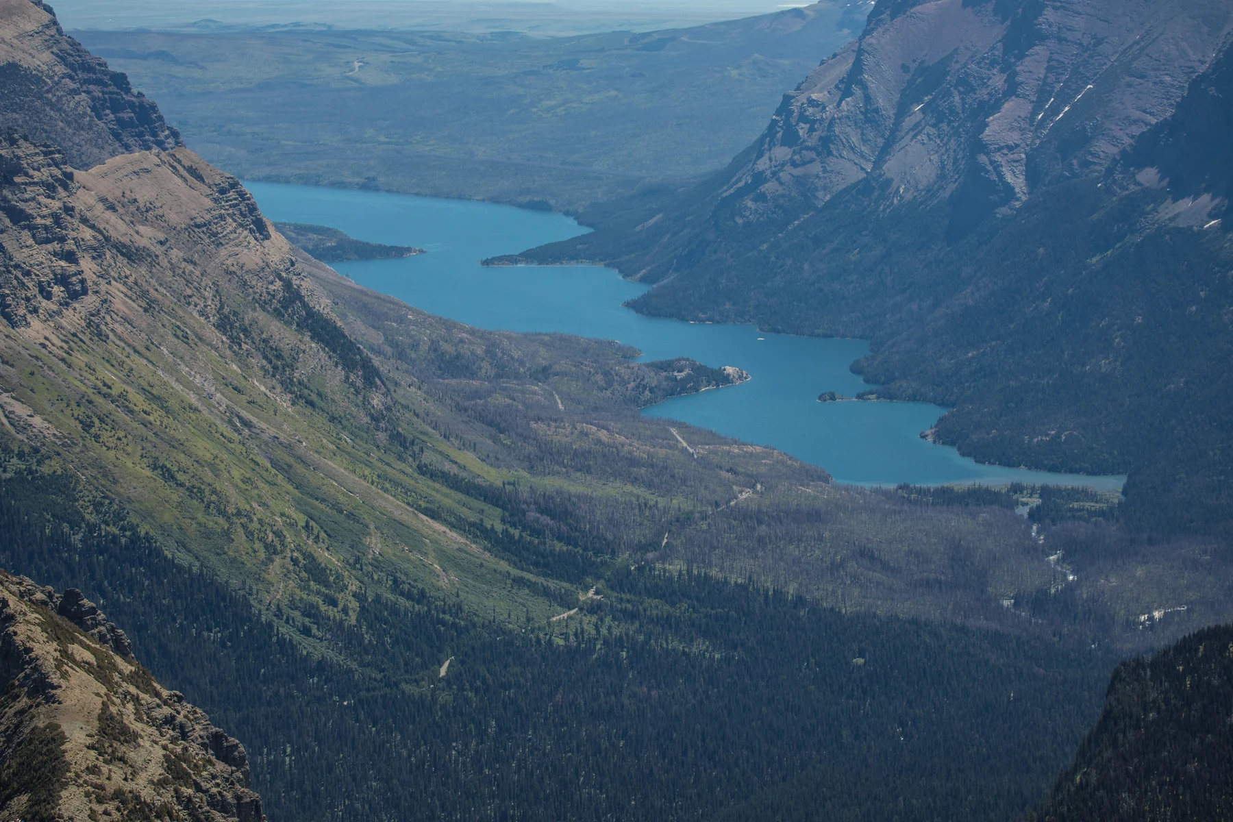
From a safe overlook, the valley looked broad at the bottom and steep along its sides.
“A big U,” Andy said. “We’ve met that letter.”
At Grand Teton, glaciers had helped explain wide troughs and lake basins. Glacier National Park held many more clues to the work of moving ice: U-shaped valleys, bowl-like hollows, sharp ridges, and piles of transported rock.
Allie imagined the landscape as a letter with enormous handwriting.
“Even if the writer leaves, the marks can remain.”
“Dear Valley,” Andy dictated. “I have scraped your sides. Love, Ice.”
Ana reminded him that glaciers did not politely smooth everything. Ice could carry rock fragments that scraped the bedrock, and it could loosen and remove pieces. Different glaciers, bedrock, and conditions produced different results.
A cirque was a steep-sided hollow near the head of a glacier. When glaciers carved on opposite sides of a ridge, a narrow, sharp crest could remain. Smaller side glaciers could leave valleys perched above a deeper main valley, sometimes with waterfalls dropping from them.
Augie studied a picture.
“The upstairs hallway has no stairs.”
“Hanging valley,” Allie said.
They observed from designated places with their parents, staying behind barriers. A waterfall was a wonderful clue without becoming a climbing invitation. Wet rocks, cold water, and a steep drop did not need to be tested personally.
Andy wrote a new postal rule: READ THE HANDWRITING FROM A SAFE DISTANCE.
The park’s name made more sense now. Its glacial story was written across the landscape, including places where no glacier remained in the valley today.
5. The ice that is here, and the ice that was
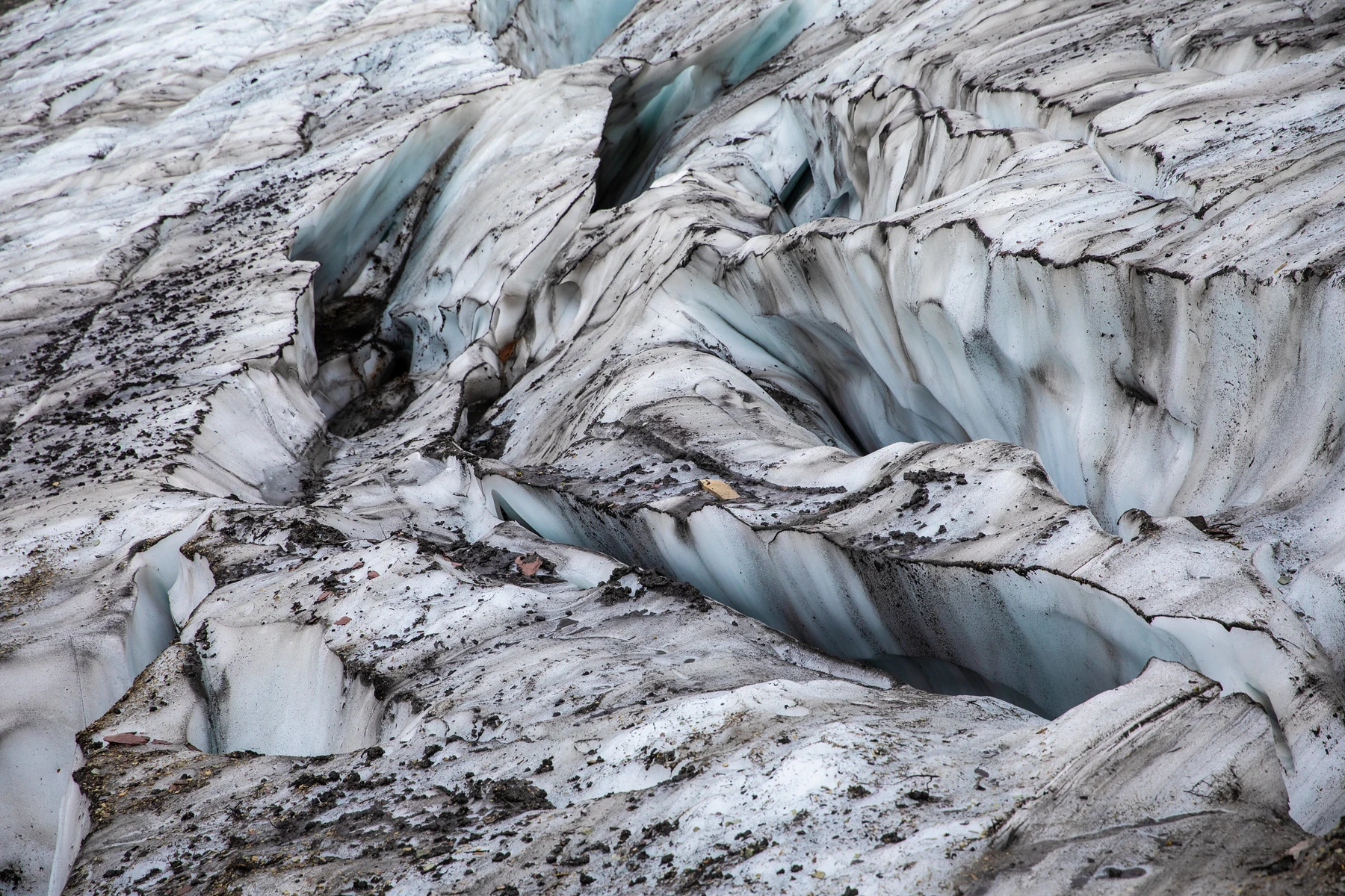
The children compared an ice-age valley illustration with a photograph of a much smaller glacier high among the peaks.
“Why isn’t the whole valley still full?” Augie asked.
Because different episodes of glaciation belonged to different times. The huge glaciers that helped carve the major valleys during the ice ages were not simply identical to the smaller glaciers now occupying high mountain hollows.
Allie drew two notebook boxes: EVIDENCE OF EARLIER ICE and ICE IN THE PHOTOGRAPH.
“Related stories,” she said. “Different chapters.”
A glacier could contain moving ice even while its end retreated. Retreat did not mean the whole glacier reversed direction and crawled uphill. If ice melted faster at the end than new ice arrived, the edge could shrink back while ice within the glacier still flowed downhill.
Andy stopped drawing a glacier with reverse lights.
“That would have been misleading.”
“Excellent parking joke, though,” Ana said.
Scientists studied changes with measurements, repeat photographs, and other evidence. The park’s glaciers had been shrinking as conditions warmed. Their exact future depended on climate and on local factors such as shade, snowfall, and ice thickness. The children did not write a countdown to a guaranteed disappearance date.
Augie put a tiny thermometer beside the drawing.
“The ice has a complicated calendar.”
Their parents explained that one snowy day did not describe a long-term climate trend. Nor could a single bright photograph tell the whole story of an ice mass gaining and losing material over many years.
Allie liked that lesson. A good investigator asked when and how a picture was taken, instead of treating every white shape as the same clue.
6. A mountain made from an old floor
At a geology exhibit, Andy noticed layers crossing the face of a mountain.
“Giant sandwich.”
“Please do not taste the evidence,” Ana said.
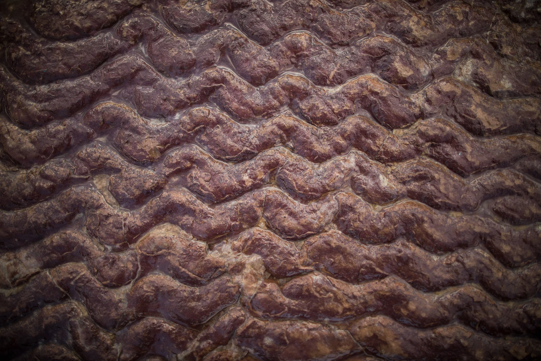
Long before these mountains existed in their present form, sediment accumulated in an ancient basin. Layers of mud, sand, and other material became rock. Some preserved traces of shallow-water conditions, including ripple marks.
Augie frowned at a pictured ripple.
“The water forgot its waves.”
“The marks were preserved,” Allie said. “The water itself isn’t trapped inside the ripple like a tiny ocean.”
Much later, mountain-building forces folded, tilted, and moved rock. Along the Lewis overthrust, an enormous slab of older rock was pushed over younger rock.
Andy held one notebook above another.
“Old upstairs. Young downstairs.”
“Yes,” Ana said. “So the simple idea that older layers must always be underneath needs a check. Fault movement can change the arrangement.”
It was different from the stretching and relative up-and-down movement they had investigated at Grand Teton. “Fault” described a break with movement, but faults did not all move in the same way.
Allie added another comparison to their growing collection: SAME WORD, CHECK THE DETAILS.
Some Glacier rocks also held stromatolites: layered structures built through the activity of ancient microbial communities. They were evidence of early life, not dinosaur footprints or little stone cabbages, even if a cross-section looked cabbage-like.
Andy drew a cabbage wearing a lab coat in the jokes margin.
The mountain’s story had begun as a floor, then become layers, then been moved and carved. It was a much longer delivery history than any of their envelopes could hold.
7. The climbing shoes nobody can borrow
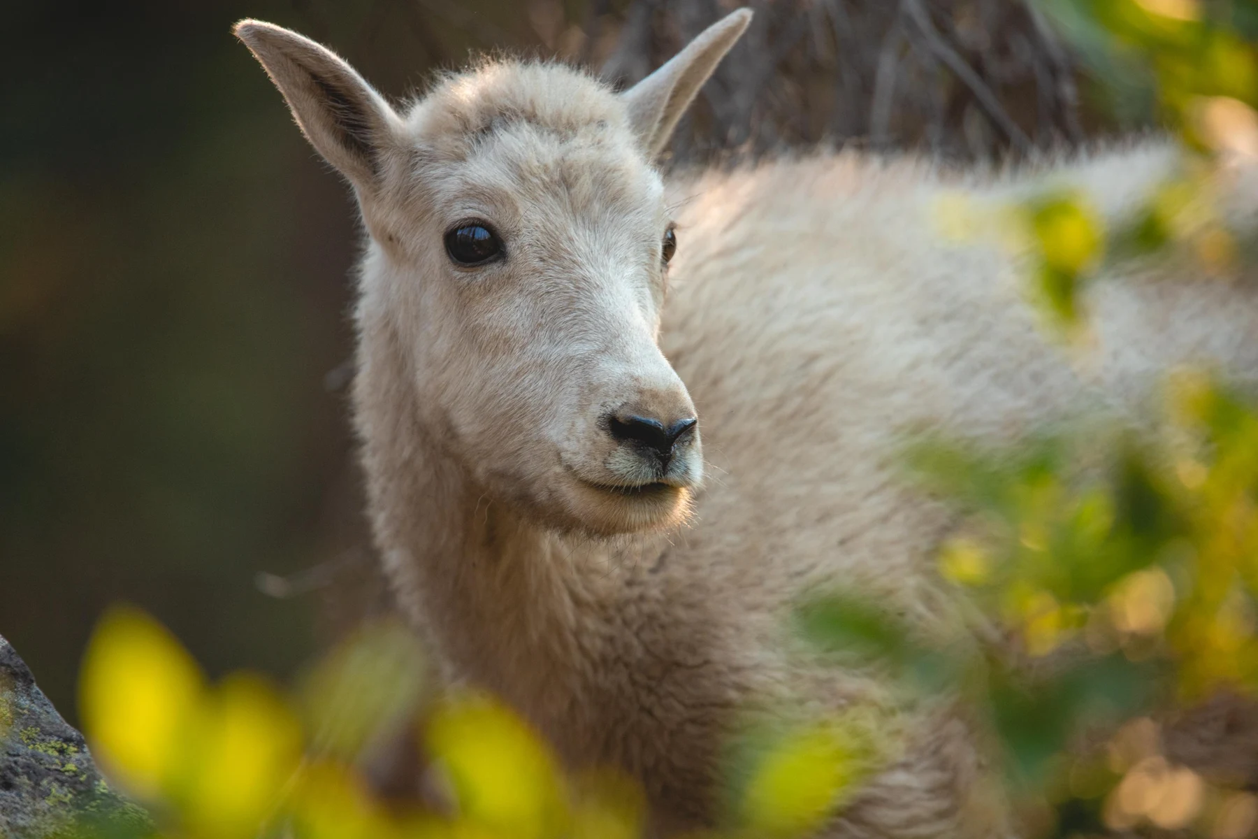
Augie spotted a mountain goat in a park photograph and immediately checked its feet.
“No boots.”
Ana read about split hooves with gripping pads, useful for steep, rocky ground. A thick coat helped the animal cope with its cold mountain environment.
Andy examined the soles of his shoes.
“Mine have mud and one pine needle.”
“Please don’t compare your climbing ability with a mountain goat,” Allie said.
The guide also showed bighorn sheep. They were different animals, even though both belonged to the mountain’s wildlife neighborhood. A white coat or a horn was a clue, not a reason to stop looking carefully.
Their family used binoculars from suitable viewing places, but no animal was obliged to appear. A photograph could introduce an adaptation without pretending the children had watched a goat perform on demand.
Their parents kept everyone together and followed wildlife guidance. They would give bears and wolves at least 100 yards, and goats and other wildlife at least 25 yards, with more room whenever behavior or conditions required it. An animal approaching them was a reason to make space, not an invitation to offer a snack.
Augie zipped his snack pocket.
“Private post.”
They also stayed on designated routes. Alpine plants had a short growing season and could be damaged by repeated trampling. Following an animal off the path would not make the visit more adventurous; it would disturb the place they had come to understand.
Andy drew two pairs of footwear: human shoes on a path, goat hooves on a rocky slope.
His caption read: DIFFERENT EQUIPMENT. DIFFERENT JOB.
It was the most sensible shoe review he had ever written.
8. A border is not a wall for rivers
Back at a resting place, Ana noticed another line on the map: the international boundary.
Glacier lay in the United States beside Canada’s Waterton Lakes National Park. Together they formed Waterton–Glacier International Peace Park, a partnership recognizing cooperation across the border.
“Do the animals need passports?” Augie asked.
“People have border rules,” Dad said. “Animals and water don’t understand our map lines.”
The family was not adding an unplanned border crossing to the afternoon. They were learning why neighbors needed to work together when wildlife habitat, watersheds, and conservation concerns extended beyond one country’s park boundary.
Allie added a dashed line across her landscape sketch. A river continued through it.
“The drawing makes the line look simple,” she said. “Caring for both sides takes real cooperation.”
They also learned that the region was part of the enduring homelands of Blackfeet, Salish, Pend d’Oreille, and Kootenai peoples. National borders and park boundaries did not mark the beginning of those relationships.
Ana wrote down questions to explore through Tribal voices and park resources, rather than inventing a traditional story to fill a blank page.
Andy looked at his three envelopes.
“We drew destinations. But people already have names, histories, and responsibilities here.”
“That belongs in the notebook too,” Allie said.
Augie added a very small house beside a river.
“Someone’s home.”
Their post-office joke had helped them begin. It could not explain everything about a place. The real landscape contained living communities and meanings much bigger than a pretend sorting desk.
9. Return address: the mountain
At their table, Allie arranged the final evidence: drainage arrows, a U-shaped valley, moving ice, rock layers, a goat’s hoof, and the international boundary.
“Who sorts the water?” she asked.
“The shape of the land,” Ana replied. “Divides separate watersheds. Around Triple Divide Peak, slopes lead into three different major drainage systems.”
“And water has delays,” Andy added. “It can become snow or ice, go underground, or take a lake break.”
Augie nodded seriously.
“Very tired water.”
The park’s glaciers were important, but the place was more than ice. Ancient sediment, mountain building, erosion, plants, animals, and people all belonged to the story. Their earlier chapters had taught them useful questions; Glacier had supplied its own answers.
Andy folded a pretend postcard.
“Dear Pacific. Please expect some water. Arrival time: complicated.”
Ana addressed the next one to Hudson Bay. Allie drew the Missouri–Mississippi route on the third. Augie’s card still said GRANDMA.
“What are you sending her?”
“A mountain joke.”
“That can travel by ordinary post,” Allie said.
She opened the next page: Joshua Tree National Park. Instead of snowy peaks, the photograph showed strange branching plants and rounded piles of rock.
Andy studied it.
“Are those trees giving directions?”
Augie drew a branching plant with three envelopes balanced on its arms.
“The post office moved somewhere warmer.”
Allie smiled and added a question mark. Their next investigation would need a different toolbox—and probably a very good sun hat.
Explorer’s notebook
Nine discoveries to take with you
- Glacier National Park is in northwestern Montana, beside the Canadian border.
- A watershed drains toward a common outlet; a divide separates drainage areas.
- Triple Divide Peak lies where drainage divides meet for routes toward the Pacific, Hudson Bay, and the Missouri–Mississippi system.
- Water can be stored, evaporate, or enter the ground rather than travel directly to a distant sea.
- U-shaped valleys, cirques, sharp ridges, and moraines record past glacial work.
- Earlier ice-age glaciers and the park’s smaller remaining glaciers belong to different episodes of its history.
- A glacier’s edge can retreat while ice within it continues moving downhill.
- Ancient sedimentary layers were shifted during mountain building, including the Lewis overthrust.
- Wildlife, watersheds, Tribal homelands, and conservation responsibilities extend beyond lines on a park map.
Five ways to explore thoughtfully
Choose suitable activities with an adult after checking current park access, weather, trail conditions, wildlife guidance, and your family’s abilities. These are alternatives across a visit, not a one-day route.
- Trace drainage directions on a park map or exhibit. Use fingers rather than pouring water on your notebook.
- Sketch a broad valley from an established overlook. Label possible glacial clues without leaving the viewing area.
- Compare dated glacier photographs or measurements. Ask whether they show seasonal snow, glacier ice, or both.
- Investigate sedimentary layers, ripple marks, or fossils through exhibits. Leave all natural objects in place.
- Learn from Tribal interpretation and explore the idea of an international peace park. Border travel requires its own adult planning.
Three questions for the crew
- Why can water falling on different sides of a ridge join different river systems?
- How can glacier ice flow downhill while its edge retreats?
- Why should a rock layer’s age and position be investigated separately?
Words worth keeping
- Watershed: an area of land draining toward a common outlet.
- Divide: higher ground separating drainage areas.
- Cirque: a steep-sided, bowl-like hollow carved near the head of a glacier.
- Retreat: the shrinking back of a glacier’s edge when losses exceed the arrival of ice there.
- Overthrust: movement along a fault that pushes a large mass of rock over other rock.
- Stromatolite: a layered structure built through the activity of microbial communities, sometimes preserved in rock.