1. The mountain needs no bathtub
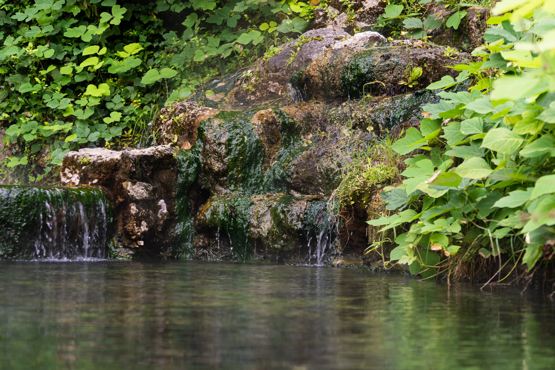
Augie arrived in Hot Springs, Arkansas, with a drawing of a mountain wearing a shower cap.
“Prepared for the hot rain,” he explained.
Andy inspected the picture. “Please don’t ask the mountain to add bubbles.”
The family’s next adventure had a puzzling title: The Mountain That Rains Hot Water. Yet the real scene included wooded slopes, town streets and a row of grand historic bathhouses. No shower nozzle hung over the trees.
Allie opened the notebook they had used at Wind Cave. “Our challenge is to discover how ordinary rain becomes hot spring water.”
Ana pointed to the mountain drawing. “We should check which way the water comes out.”
At Hot Springs National Park, thermal water emerged from the ground near the foot of Hot Springs Mountain. It did not fall hot from the clouds. Their title was an invitation to follow a journey, beginning with precipitation and continuing deep below the surface.
Augie drew a small arrow pointing down into the mountain. Then he added another coming up.
“A very confusing shower.”
Their grown-up had planned a visit to park exhibits, Bathhouse Row and designated spring-viewing places. They would observe from the established paths and use information and photographs to investigate the underground parts of the story.
The children’s own drinking water stayed in their picnic bag. A steaming spring was a subject for careful observation, not a place to dip a cup or try a hand-temperature test.
“We need three answers,” Allie said. “Where does the water begin? What warms it? How does it return?”
Andy drew a mountain with an enormous water heater inside.
Ana gave it a question mark.
“A hypothesis,” she said. “We’ll see how long it survives.”
Augie added a tiny towel to his shower-cap mountain. It looked ready for a very long investigation.
2. Follow the rain into the forest
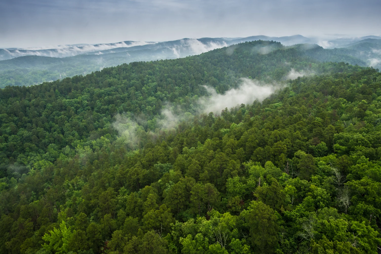
A photograph showed green ridges stretching into the distance, with low mist among the valleys. From that viewpoint, the forest looked like a soft blanket laid over the hills.
“A mountain bathrobe,” Andy suggested.
“A place where the water journey begins,” Allie said.
Rain and snowmelt falling within the recharge area could soak into the ground and enter the underground system that supplied the springs. The recharge area extended across forested ridges, including land beyond the national park boundary.
Ana drew a dashed boundary on the page. Then she drew water arrows crossing it.
“The water doesn’t stop to check the park sign.”
Not every raindrop took the same route. Some water ran over the surface. Some returned to the air through evaporation or plants. Some soaked into soil and continued into suitable pathways below.
Augie drew three raindrops, each with a different destination.
“They split up.”
“That’s why a water-cycle picture needs more than one arrow,” Ana said.
The forest, soil and rocks worked together to influence how water entered and moved through this landscape. Groundwater recharge meant replenishing water underground; it was not a battery charging beside a tree.
Andy quietly removed the electrical plug from his diagram.
Allie remembered the other parks. At Guadalupe Mountains, water had helped build and later reveal an ancient reef story. At Wind Cave, water chemistry had helped enlarge passages. Here, precipitation was the beginning of a long journey toward a thermal spring.
“Water keeps finding new assignments,” she said.
Augie drew a raincloud holding a clipboard.
The children did not pretend they could follow a particular drop through the mountain with their eyes. The underground route was something scientists investigated using evidence from rocks, water and measurements.
Their first answer was ready: the spring water begins with precipitation entering a recharge area.
3. The rock has pathways
Inside the visitor center, Ana studied a geological explanation. The water’s route depended on the rocks and the spaces within them.
“So the mountain isn’t an empty bathtub,” she said.
“An important correction,” Andy admitted.
The Ouachita Mountains had experienced enormous forces over their history. Rock layers were folded and fractured. Those fractures could provide connected pathways through which water moved.
Allie drew several layers, bent them into a fold and added cracks. Her drawing left room for arrows, but she knew the real system was much more complicated.
“We’re showing a useful idea,” she said. “We haven’t drawn every crack.”
Some rocks were dense when considered as solid material, yet fractures could allow water through the larger rock mass. Permeability described how readily water could move through connected openings. A rock did not need to resemble a kitchen sponge on its outside to contain an important pathway.
Augie looked at Andy’s water-heater drawing. “The mountain has plumbing.”
“Geology installed it,” Andy replied.
Their grown-up asked whether every crack led directly to a spring.
Ana shook her head. The connections, rock layers and pressure conditions mattered. A line drawn on paper could hide how narrow, broken or complicated a real route might be.
They remembered their three-dimensional cave-map lesson. A flat diagram helped explain a system, but it left out distances, depths and many branches.
Allie added a key beside the drawing: blue arrows for possible water movement; dark lines for rock layers.
Andy added a lunch arrow pointing straight toward the picnic bag.
“That one has a fully investigated connection.”
Ana moved it to the margin. The rocks deserved an uncluttered explanation, even if the explorers were beginning to appreciate the next snack break.
4. Warmth comes from depth
“Now for the water heater,” Allie said.
Andy presented his drawing with great ceremony. It had a dial, a chimney and a button labeled extra bubbles.
Ana checked the park explanation. “The button is having a difficult day.”
Temperature generally increased with depth below the surface. This increase was called the geothermal gradient. Water traveling sufficiently deep through the fractured rocks absorbed heat from its surroundings.
At Hot Springs National Park, the explanation did not require a nearby chamber of magma heating the water. The combination of deep circulation, suitable rock pathways and Earth’s internal heat made these springs possible.
Allie remembered Yellowstone’s different thermal story. A familiar word, hot spring, did not guarantee an identical source of heat at every park.
“We have to investigate this place,” she said.
Augie crossed out the chimney on the water heater.
“No smoke needed.”
The water remained within the Earth’s crust during this journey. It did not travel all the way to the planet’s center and return in a little elevator.
Andy looked disappointed. His underground elevator had already acquired a snack shelf.
“Keep the shelf,” Ana said. “Retire the route.”
The children drew a thermometer beside a downward arrow. They used it to represent increasing temperature with depth, while remembering that the actual temperatures depended on the setting and the route.
Their grown-up asked where the heat was moving.
“From warmer surroundings into the cooler water,” Allie answered.
That gave them their second answer: deep circulation lets water gain heat from the rocks around it.
The mountain had no adjustable bath knob. Its water journey depended on a natural system with a history much longer than any household appliance.
Augie drew a small sign on the retired heater: Interesting idea. Wrong equipment.
5. Ancient rain has no appointment book
The next discovery made Andy put down his pencil.
“Thousands of years?”
Much of the thermal water had spent thousands of years underground before emerging. Park explanations often described a journey of about 4,400 years. That figure summarized scientific evidence about water in a complex system; it was not a promise that every drop followed exactly the same schedule.
Ana drew a calendar, then stopped before adding individual pages.
“We don’t have enough paper.”
Scientists could study chemical and isotopic clues in water to investigate its history. They did not need a label attached to each raindrop. Water from different pathways and ages could mix, making the answer more complicated than one birthday for the whole spring.
Augie considered this. “Does ancient rain have wrinkles?”
“Only in your drawing,” Allie said.
The thermal water’s long history also did not mean a storm that afternoon would send the very same new raindrops straight through the deep system before dinner. A change in spring behavior and the travel time of water were different questions.
Andy added two columns: What changes now? Where has the water traveled?
“Another two-calendar problem,” he said.
At Wind Cave, air pressure could change over a day while the cave’s geological history reached far into the past. Here too, measurements on different timescales could describe different parts of one system.
The water returned through pathways that allowed a much quicker final rise than its long underground circulation. Differences in hydraulic head, related to elevation and pressure in the connected water system, helped drive the flow.
Ana drew a higher recharge area and lower spring outlet, connected through the rock.
“The system matters,” she said. “Not just the fact that the water is warm.”
Augie gave his raindrop a suitcase. “For a long stay.”
6. The water carries invisible passengers
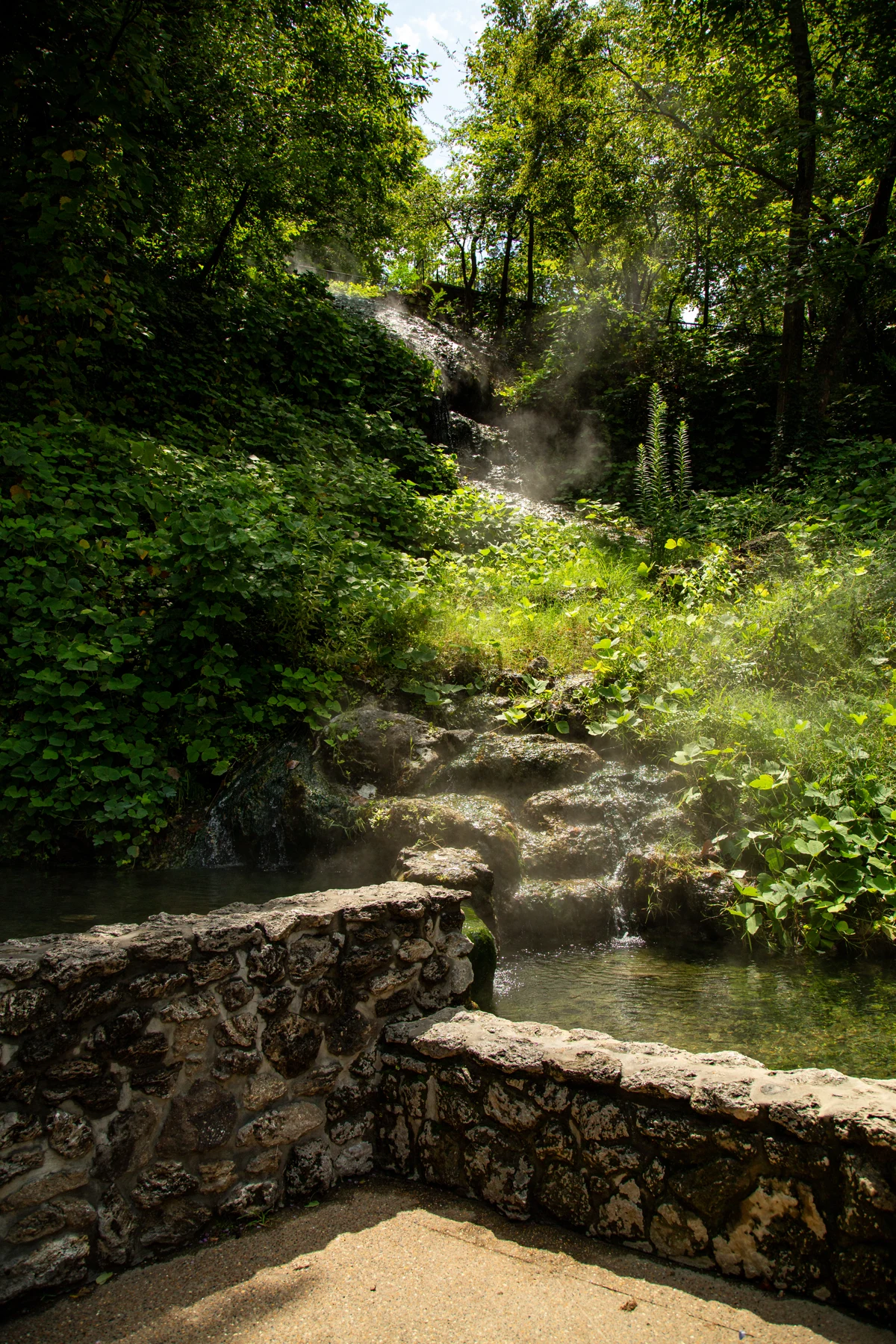
A park photograph showed thermal water flowing over pale rock and patches of green growth. Allie studied the textured surface beside the water.
“Something else came on the journey.”
As groundwater interacted with rock, it could dissolve small amounts of minerals and carry the dissolved material along. Clear water could contain dissolved substances that were not visible as floating grains.
Andy drew a raindrop pulling a wagon full of rocks.
Ana smiled. “A useful start, but the dissolved material isn’t a pile of miniature pebbles rattling inside it.”
They remembered how sugar could disappear from view when stirred into water. It had not stopped existing. The comparison helped them think about dissolved material, although sugar water was not a model of all the chemistry inside a mountain.
Augie drew a passenger list beside his raindrop. The first entry said minerals. The second said no actual wagon.
When spring water reached the surface, changing conditions could allow some dissolved material to form solid deposits. Around some display springs, calcium carbonate deposits formed a pale, porous-looking rock called tufa.
Allie compared that with the boxwork at Wind Cave. Minerals and water were involved in both stories, but the shapes and processes needed their own explanations.
“One familiar ingredient,” she said, “doesn’t mean one identical recipe.”
The thermal water emerged hot enough to burn. The family observed from the designated viewing place and left the water and deposits untouched. Neither the color of a pool nor a quiet surface could tell a child that it was safe to reach in.
“Admire the geology,” Andy said. “Keep yourself out of the soup.”
Their grown-up approved the general idea and reminded them to follow the actual park instructions at each place.
Augie added another note to the drawing: The spring is not our bathtub.
7. Bathhouses borrow the journey
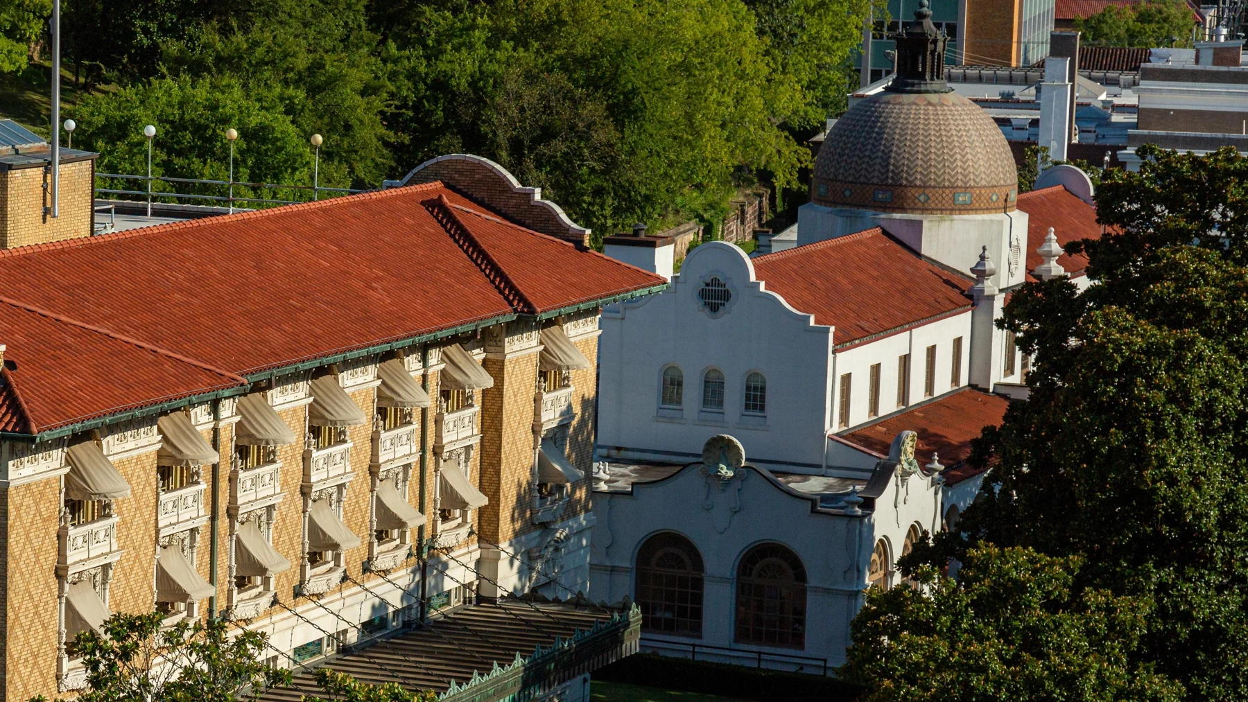
Bathhouse Row introduced a different kind of pathway: pipes, reservoirs and buildings created by people.
“Now the plumbing really is plumbing,” Andy said.
The family visited the Fordyce Bathhouse, now used as a visitor center and museum. Exhibits and restored rooms showed how people had brought the thermal water into buildings for bathing and other historical uses.
Augie looked for the giant tub he had imagined at the start. What he found was a building full of details, equipment and questions.
“A mountain-sized bath needs a lot of rooms.”
The Fordyce had opened in 1915. Much later, after it stopped operating as a bathhouse, restoration gave it another role as a place for learning about the park’s history.
Ana drew two labels for the same building: bathhouse and museum.
“A building can have chapters too.”
People had promoted many treatments involving the water in the past. The children understood that an exhibit about a historical belief did not make that belief a medical recommendation today. Their investigation was about water, geology and the people who used it.
The human story also reached much farther back than the grand buildings. Indigenous peoples had connections with this area long before federal protection, including use of novaculite, a hard local rock, for tools.
Allie added a longer line before the bathhouse dates. “The story doesn’t start when this building opens.”
Federal protection as Hot Springs Reservation began in 1832. The area became Hot Springs National Park in 1921. Those were different milestones, rather than two competing answers to exactly the same question.
Andy made separate timeline cards.
“No squeezing the whole history onto one birthday cake.”
Augie drew two cakes anyway, then put them firmly in the joke column.
The buildings helped reveal how a natural resource shaped a town, while the museum helped them ask how people’s ideas and uses had changed.
8. Protect the beginning, not only the spring
Allie returned to the forest photograph. Now the ridges looked like more than a pleasant background behind the bathhouses.
“We’ve been following the water backward,” she said. “From the spring to the place where it starts.”
Protecting water meant paying attention to recharge areas and underground connections as well as the spring outlet. Changes on the surface could affect how water entered the ground and what it carried with it.
Ana drew a park boundary again, then extended the recharge area beyond it.
“Caring for the system needs a bigger map.”
Their grown-up asked why a covered spring might be part of conservation rather than a missing attraction.
The park collected much of the thermal water in a managed system. Protective structures, pipes and reservoirs helped keep the resource available for its designated uses. Scientists and park staff monitored water properties and flow to watch for changes.
Andy drew a thermometer, a measuring container and a notebook beside the spring.
“The mountain has a checkup.”
“Repeated measurements,” Ana said. “The same kind of information collected carefully over time.”
A single photograph could not establish whether a spring’s temperature or chemistry had changed. Researchers needed measurements, dates and an understanding of the system.
The family also distinguished protected display springs from places specifically designated for obtaining water. They would follow current signs and adult guidance, rather than assume every fountain or flowing outlet served the same purpose.
For this outing, their own bottles were already filled. Nobody needed a taste test to complete the investigation.
Augie took a drink and looked at the mountain.
“I can wait for the ancient rain.”
Allie wrote their final connection: forest, soil, rock pathways, heat, springs, people.
Andy added a line underneath: A watershed wearing a bathrobe.
Ana left that one in place. It was a joke that might actually help them remember the larger system.
9. The longest route to a bath
At the end of their visit, Allie reopened the three questions.
“Where does the water begin?”
“As precipitation entering the recharge area,” Ana answered.
“What warms it?”
“Earth’s heat at depth,” Andy said. “Transferred from the surroundings into the water.”
“And how does it return?”
Augie traced the upward arrow through their cracked-rock drawing. “Along connected pathways, with pressure helping it move.”
They had followed a water cycle with a very long underground chapter. Rain could enter the ground, move through fractured rock, gain heat and dissolved minerals, and eventually emerge from a spring.
Their picture was simple. The real pathways, mixing and geological history were much more complicated. But the children could now explain the main ideas and name some evidence they would need to investigate further.
Ana put three marks beside the old water-heater drawing: no plug, no dial, no bubble button.
“The mountain does this without a household appliance,” she said.
Augie removed the shower cap from his original mountain. He left the towel beside it.
“For the bathhouse,” he explained.
Allie looked at the forested slope beyond the buildings. The park combined natural processes with human history in a way that made both stories easier to notice.
“The water helped shape what people built,” she said. “People’s decisions help shape how the water is protected.”
Next in their park order was White Sands National Park in New Mexico. There they would investigate a desert of bright gypsum sand and another surprising water story.
Andy stared at the next title. “Hot water in a mountain. Snow-white sand in a desert. The water cycle is showing off.”
“It has excellent material,” Ana replied.
Augie closed the notebook. “I’m bringing sunglasses.”
The mountain had never needed to rain hot water from the sky. The mystery was in the journey: ordinary precipitation taking an extraordinary route through rock, heat and time.
Explorer’s notebook
Nine discoveries to keep
- Hot Springs National Park is in Arkansas, where thermal springs emerge near the base of Hot Springs Mountain.
- The water begins as precipitation entering a recharge area that includes forested ridges beyond the park boundary.
- Folded and fractured rocks provide connected pathways for groundwater. Permeability depends on openings and their connections.
- Water gains heat from warmer rock at depth. This system is explained by deep circulation and the geothermal gradient rather than a nearby magma chamber.
- Much of the thermal water has spent thousands of years underground. About 4,400 years is a useful estimate, not an identical travel time for every drop.
- Hydraulic head and connected fractures help water move through the system and return toward the surface.
- Groundwater can carry dissolved minerals. Some spring deposits form tufa, a calcium carbonate rock.
- Bathhouse Row and the Fordyce museum help tell the human story. Federal reservation status began in 1832; national park designation followed in 1921.
- Protecting the springs includes caring for recharge areas, managing collection systems and monitoring water over time.
Five family adventures
- Draw the long water cycle: Show a raincloud, forested recharge area, fractured rock, a deep warm zone and a spring. Use labeled arrows to explain the journey. Add a reminder that the drawing simplifies many pathways and that not every raindrop enters the deep system.
- Where can water go? With a grown-up, gently sprinkle a little room-temperature tap water on a clean sponge in a tray. Observe soaking, storage and dripping. Compare those ideas with recharge, then explain a limitation: a sponge is not fractured mountain rock, and this model does not show deep heating or a thousands-year journey.
- Feel heat move safely: Have a grown-up place a closed, cool water bottle in a bowl of comfortably warm tap water. Leave it briefly, then compare the bottle’s temperature with its starting temperature. Use no stove, kettle, glass or hot water. Discuss heat moving from warmer surroundings to cooler water. This models heat transfer, not the whole spring system.
- One place, several timelines: Make separate cards for old rock formation, water circulation, the 1832 reservation, the 1915 Fordyce opening and the 1921 national park designation. Arrange them with labels that distinguish geological events from human milestones. Avoid pretending that one evenly spaced line shows these very different timescales accurately.
- Protect the upstream story: Draw a spring and work backward to its recharge area. Add helpful actions such as staying on trails, preventing litter and following local water-protection guidance. Discuss why protecting only the visible outlet could miss important parts of the system. Do not sample or taste unknown water.
Four questions for the road
- Why does the title describe a water journey rather than hot rain falling from clouds?
- How can fractured rock allow water to travel through a mountain?
- Why should the water’s age estimate and the history of the bathhouses be kept on different timelines?
- Why does protecting a spring require attention to places beyond the spring itself?
Eight words for your explorer kit
- Recharge: The replenishment of groundwater as water enters an underground system.
- Groundwater: Water beneath the surface in connected pores and fractures within soil or rock.
- Fracture: A break in rock that may provide a pathway for water.
- Permeability: How readily a material allows water to move through connected openings.
- Geothermal gradient: The rate at which temperature increases with depth below the surface in a particular setting.
- Hydraulic head: A measure of water’s potential to move, related to elevation and pressure.
- Thermal spring: A spring where naturally warmed groundwater emerges at the surface.
- Tufa: A porous calcium carbonate deposit that can form from spring water.