1. The missing river
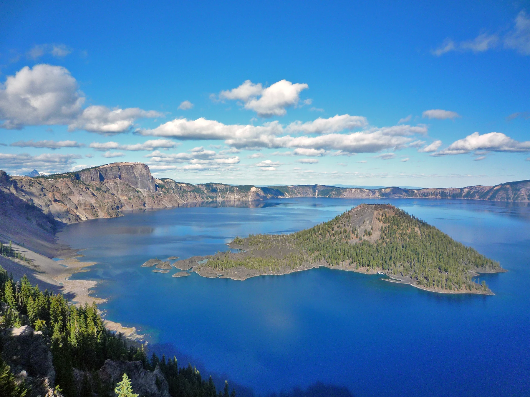
“There should be a door,” Augie said.
Allie looked around the viewing area. “For what?”
“For the lake to get out.”
Far below them, blue water filled a vast basin surrounded by steep walls. Wizard Island rose from the surface, its forested cone looking rather like a mountain that had misplaced the rest of its range.
After investigating the saguaro's water storage, the four explorers had reached Crater Lake National Park in Oregon. They had traded desert cactus stems for a much larger water puzzle.
Andy inspected their park map. He could find the lake. He could find roads, overlooks, and mountains. But he could not find a river carrying water out through the rim.
“Maybe they forgot to draw it.”
Ana checked the park information. “No river outlet. The map isn't missing one.”
“Then where does the water go?” Allie asked. “And why doesn't the basin keep filling until it overflows?”
That was an excellent notebook question. Ana wrote it down while Augie drew a lake with a doorknob.
Their parents had checked road access, the forecast, and suitable places for the family to explore. The children stayed in the designated viewing area, with a grown-up beside Augie. Nobody would lean over an edge to hunt for a secret drain.
Andy peered at the drawing. “Your lake door opens the wrong way.”
“It opens underwater,” Augie explained. “Very special.”
Allie added two columns beneath their question: Water arriving and Water leaving.
Before they could fill those columns, they needed to understand the extraordinary bowl holding all that blue water.
“Step one,” Ana said. “Find out who made the bowl.”
2. The mountain that became a basin
At a park exhibit, the children met Mount Mazama—not an animal, but the volcano whose story had created the lake's setting.
“Did something crash into it?” Andy asked. “Like a giant space pebble?”
The evidence described a volcanic collapse, not a meteorite impact.
About 7,700 years ago, enormous eruptions released material from the volcano's underground magma system. As so much magma erupted, the mountain lost support, and its central portion collapsed inward. The resulting large depression was called a caldera.
“So the whole mountain didn't simply fly away,” Allie said. “Collapse made the basin.”
Ana sketched a mountain, then crossed out her first attempt at a neat scoop-shaped missing top.
“The real process was much messier than my drawing.”
“And considerably louder,” Andy said.
The lake did not appear at its full size in the same instant. Rain and snowmelt gradually accumulated within the new basin over the following centuries. Volcanic activity continued inside it too.
Wizard Island was a clue to that later activity. Its cone grew from eruptions within the caldera while the developing lake rose around it. More volcanic features lay hidden beneath the water.
“A volcano inside the old volcano's basin,” Ana said.
Augie drew a tiny wizard on the island.
“Not the geological explanation,” Allie told him.
“Only visiting.”
The children compared what they could see with what the exhibit explained. The water covered much of the evidence. A beautiful surface view was the beginning of the investigation, not a complete picture of the lake floor.
Andy looked back toward the rim. “So our bowl has a very dramatic construction history.”
“And no cupboard big enough to put it away,” said Ana.
3. Snow is water waiting
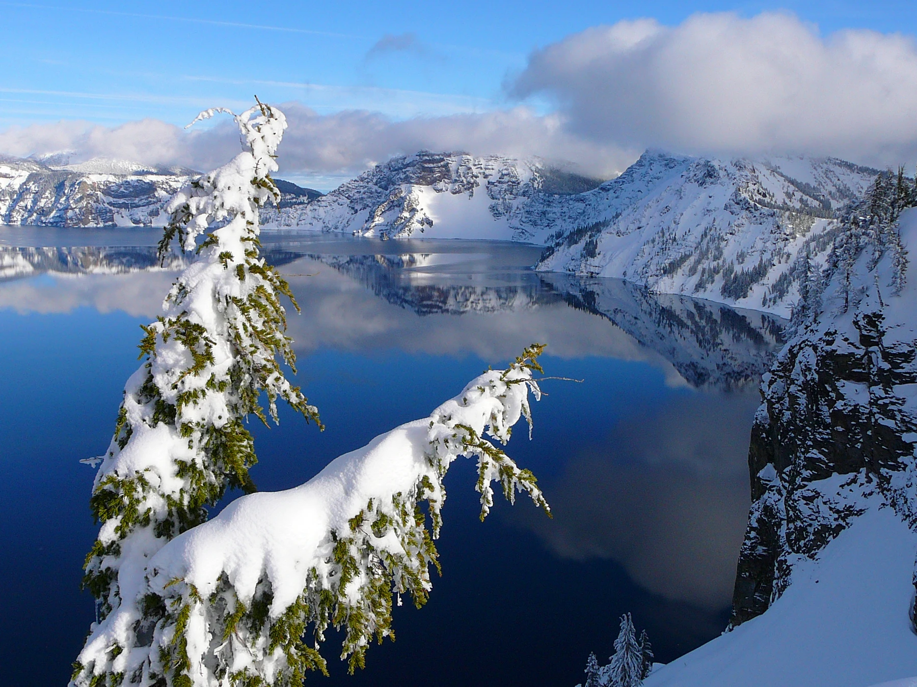
A winter photograph showed white slopes around the same blue lake. The snow looked soft and peaceful. Their parents reminded them that snow near a steep rim could hide dangerous edges, so a photograph was a much better place for today's snow investigation.
“Who put a blanket around the bowl?” Augie asked.
“The weather,” said Allie. “And that blanket helps supply the water.”
Crater Lake was supplied mainly by rain and snow. Snow that accumulated within the basin could later melt and join the lake. There was no river bringing water in from a broad landscape upstream.
“So the sky does much of the delivering,” Ana said.
“And winter stores some deliveries for later,” Andy added.
They remembered the saguaro storing water in living tissue. Snowpack stored water in a very different form: ice crystals accumulated on the landscape.
Augie drew a parcel with a snowflake on it. “Water. Do not open until warmer.”
The amount of snowfall varied, as did the weather from year to year. A summer visit did not tell them everything about the park's annual water supply. Neither did one snowy photograph reveal a long-term trend.
Allie added rain and melting snow to their arrivals column. Park research also described small groundwater springs and seeps inside the caldera. The main source was precipitation, but careful scientists still investigated the smaller pathways.
“Mainly isn't always the same as only,” Ana said.
Andy nodded. “Mainly I have good ideas. Occasionally I put my hat on backward.”
“You've put it on backward now.”
“That is part of today's evidence.”
The arrivals column was filling nicely. The departures column remained suspiciously blank.
4. Two exits without a river
“The water can't disappear,” Andy said.
“It can leave without being a river,” Allie replied.
One route was evaporation. Liquid water at the surface changed into water vapor and entered the air. The vapor was invisible; it did not have to look like a cloud of steam to be present.
Augie studied the lake photograph. “Invisible door.”
“A change of state,” Ana said. “The water is still water.”
The second route went into the ground. Lake water could seep through porous rock and deposits in the caldera wall. Spaces and pathways within that material allowed water to move out of the basin below the surface.
“Not one enormous bathtub plug,” Allie explained.
“Many much less convenient plumbing routes,” Andy suggested.
This was the answer hidden in their title. No river outlet did not mean no way for water to leave. Rain and snow added water; evaporation and seepage removed it. Their balance helped keep the lake from continually filling to the rim, although its level could change.
To model that balance without wasting any water, Ana put ten paper counters inside a drawn bowl. She added three for arriving water and removed three for water leaving.
“Same number,” Andy said.
Then she added four and removed two.
“More stored in the lake.”
Their counters were pretend units, not measurements of Crater Lake. The real lake's gains and losses varied, and researchers used observations to work out the water balance over time.
Augie wanted to keep all the counters.
“Then our model isn't showing water leaving,” Allie said.
“It's showing my collection.”
Ana returned two to the departures pile.
The notebook now had both columns filled. But the lake had another question waiting in plain sight: why was the water such an astonishing blue?
5. A very large glass of blue
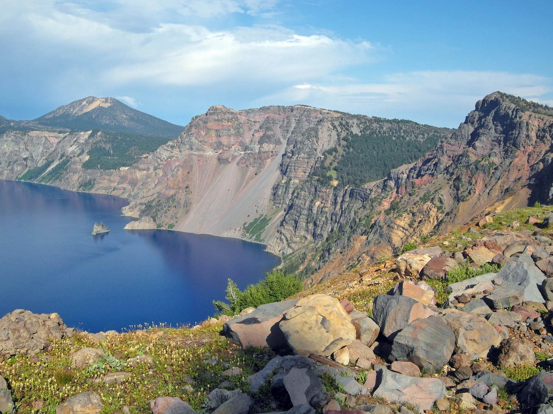
Andy held up his clear drinking bottle.
“My water doesn't look like that.”
He pointed toward the deep blue lake. His bottle looked almost colorless.
“You're looking through a much shorter distance of water,” Allie said, reading the explanation with their mother.
Sunlight contained many wavelengths that our eyes perceived as different colors. Water absorbed some wavelengths more readily than others, including light toward the red end of the visible spectrum. Looking through enough relatively clear water made its blue color much more noticeable.
Ana drew a tiny bottle beside a deep lake.
“Same substance. Different amount for light to travel through.”
“An extremely oversized drinks container,” Andy said.
Clouds, reflections, the depth, and their viewing position could influence how the surface looked. But the lake's blue was not simply blue sky painted onto it. The properties of the water itself mattered.
The children compared deep-blue areas with shallower-looking turquoise water in a photograph near the caldera walls. A picture could show striking contrasts without revealing every detail about the depth or the bottom.
“Clear doesn't mean nothing lives there,” Ana added.
Nor did it mean visitors should drink untreated lake water. Their parents had brought safe drinking water, and nobody needed to test the lake by tasting it.
Augie held his bottle up to the light too.
“Mine is snack-colored.”
The others stared.
“A reflection of my biscuit,” he explained.
Andy inspected the bottle carefully. “I hope that's the explanation.”
They turned from color to living things. Beneath that remarkable surface was an ecosystem—not a giant display of empty blue glass.
6. A lake is not a fish bowl to improve
A picture of a small newt introduced an animal the children could not see from the rim.
“A tiny lake dragon,” Augie whispered.
“A newt,” Allie said. “An amphibian.”
The Mazama newt was a distinctive native population associated with Crater Lake. Its story showed why a clear and beautiful lake still needed careful protection.
People had introduced fish into the lake, which originally had no native fish. They had also introduced crayfish as food for those fish. The additions had consequences for the animals already there.
“Someone thought more animals would make it better?” Andy asked.
“A change can seem useful and still cause problems,” Ana said.
Introduced crayfish could compete with newts for shelter and food, and they could prey on them too. Researchers investigated these interactions and other effects on the lake's nearshore ecosystem.
It was a complicated living system. The children did not need to decide that one animal was personally naughty. A crayfish living where people had put it was not following a villain's plan.
“The important thing is what happens to the whole community,” Allie said.
She added a rule to their notes: Never move animals or plants into a new wild home.
Their parents pointed out that protecting a lake could also mean following restrictions intended to prevent additional species or unwanted material from entering it. The family would check current park guidance rather than assume equipment allowed at one lake was allowed at every lake.
Augie revised his drawing. The newt now had a very small house.
“Good shelter,” he said.
“No actual newts relocated,” Ana confirmed.
7. The disk that vanishes on purpose
At the exhibits, the explorers learned how scientists studied a lake too deep to understand just by looking down from the rim.
“An enormous ruler?” Andy suggested.
“That would be difficult to fit in the equipment cupboard,” Ana said.
Sonar studies used sound to investigate the underwater landscape. Signals traveled through water, and returning echoes helped researchers map depths and shapes. Features concealed by the lake's surface became part of a much more detailed picture.
The children remembered the hidden volcanic features inside the caldera. The lake floor had a landscape of its own.
Other measurements answered different questions. A Secchi disk helped researchers measure clarity. They lowered the disk into the water and noted the depth at which it disappeared from view, then followed a consistent method as they brought it back up.
“Not a missing-disk emergency,” Allie said.
“Good,” Andy replied. “I was about to organize a search party.”
Instruments also measured temperature and other characteristics at different depths. Repeating measurements over time helped scientists distinguish a temporary change from a longer pattern.
“Like the cactus photographs,” Ana said. “Keep returning. Use methods you can compare.”
One pretty photograph could not measure the whole lake's health. Neither could one murky-looking patch tell them the cause of a change without more investigation.
Augie drew a scientist with a disk on a string.
“Could we try that with a biscuit?”
“Only as a drawing,” their mother said.
“A biscuit would disappear for a different reason,” Andy admitted.
The family was studying research methods, not carrying out experiments at the cliff edge. Their safest laboratory was a table, their notebook, and the park's information.
8. A place with a much longer memory
The map called it Crater Lake. The children also learned the Klamath name giiwas.
The Klamath Tribes described the lake as a sacred place, with relationships and knowledge passed through generations. Ancestors of the Klamath people had witnessed the eruption long before the lake became a national park. Those connections continued among living communities today.
Allie paused over an old account of outsiders arriving at the lake.
“Finding a place that's new to you isn't the same as being the first person to know it,” she said.
Ana added that sentence to the notebook.
They could learn from materials shared by the Klamath Tribes, as well as the park. They would listen to how the people connected with a place described it, rather than inventing a traditional tale for their own adventure.
Andy looked back at their list of measurements.
“Geology explains how the basin formed,” he said. “It isn't the whole story of why this place matters.”
“Exactly,” their mother replied.
Outside, clouds shifted over the rim. The children had spent the morning asking where water traveled. Now they considered something else that traveled: knowledge, shared over many generations and still being shared.
Augie drew a notebook with more pages than he could count.
“Ours isn't finished,” he said.
“Good,” said Ana. “There's plenty left to learn.”
He carefully added another blank page. Then he added a pencil with a very long eraser.
“For when Andy's map needs fixing,” he explained.
Andy chose to regard that as generous scientific support.
9. The waterfall that doesn't solve the case
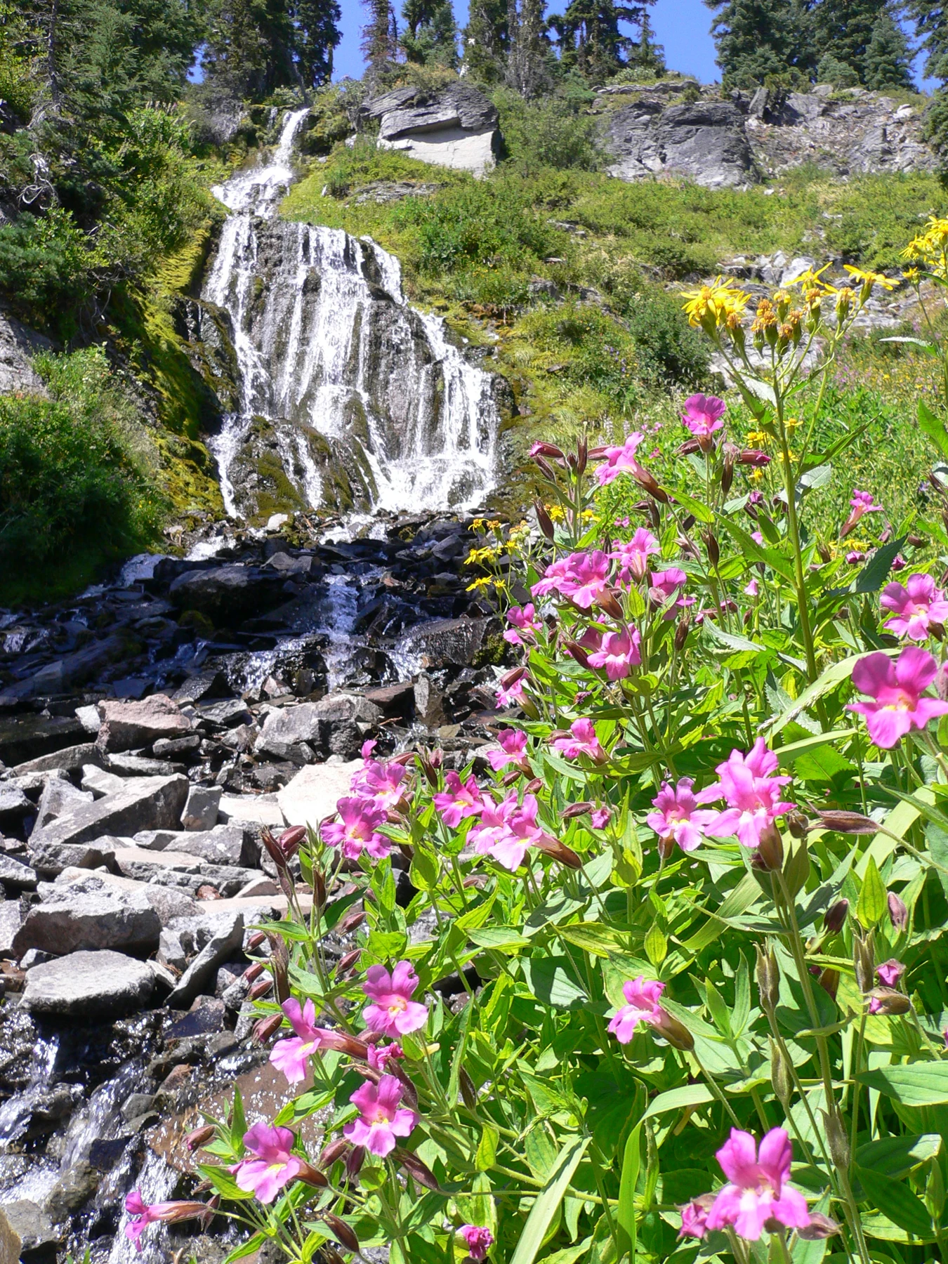
A photograph of Vidae Falls gave Andy one final objection.
“There's water going downhill in the park. Couldn't that be the lake getting out?”
Allie returned to the map. A national park boundary could include many streams and slopes outside the lake's own basin. A waterfall somewhere in the park did not prove there was a river flowing from Crater Lake through the caldera rim.
“Park and lake aren't the same shape,” Ana said.
“Excellent waterfall,” Andy conceded. “Wrong evidence for my missing river.”
The family admired it in the photograph. Their visit did not require driving every road, reaching every viewpoint, or going down to the lakeshore. Current conditions and open routes determined the day's plans, and much of their exploring could happen from suitable rim viewpoints and exhibits.
They stayed on designated paths and behind barriers. Snow-covered edges and unstable slopes were not shortcuts. A lovely view was already lovely from the place intended for viewing it.
Allie asked Augie to summarize their mystery.
“Water arrives from the sky,” he began.
“Mainly rain and snow,” Ana said.
“Some leaves into the air,” Andy continued. “Some seeps through the ground.”
“No river door needed,” Augie finished.
Their lake had no river exit, but it was not sealed shut. Its water belonged to a moving cycle, even when the surface looked wonderfully still.
They closed the notebook with a new appreciation for hidden things: water pathways, underwater volcanoes, small animals, and histories they had only begun to understand.
Next came Mesa Verde National Park, where buildings beneath cliffs would raise a different set of questions about people and place.
Andy checked their two columns once more.
“Snack arriving,” he announced.
Augie held out his hand.
“Snack leaving bag.”
For that particular balance, everyone knew exactly where the biscuit had gone.
Explorer’s notebook
Nine discoveries to take home
- Crater Lake National Park is in Oregon's Cascade Range. The lake occupies a volcanic caldera.
- A major eruption about 7,700 years ago led to Mount Mazama's central collapse. The basin was not made by a meteorite impact.
- Rain and snowmelt accumulated over time. Wizard Island grew through later volcanic activity within the caldera.
- The lake is supplied mainly by precipitation, with small contributions from groundwater springs and seeps within the basin.
- No river flows out through the rim. Water leaves by evaporation and seepage, so the lake is not a sealed container.
- Water balance compares gains, losses, and changes in storage. A lake's level can change even when it does not continually overflow.
- Deep, relatively clear water makes water's blue color especially noticeable. Its appearance is not just a reflection of the sky.
- Fish and crayfish were introduced to the lake. Native Mazama newts are among the living things affected by those changes.
- Scientists use repeated measurements to investigate the lake. Klamath connections with giiwas are much older than the national park and continue today.
Five small adventures
- Make a paper water budget. Put ten counters in a drawn lake. Add counters for rain and snowmelt; remove counters for evaporation and seepage. Compare equal gains and losses with unequal ones. The counters are pretend units, not actual lake measurements.
- Draw the basin's sequence. Sketch a volcano, a collapsed caldera, and a lake partly filling it. Add Wizard Island during the lake's early development. Explain why one drawing cannot show every stage or feature.
- Investigate disappearing water safely. With a grown-up, mark the water level in a shallow container kept in a safe place away from pets and young children. Observe it over several days without adding water. What does a lower level suggest? What conditions might change the result?
- Read a map's boundaries. Find the park outline, the caldera rim, and streams outside the lake basin. Explain why a stream inside a park does not necessarily come from its lake.
- Be a careful observer. Choose one photograph. List what it shows and what it cannot establish, such as today's weather, whether a trail is open, water quality, or the number of animals beneath the surface.
Talk it over
- Why is “no river outlet” more accurate than “no water ever leaves”?
- Why might putting an animal into a lake create problems even if the person intended to help?
- What can scientific measurements and the knowledge of people connected with a place each help us understand?
Words for your explorer pack
- Caldera: A large volcanic depression formed when ground collapses as magma is withdrawn during an eruption.
- Precipitation: Water falling from clouds, including rain and snow.
- Evaporation: The change from liquid water to water vapor.
- Seepage: Slow movement of water through spaces in soil, rock, or other material.
- Water balance: An account of water arriving, leaving, and remaining in storage.
- Clarity: How easily light passes through water, often investigated by visibility measurements.
- Sonar: A method using sound signals and their echoes to investigate underwater surroundings.
- Limnology: The study of inland waters, including their physical, chemical, and biological characteristics.